Contributory members are able to log private notes and comments about each site
Sites theCAptain has logged. View this log as a table or view the most recent logs from everyone
Table des Fées (Rocheville)
Date Added: 18th Sep 2010
Site Type: Passage Grave
Country: France (Normandie:Manche (50))
Visited: Yes on 5th Apr 2009
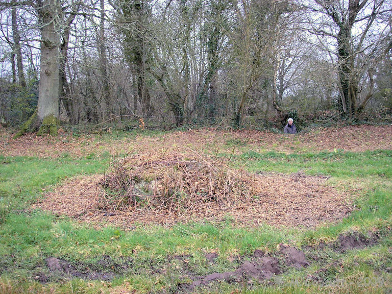
Table des Fées (Rocheville) submitted by thecaptain on 5th Apr 2009. La Table des Fées.
My Dad can be seen in the lane, with the gap through to the stone seen.
(View photo, vote or add a comment)
Log Text: None
Symonds Yat Fort
Date Added: 18th Sep 2010
Site Type: Hillfort
Country: England (Gloucestershire)
Visited: Yes on 5th Apr 2004
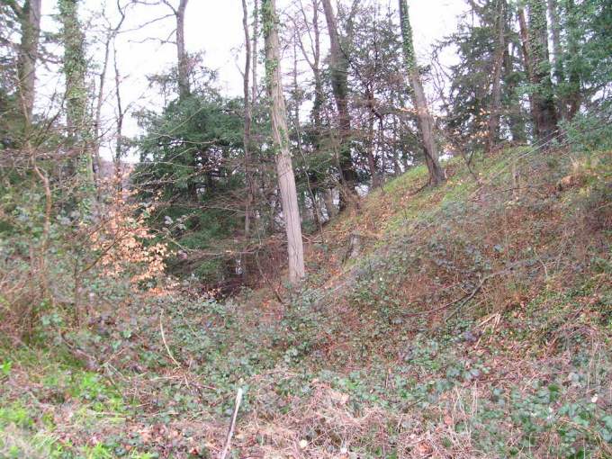
Symonds Yat Fort submitted by TheCaptain on 5th Apr 2004. Iron age hillfort on the headland of Symonds Yat Rock, high above a complete U Bend in the river Wye. This promontory hillfort has remains of four rows of ditch and bank ramparts, the largest remaining being the bank on the inside. This is the inner bank.
A lovely place to visit on a nice day Symonds Yat Fort, Symonds Yat Rock, Gloucestershire, SO563157
(View photo, vote or add a comment)
Log Text: None
Symonds Hall Farm
Date Added: 18th Sep 2010
Site Type: Long Barrow
Country: England (Gloucestershire)
Visited: Yes on 18th Nov 2004

Symonds Hall Farm submitted by thecaptain on 18th Nov 2004. Symonds Hall Farm Long Barrow, as seen when approaching from the west.
It can be seen to be in two parts now, and with the odd stone or two to be seen
(View photo, vote or add a comment)
Log Text: None
Swyre Head
Date Added: 19th Oct 2021
Site Type: Round Barrow(s)
Country: England (Dorset)
Visited: Yes on 17th Oct 2021. My rating: Condition 3 Ambience 4 Access 3
Swyre Head submitted by JimChampion on 26th Apr 2008. The barrow on Swyre Head from the north-west. The permissive path from the coastal path at Rope Lake Head ends at the stile in the foreground, after a very steep climb up the escarpment.
(View photo, vote or add a comment)
Log Text: Walking with friends out to Swyre Head then down to the coast path and along to Kimmeridge and back along the ridge. This huge mound has beautiful views but is much modified for its previous use as a windmill base, now a perfect place for a sit.
Swinside
Date Added: 29th Oct 2019
Site Type: Stone Circle
Country: England (Cumbria)
Visited: Yes on 27th Sep 2017

Swinside submitted by TheCaptain on 27th Sep 2017. Sunkenkirk as a stone row !
Stitched together set of photos taken from the middle of the stone circle.
Probably wont get to show too well shrunk to fit the Portal's sitepage!
(View photo, vote or add a comment)
Log Text: None
Sweyne's Howse ring cairn
Date Added: 29th Oct 2019
Site Type: Ring Cairn
Country: Wales (West Glamorgan)
Visited: Yes on 8th Feb 2018
Sweyne's Howse ring cairn submitted by TheCaptain on 8th Feb 2018. Remains of a 10m diameter ring cairn on Rhossili Down, to the south east of Sweyne's Howse. It has a decent ring of white stones standing in a circle to give the shape.
View east towards Hardings Down
(View photo, vote or add a comment)
Log Text: None
Sweyne's Howes South
Date Added: 29th Oct 2019
Site Type: Chambered Tomb
Country: Wales (West Glamorgan)
Visited: Yes on 16th Feb 2018
Sweyne's Howes South submitted by TheCaptain on 16th Feb 2018. Approaching the Sweyne's Howse sites from the top of Rhossili Down
(View photo, vote or add a comment)
Log Text: None
Sweyne's Howes North
Date Added: 29th Oct 2019
Site Type: Chambered Tomb
Country: Wales (West Glamorgan)
Visited: Yes on 19th Feb 2018
Sweyne's Howes North submitted by TheCaptain on 19th Feb 2018. Approaching the Sweyne's Howse sites from the top of Rhossili Down
(View photo, vote or add a comment)
Log Text: None
Swap Hill (N)
Date Added: 18th Sep 2010
Site Type: Standing Stone (Menhir)
Country: England (Somerset)
Visited: Yes on 28th May 2007

Swap Hill (N) submitted by TheCaptain on 28th May 2007. The best I could find at the given grid ref for this outlying stone. I dont think it is the one intended.
(View photo, vote or add a comment)
Log Text: None
Swap Hill
Date Added: 18th Sep 2010
Site Type: Standing Stones
Country: England (Somerset)
Visited: Yes on 28th May 2007

Swap Hill submitted by TheCaptain on 28th May 2007. Swap Hill stone setting looking southeast.
An edge set outlier in the foreground.
(View photo, vote or add a comment)
Log Text: None
Sunhoney
Date Added: 29th Oct 2019
Site Type: Stone Circle
Country: Scotland (Aberdeenshire)
Visited: Yes on 30th Jul 2017
Sunhoney submitted by TheCaptain on 30th Jul 2017. A shortish walk up a farm track and then footpath brings you to this splendid recumbant stone circle in a round wooded area on a little hilltop.
(View photo, vote or add a comment)
Log Text: None
Sudbrook Camp
Date Added: 31st Mar 2022
Site Type: Hillfort
Country: Wales (Monmouthshire)
Visited: Yes on 26th Mar 2022. My rating: Condition 3 Ambience 3 Access 4
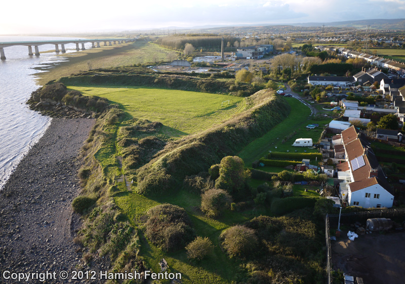
Sudbrook Camp submitted by h_fenton on 13th Nov 2012. Sudbrook Camp, viewed from the east.
Kite Aerial Photograph
10 November 2012
(View photo, vote or add a comment)
Log Text: Walking the Welsh Coast Path from Chepstow to Caldicot. Remains of iron age fortifications on the banks of the Severn estuary at Sudbrook, beside the railway tunnel pumping station and the landfall of the M4 Severn Crossing on the Welsh side. Lovely looking out to sea when the tide is in, not so lovely looking inland with the houses built so near.
Stripple Stones
Date Added: 18th Sep 2010
Site Type: Stone Circle
Country: England (Cornwall)
Visited: Yes on 27th Nov 2008
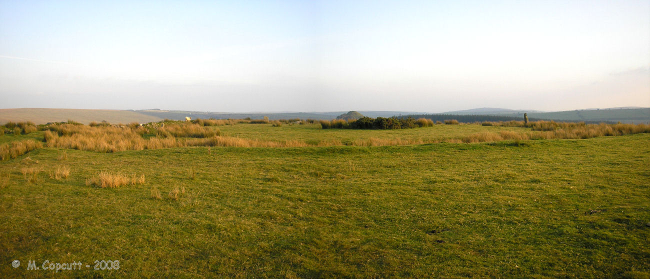
Stripple Stones submitted by thecaptain on 27th Nov 2008. The Stripple Stones Henge and Stone Circle.
Viewed here looking approx southwards.
(View photo, vote or add a comment)
Log Text: None
Stretton Sheela
Date Added: 29th Oct 2019
Site Type: Early Christian Sculptured Stone
Country: England (Shropshire)
Visited: Yes on 23rd Nov 2018
Stretton Sheela submitted by TheCaptain on 23rd Nov 2018. Above the old Norman doorway on the north side of the church at Church Stretton is a much older carved Sheela-na-gig stone, presumably from an earlier time and built into the church.
(View photo, vote or add a comment)
Log Text: None
Stowe's Pound
Date Added: 18th Sep 2010
Site Type: Ancient Village or Settlement
Country: England (Cornwall)
Visited: Yes on 2nd Oct 2009
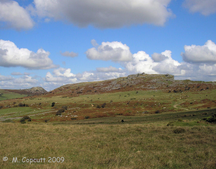
Stowe's Pound submitted by thecaptain on 2nd Oct 2009. Stowe's Pound, with its two neolithic hilltop enclosures, plus settlement with its many hut circles and field systems.
Seen here looking east from Craddock Moor.
(View photo, vote or add a comment)
Log Text: None
Stoney Littleton
Date Added: 18th Sep 2010
Site Type: Chambered Cairn
Country: England (Somerset)
Visited: Yes on 18th Mar 2005
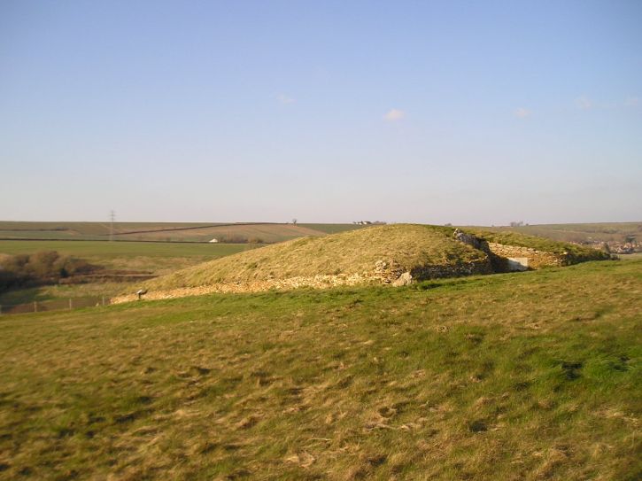
Stoney Littleton submitted by TheCaptain on 18th Mar 2005. I called in at Stoney Littleton last weekend, a cracking little barrow. A lovely sunny day, but the walk to the barrow was horrendously muddy.
Checked out the pictures here, lots of the entrance and from inside, but there are none which show the whole barrow. So here is one looking at it from the south.
(View photo, vote or add a comment)
Log Text: None
Stoney Littleton
Date Added: 2nd Sep 2024
Site Type: Chambered Cairn
Country: England (Somerset)
Visited: Yes on 29th Aug 2024. My rating: Condition 5 Ambience 4 Access 4

Stoney Littleton submitted by TheCaptain on 18th Mar 2005. Stoney Littleton barrow viewed from the west.
Its a cracking little barrow, with the most wonderful passage and chambers inside, and the powers that be have even left a decent sized area around it free of any farming activity. A lovely sunny day, but some of the walk to the barrow was horrendously muddy.
The fields around the barrow had recently been ploughed, a crop of beet of some sort having been the last grown. While walking back after my visit, I found a bit of the lovely golden colou...
(View photo, vote or add a comment)
Log Text: I parked in the area by the wooden bridge to the southwest of Wellow, but the bridge had been fenced off with notices stating that it is dangerous. An alternate route is posted, taking the dangerous narrow lane to the west before crossing the river on a concrete farm bridge, then over an electric fence back along the far side of the river through a field with a rampant ram in it, before we are back to the normal way up to the barrow. Lovely to see it again after all this time, and in clear sunlight. I do not recommend crawling inside with bare knees, a bad back and without a torch, but it had to be done, didn't it.
Stonehenge.
Date Added: 29th Oct 2019
Site Type: Stone Circle
Country: England (Wiltshire)
Visited: Yes on 1st Jun 2011

Stonehenge. submitted by TheCaptain on 1st Jun 2011. Stopping off for a rest (and no doubt a picnic) at Stonehenge, while travelling back up the A303 from summer holiday in Cornwall, 1969.
Spot the young Stonehunter!
(View photo, vote or add a comment)
Log Text: None
Ston Easton Barrow
Date Added: 18th Sep 2010
Site Type: Round Barrow(s)
Country: England (Somerset)
Visited: Yes on 20th Nov 2005
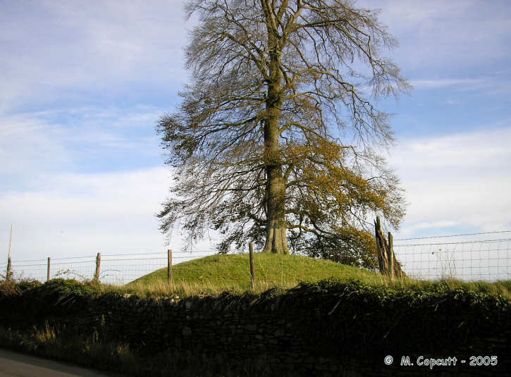
Ston Easton Barrow submitted by thecaptain on 20th Nov 2005. Ston Easton Barrow as seen from the A37.
I have driven past this barrow hundreds of times and regularly thought I ought to pay it a proper visit. Travelling home from my friends the Shepto Steptoe's the morning after Wells Carnival it was wonderfully sunny, and I had my camera.
This is the view from the roadside.
(View photo, vote or add a comment)
Log Text: None
Stokeleigh Camp
Date Added: 6th Nov 2023
Site Type: Promontory Fort / Cliff Castle
Country: England (Somerset)
Visited: Yes on 28th Aug 2011. My rating: Condition 4 Ambience 4 Access 4
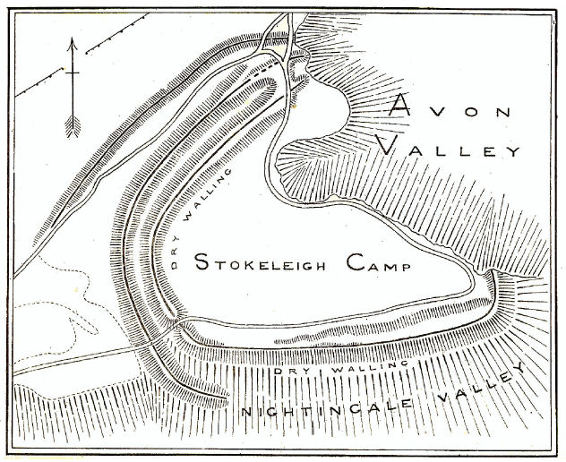
Stokeleigh Camp submitted by TheCaptain on 19th Aug 2011. Plan of Stokeleigh Camp from
Notes on the Clifton, Burwalls and Stokeleigh Camps
by Professor C. Lloyd Morgan,
Clifton Antiquarian Club 1900.
(View photo, vote or add a comment)
Log Text: Iron age promontary hillfort on a spur overlooking the Avon Gorge from the high plateau at the western side of the Gorge, now a part of the large Leigh Woods nature reserve. This is one of three iron age forts here probably guarding a ford crossing of the river Avon at the bottom of the Avon Gorge, below where is now the Clifton Suspension Bridge. The promontary points towards the east, with the steep sided Nightingale valley marking the southern edge, where the hillside has been sculpted, with another smaller steep sided valley making the northeastern edges of the camp. The camp is completed around its northwestern sides by a double arc of massive ditch and bank ramparts, both once topped with stone walling. The main entrance was probably at the northern edge of the plateau, beside the steep cliff edge, where there is a third row of ditch and bank to help gaurd. I decided on a walk round Leigh Woods and to take in Stokeleigh Camp, on a showery bank holiday afternoon. Several things took my notice since my last visit here many years ago, firstly that it has all been tidied up by National Trust and much of the woodland cleared around the ramparts, making them very visible (I wasn't expecting to really be able to see them or get any decent pictures at all). I was most impressed with the massive size of the main ramparts, the inner bank being about 5 metres above the ground level inside, while the ditch outside must be almost of equal depth, making a top to bottom height of between 8 and 10 metres! Massive! Outside the inner bank and ditch is a second ring of bank and ditch, this time the relative heights and depth being about +/- 2 metres. At places around the top of the major rampart, there are places where stretches of vertical stone walling can be seen. In order to keep the vegetation down, NT and English Nature have decided to graze half a dozen Devon Red cattle around the camp.
