Contributory members are able to log private notes and comments about each site
Sites theCAptain has logged. View this log as a table or view the most recent logs from everyone
Haresfield Beacon tumulus
Date Added: 9th Sep 2020
Site Type: Round Barrow(s)
Country: England (Gloucestershire)
Visited: Yes on 31st Aug 2020. My rating: Condition 3 Ambience 5 Access 4
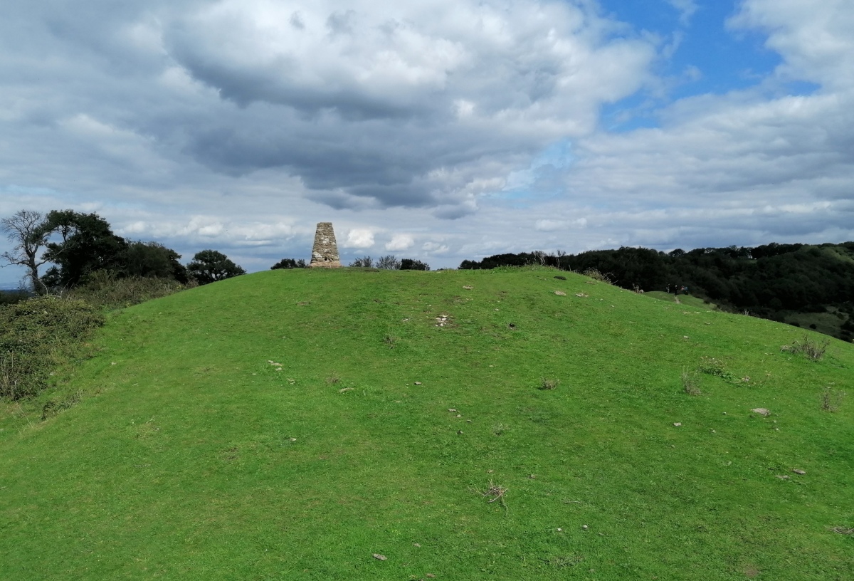
Haresfield Beacon tumulus submitted by TheCaptain on 3rd Sep 2020. The tumulus with trig point on top, at the western end of Haresfield Beacon.
(View photo, vote or add a comment)
Log Text: Walk around the Bruce Friendship Trail, which takes in the superb Haresfield Beacon with its remnants of promontory hillfort with a round tumulus at the western point, with a trig point on the top. Superb views over the Severn Vale
Drakestone Camp
Date Added: 9th Sep 2020
Site Type: Misc. Earthwork
Country: England (Gloucestershire)
Visited: Yes on 23rd Aug 2020. My rating: Condition 2 Ambience 5 Access 3
Drakestone Camp submitted by 4clydesdale7 on 6th Jul 2011. One of the middle banks and ditches
(View photo, vote or add a comment)
Log Text: Walk round the Korea Friendship Trail from Dursley on a bright and breezy Sunday afternoon with a pint in the Old Spot afterwards. The views up here are tremendous, and with various other nearby viewpoints you get a full 360 degrees. Even on this not very clear day, as well as almost the entire length of the Cotswold Edge, I could make out the Mendip Hills, Bristol Channel, Black Mountains, Malvern Hills.
Hawkesbury Knoll
Date Added: 9th Sep 2020
Site Type: Long Barrow
Country: England (Gloucestershire)
Visited: Saw from a distance on 7th Aug 2020

Hawkesbury Knoll submitted by TheCaptain on 15th Apr 2004. Hawksbury Knoll, Chambered Tomb, South Gloucestershire, ST768872.
The view of the barrow atop Hawkesbury Knoll from the Somerset Monument.
(View photo, vote or add a comment)
Log Text: Seen up on the top of the Cotswold Edge during a hot and humid Friday afternoon 11k walk, north from Hawkesbury Upton to the monument, then down the Cotswold Edge to Inglestone Common, south to Hawkesbury Common and on to Horton Court before going back up the Cotswold Edge and along the Cotswold Way andd "Yellow Brick Road" to Hawkesbury and a pint at the Beaufort Arms afterwards.
Horton Camp
Date Added: 9th Sep 2020
Site Type: Hillfort
Country: England (Gloucestershire)
Visited: Yes on 31st Jul 2020. My rating: Condition 3 Ambience 5 Access 4
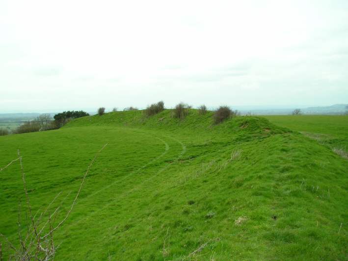
Horton Camp submitted by TheCaptain on 29th Mar 2004. Horton Camp Hillfort, South Gloucestershire, ST765845, March 2004.
View looking northwest along the remaining bank across the top of the hill. There is no sign of a ditch. The "inside" of the camp is to the left.
I may well be wrong, but I think that this bank may be a former internal division of what was once a much bigger camp taking in the entire promontary, not just the southern end.
(View photo, vote or add a comment)
Log Text: Friday afternoon 10k walk, north from Old Sodbury along the Cotswold Edge through two ancient forts, past three old churches and lots of big houses to Horton Court. Back over fields through Little Sodbury. Stopped for a pint at the Dog afterwards.
Old Sodbury
Date Added: 9th Sep 2020
Site Type: Hillfort
Country: England (Gloucestershire)
Visited: Yes on 31st Jul 2020. My rating: Condition 4 Ambience 3 Access 4
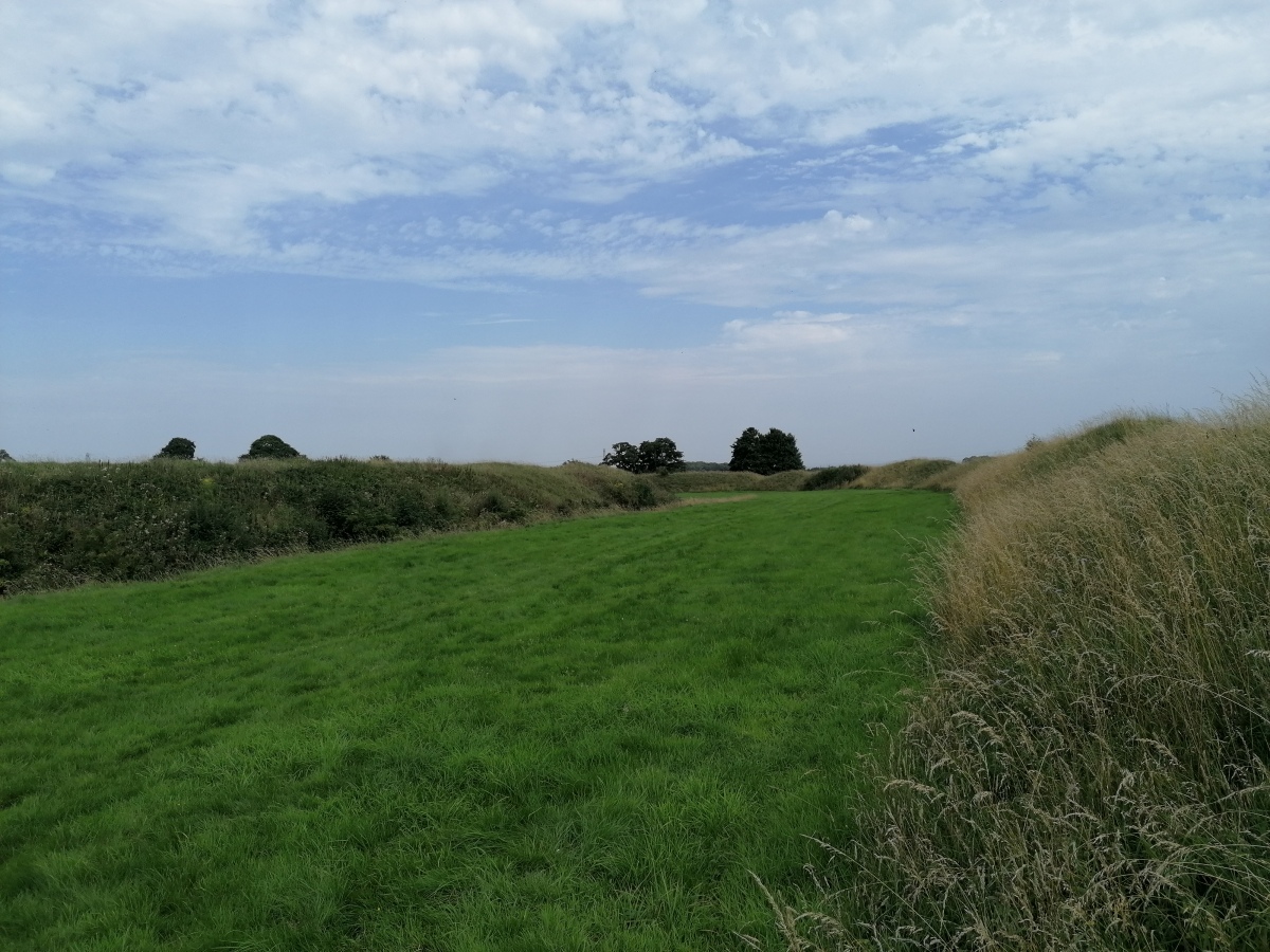
Old Sodbury submitted by TheCaptain on 4th Aug 2020. View east between the fortifications from the outer bank of Old Sodbury Camp
(View photo, vote or add a comment)
Log Text: Friday afternoon 10k walk, north from Old Sodbury along the Cotswold Edge through two ancient forts, past three old churches and lots of big houses to Horton Court. Back over fields through Little Sodbury. Stopped for a pint at the Dog afterwards.
Oldbury Standing Stone
Date Added: 9th Sep 2020
Site Type: Standing Stone (Menhir)
Country: England (Gloucestershire)
Visited: Yes on 3rd Jun 2020. My rating: Condition 3 Ambience 3 Access 4

Oldbury Standing Stone submitted by TheCaptain on 8th May 2016. On a warm sunny afternoon, I went for a good look for this, but found nothing to match the description. In fact, at some time in the past (since 1953) a whole load of drainage and seawall flood protection work has been done, which now contains the Oldbury Naite Rhine within substantial banks, with any of its little tributaries in the area now in underground culverts emptying through flap doors into the Rhine. The height of the banking is now well above what it would have been.
(View photo, vote or add a comment)
Log Text: Went for a look for this stone on a hot sunny June afternoon as part of a walk around Oldbury. Despite being 99% sure where it was to be found, I initially didn't find it as it was totally overgrown, and not under the new footpath gate, but an old wooden bit of fence to the side. With a bit of trampling on the long grass, I got to see the whole stone. Great to see it, it would be a splendid standing stone.
The Toots (Oldbury)
Date Added: 9th Sep 2020
Site Type: Hillfort
Country: England (Gloucestershire)
Visited: Yes on 3rd Jun 2020. My rating: Condition 3 Ambience 3 Access 4
The Toots (Oldbury) submitted by 4clydesdale7 on 4th Jul 2011. The best evidence of the Fort - the NNE rampart looking SE
(View photo, vote or add a comment)
Log Text: At the end of a walk along the Severn estuary and all round the old Oldbury Nuclear Powerstation, I walked back to Oldbury-on-Severn right through the Toots camp. Nice roadsign leading to it, and some information boards have now been put up in the village.
Oldbury-on-Severn Submerged Forest
Date Added: 9th Sep 2020
Site Type: Natural Stone / Erratic / Other Natural Feature
Country: England (Gloucestershire)
Visited: Saw from a distance on 3rd Jun 2020
Oldbury-on-Severn Submerged Forest submitted by 4clydesdale7 on 4th Jul 2011. As I stated like Atlantis risng
(View photo, vote or add a comment)
Log Text: It is now possible to walk all the way up the Severn Estuary past the tidal pool, and through the ex nuclear power station. Looking out at the tidal pool at low tide, all sorts of lumpy bumpy bits can be seen below the wall, quite possibly the remains of the petrified forest.
Shortwood Hill barrow
Date Added: 9th Sep 2020
Site Type: Round Barrow(s)
Country: England (Gloucestershire)
Visited: Yes on 30th May 2020. My rating: Condition 2 Ambience 2 Access 4
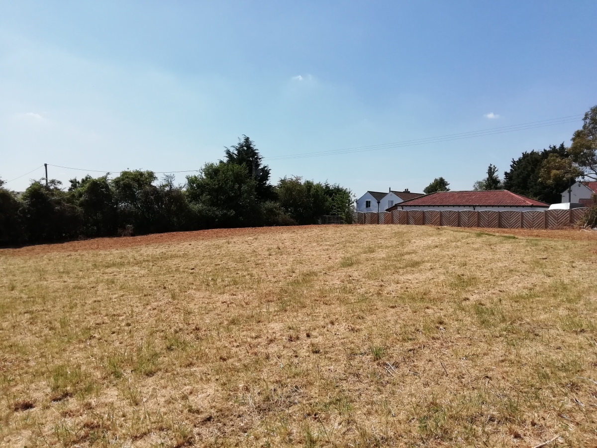
Shortwood Hill barrow submitted by TheCaptain on 30th May 2020. A long walk during the supposed lockdown (end May 2020) took me through this field and over the barrow for the first time in many years. Despite the field being cleared and shorn of vegetation, the barrow was more disappointing to see than I remembered.
(View photo, vote or add a comment)
Log Text: A long walk during the lockdown (end May 2020) took me through this field and over the barrow for the first time in many years. Despite the field being cleared and shorn of vegetation, the barrow was more disappointing to see than I remembered.
St Anne’s well (Siston)
Date Added: 9th Sep 2020
Site Type: Holy Well or Sacred Spring
Country: England (Gloucestershire)
Visited: Yes on 30th May 2020. My rating: Condition 2 Ambience 2 Access 5
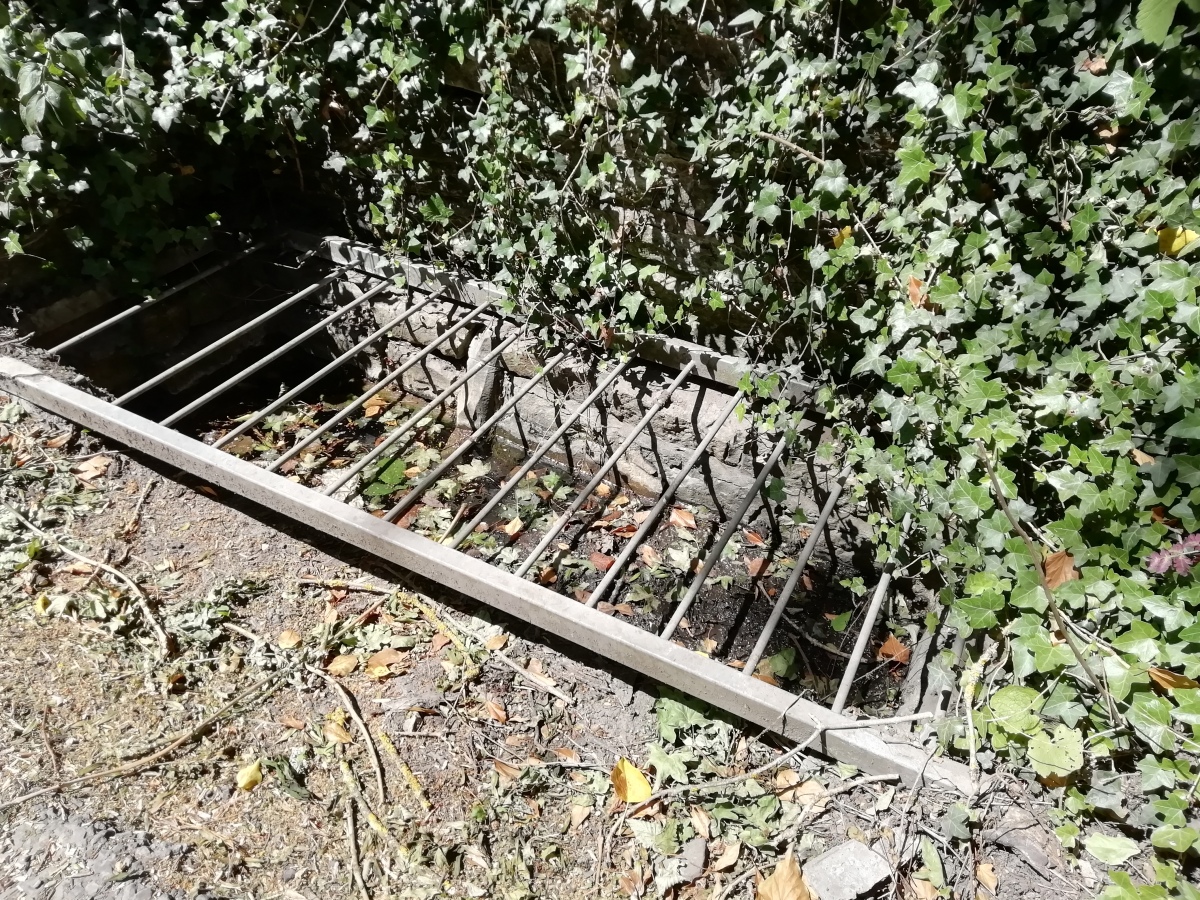
St Anne’s well (Siston) submitted by TheCaptain on 30th May 2020. St Anne’s well (Siston), an open stone trough with a covering grate, right at the edge of the road. On the day of my visit, this was largely dry.
(View photo, vote or add a comment)
Log Text: Not to be confused with the hexagonal gothic wellhouse tower to the north of Siston Court, the real St Anne's well is found down by the stream beside the road, just to the north of the old bridge and on a very dangerous bend. Amongst other things, the water was supposed to be good for healing poor eyesight, and people travelled for miles to try the cure, which was still being publicised into the 1930's.
What there is to see today is an open stone trough, about 4 feet by 18 inches with a covering grate, right at the edge of the road rather like a big drain. On the day of my visit, this was largely dry.
Mynydd Bach Cairn 2
Date Added: 22nd Mar 2020
Site Type: Round Barrow(s)
Country: Wales (Monmouthshire)
Visited: Yes on 21st Mar 2020. My rating: Condition 2 Ambience 2 Access 4
Mynydd Bach Cairn 2 submitted by TheCaptain on 25th Mar 2020. Found the remains of this cairn fairly easily, making a circular patch of green grass amongst the gorse and other growth. It is not a great monument being very flattened and destroyed, and also the whole area is absolutely covered with rubbish of all sorts.
(View photo, vote or add a comment)
Log Text: First cairn of four marked on the OS Map during a walk from the Sirhowy Country Park around the Cwmfelinfach valley, up the Sirhowy River and back along the Rhymney Ridgeway path. Found the remains of this cairn fairly easily, making a circular patch of green grass amongst the gorse and other growth. It is not a great monument being very flattened and destroyed, and also the whole area is absolutely covered with rubbish of all sorts. The whole area is used by people for offroading and all sorts of other activities, some not so wholesome.
Twyn Cae-Hugh
Date Added: 22nd Mar 2020
Site Type: Round Barrow(s)
Country: Wales (Monmouthshire)
Visited: Yes on 21st Mar 2020. My rating: Condition 3 Ambience 3 Access 4
Twyn Cae-Hugh submitted by TheCaptain on 25th Mar 2020. This was an easily seen tumulus of fairly large size just to the east of the trackway
(View photo, vote or add a comment)
Log Text: The second cairn of four marked on the OS Map during a walk from the Sirhowy Country Park around the Cwmfelinfach valley, up the Sirhowy River and back along the Rhymney Ridgeway path.
This was an easily seen tumulus of fairly large size just to the east of the trackway and walled off from it, which has helped with its survival. We stopped here for lunch sheltered from the wind and in the sun.
Twyn-Yr-Oerfel A
Date Added: 22nd Mar 2020
Site Type: Round Barrow(s)
Country: Wales (Monmouthshire)
Visited: Yes on 21st Mar 2020. My rating: Condition 3 Ambience 3 Access 4
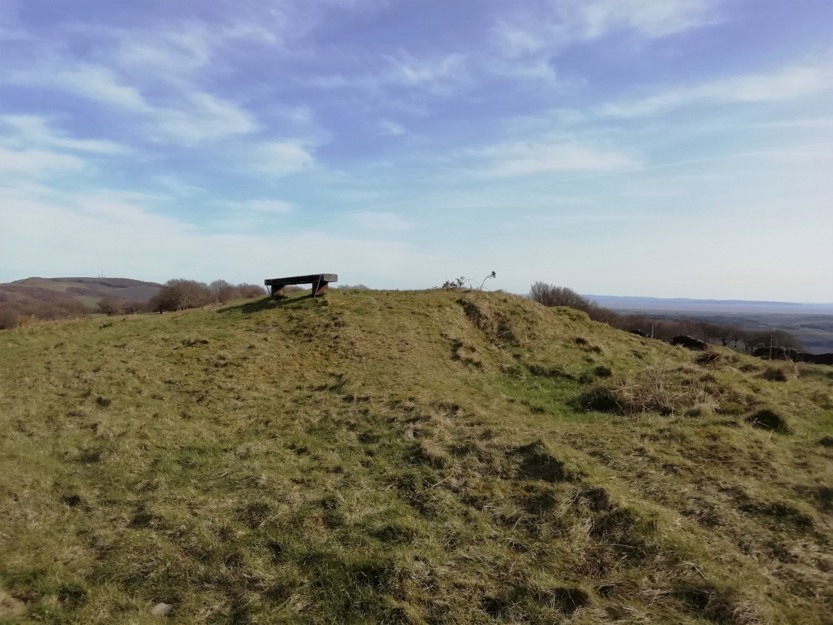
Twyn-Yr-Oerfel A submitted by TheCaptain on 25th Mar 2020. The easterly of the two barrows, this one is the more ruined, but easily found and identified. It has a large pit dug into the top and a bench positioned on the top.
The views from up here would be terriffic, but the whole area is not a great place to be with so many off road tracks all around making the whole area a mess of mud.
(View photo, vote or add a comment)
Log Text: The fourth and last cairn marked on the OS Map during a walk from the Sirhowy Country Park around the Cwmfelinfach valley, up the Sirhowy River and back along the Rhymney Ridgeway path.
A few hundred yards to the east of the previous barrow, this one is more ruined than that, but easily found and identified. It has a large pit dug into the top and a bench positioned on the top. The views from up here would be terriffic, but the whole area is not a great place to be with so many off road tracks all around making the whole area a mess of mud. The old mining tips don't help, so perhaps it is an improvement on a century ago.
Twyn-Yr-Oerfel B
Date Added: 22nd Mar 2020
Site Type: Round Barrow(s)
Country: Wales (Monmouthshire)
Visited: Yes on 21st Mar 2020. My rating: Condition 3 Ambience 3 Access 4

Twyn-Yr-Oerfel B submitted by TheCaptain on 29th Mar 2020. Following the ridgeway track to the south the barrow is right in front of you as you descend into the open land. It was surrounded by many large blocks of stone to prevent the off road drivers driving over it.
(View photo, vote or add a comment)
Log Text: The third cairn of four marked on the OS Map during a walk from the Sirhowy Country Park around the Cwmfelinfach valley, up the Sirhowy River and back along the Rhymney Ridgeway path.
Following the ridgeway track to the south and then east passing beween the large minimg tip and the forest along the stony track used by off road bikers, and the barrow is right in front of you as you descend into the open land. It was surrounded by many large blocks of stone to prevent the off road drivers driving over it, but this does not prevent the bikers.
While here there was the remains of a burnt out motorbike laying just beside it. The barrow is nicely formed apart from the tracks over it, and looked initially to have a large stone structure within, but I later read that it is built onto a natural rock outcrop, so this is probably part of it.
Offa's Dyke at Tidenham Chase
Date Added: 9th Sep 2020
Site Type: Misc. Earthwork
Country: England (Gloucestershire)
Visited: Yes on 22nd Nov 2019. My rating: Condition 4 Ambience 4 Access 4
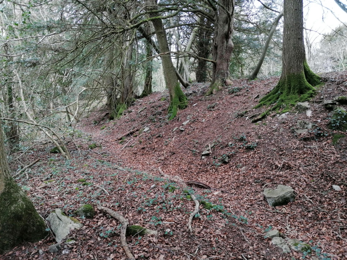
Offa's Dyke at Tidenham Chase submitted by TheCaptain on 7th Apr 2022. A walk up Offas Dyke from Chepstow to Brockweir, and not hammering down with rain this time, so I got a few snaps. The banks are not built as big as further north, but there is a lot of stone in the construction here, looking more like a wall in places.
(View photo, vote or add a comment)
Log Text: Well preserved and significantly built section of Offa's Dyke high up on the eastern side of the River Wye at Tidenham Chase. The Offa's Dyke path is well used here, and in places offers splendid views over the river to Wales, with options to walk north to the well known "Devil's Pulpit" rock stack allowing intrepid visitors a superb vista of Tintern Abbey. South leads to the rocky cliffs above the River Wye at Wintour's Leap.
Anta de Folgos I
Date Added: 26th Oct 2019
Site Type: Burial Chamber or Dolmen
Country: Portugal (Évora)
Visited: Saw from a distance on 13th Oct 2019. My rating: Access 4
Log Text: Saw this from the car while driving south east. Nowhere obvious to park to go back and have a look, so didn't.
Anta do Barrocal 2
Date Added: 28th Oct 2019
Site Type: Burial Chamber or Dolmen
Country: Portugal (Évora)
Visited: Saw from a distance on 13th Oct 2019. My rating: Condition 3 Ambience 3 Access 3

Anta do Barrocal 2 submitted by Bak_teria on 9th Mar 2015. A view from near by Barrocal 2 in 2015.
(View photo, vote or add a comment)
Log Text: From the dolmen 1, I see a gate with signpost into the field, so use that to get out, and start to look for the dolmen number 2, which is on the other sde of the trackway. I see it up on the hillside a hundred yards or so away, and with no obvious way in, and cattle in the field.
Compared to the number 1, its a bit of a wreck anyway, so I make do with a couple of pictures from the trackway. At this point, while going back to the car, I see somebody on a quadbike haring up the lane towards me, so I nod and wave at him as he approaches. He slows down and looks like he's heading into the nearby field, but just looks at me, turns round and heads back from whence he came. I guess he had seen me from the farm and was just checking me out, but as I was obviously leaving anyway said nothing.
Gruta do Escoural
Date Added: 29th Oct 2019
Site Type: Cave or Rock Shelter
Country: Portugal (Évora)
Visited: Saw from a distance on 13th Oct 2019
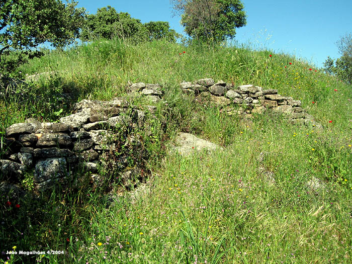
Gruta do Escoural submitted by Magalhaes on 30th Apr 2006. Wall from the neolithic (?) settling, straight uphill from the cave.
(View photo, vote or add a comment)
Log Text: Next I go for a quick look at the Escoural caves, which are all fenced off and locked up, with a sign telling how to book a visit with at least 24 hours notice. Hey Ho.
Anta Herdade do Barrocal 1
Date Added: 29th Oct 2019
Site Type: Burial Chamber or Dolmen
Country: Portugal (Évora)
Visited: Yes on 13th Oct 2019. My rating: Condition 4 Ambience 4 Access 4

Anta Herdade do Barrocal 1 submitted by KenWilliams on 26th Feb 2007. The larger Barrorcal Anta, the second, smaller one is behind the trees to the right of that tower in the background.
(View photo, vote or add a comment)
Log Text: From Evora it was time for my day hunting stones. Thankfully I had done much previous research, otherwise I would have found it extremely difficult. I struggled to get out of the walled city of Evora, round all the one way systems etc, but eventually after finding a place to stop, where I figured out how to use the satnav, and there was no looking back!
The next problem was how to locate the sites, as nothing is on any maps, and very little is signposted. However, with use of my previously prepared Google map of sites, and better phone coverage out here than most places at home, I was able to locate the road to these dolmens, where I realised that many of the roads are actually dirt and gravel tracks, and many seem to start from the main roads through gated entrances.
About threequarters of a km along the dirt track to Barrocal, and I see the old windmill and a place I can park, and then I see the dolmen just in the field to the right. There is a path to it, and it is well sited on the top of a hillock, a nicely complete dolmen with remains of its entrance passageway. It is not very picturesque today, grey skies threatening to rain, and the ground covered in scrub.
Anta Grande do Zambujeiro
Date Added: 4th Nov 2019
Site Type: Burial Chamber or Dolmen
Country: Portugal (Évora)
Visited: Yes on 13th Oct 2019. My rating: Condition 3 Ambience 2 Access 4
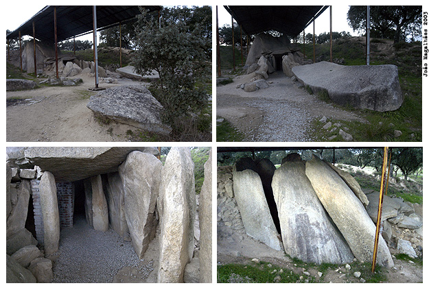
Anta Grande do Zambujeiro submitted by Magalhaes on 14th Apr 2006.
(View photo, vote or add a comment)
Log Text: With claims to being the largest burial chamber in the Iberian Peninsula, and hence one of the biggest in the world, the Anta Grande do Zambujeiro is relatively easy to find, as it is on all the megalithic circuits and leaflets, and signposted from all around. However, it is again about a kilometer along a dirt track, this one not very smooth and with some huge potholes in, so be careful. There is a nice shady place to park, with several cars in it, from where it is a couple of hundred metres walk across a footbridge and field to the fenced in site.
It is huge, but all a bit of a mess, with a big iron shed built over most of it. The entrance corridor is all falling down, and any sort of entrance to the main chamber is well blocked off. It was all obviously once buried under an enormous mound, most of which remains, but the main structure has been dug out, which is what is causing it to collapse. The main chamber, still partially enclosed, is massive and must be almost 8 metres tall, made from huge slabs. For somebody more nimble than me, it would be possible to get in through a gap in some of the side slabs, but good luck getting out again as it's 2 metres down to the floor! The capstone has been removed and lies on the ground on the slope of the mound behind the chamber. There are several other large slabs, with cupmarks and other engravings laying down outside the entrance.
Despite its massive size, and obvious importance, for me it all lacked something, perhaps because of the shed and fencing. I hope that something can be done to stabilise and repair it, and make it a much more pleasant place to visit, as obviously a lot of people do come here.
