Contributory members are able to log private notes and comments about each site
Sites theCAptain has logged. View this log as a table or view the most recent logs from everyone
Dolmen de la Pierre (Hercé)
Trip No.202 Entry No.25 Date Added: 26th Mar 2020
Site Type: Burial Chamber or Dolmen
Country: France (Pays de la Loire:Mayenne (53))
Visited: Yes on 24th Apr 2005. My rating: Condition 3 Ambience 3 Access 3
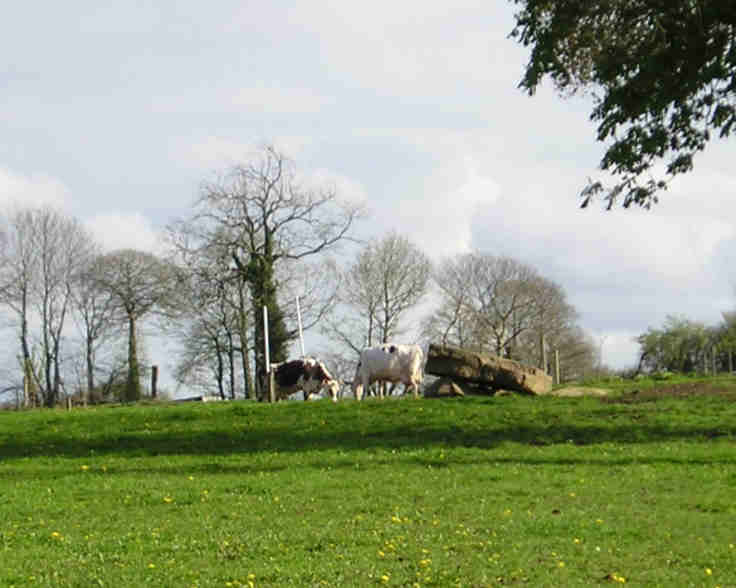
Dolmen de la Pierre (Hercé) submitted by TheCaptain on 7th May 2005. La Pierre dolmen, Hercé, Mayenne.
This is a simple dolmen with a large capstone supported by several small uprights in a field just in front of a farmhouse. Access to the dolmen was not available at the time of my visit, as it was in a field of young cows.
(View photo, vote or add a comment)
Log Text: This small dolmen can be found a few hundred metres to the south of the D33 road turning first left travelling westwards from Hercé. It is a simple dolmen with a large capstone supported by several small uprights in a field just in front of a farmhouse. Access to the dolmen was not available at the time of my visit as it was in a field of young cows but there was a signpost towards it as if it is possible to get to it at other times.
Menhir dit la Pierre Saint-Siviard
Trip No.202 Entry No.23 Date Added: 26th Mar 2020
Site Type: Standing Stone (Menhir)
Country: France (Pays de la Loire:Mayenne (53))
Visited: Yes on 24th Apr 2005. My rating: Condition 3 Ambience 3 Access 4

Menhir dit la Pierre Saint-Siviard submitted by TheCaptain on 7th May 2005. Menhir dit la Pierre Saint-Siviard, Le Pas, Mayenne.
Near L’Ervault on the is this smoothed menhir, 2.5 to 3 metres tall.
(View photo, vote or add a comment)
Log Text: Near L’Ervault on the D33 road from Ambrieres to Gorron this menhir can be found a few hundred metres north of the road up the trackway from the roadside cross. It is a smoothed menhir 2.5 to 3 metres tall in a little open area between fields used for storage of wood and other farm items.
La Table aux Diables (Passais)
Trip No.202 Entry No.19 Date Added: 26th Mar 2020
Site Type: Passage Grave
Country: France (Normandie:Orne (61))
Visited: Yes on 24th Apr 2005. My rating: Condition 4 Ambience 4 Access 5
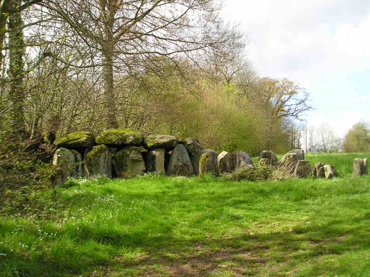
La Table aux Diables (Passais) submitted by TheCaptain on 7th May 2005. La Table aux Diables allée couverte, Passais, Orne.
A surprise find, this smashing little lateral entry Allée Couvert is about 12 or 13 metres in length, seen here from the southeast.
(View photo, vote or add a comment)
Log Text: Blimey what a pleasure to find this monument signposted from the Mantilly to Passais road as well as marked on the ign map. Heading south along the small road just west of Passais and turn right just before a little fishing lake is reached. A few hundred yards up a small track and the monument is found in a field to the right.
A surprise find this is a smashing little lateral entry Allée Couvert is about 12 or 13 metres in length with an orientation of 049° Magnetic. The main chamber is about 1.5 metres in width with 4 large capstones still remaining on 6 pairs of uprights at the western end with a height of 2 metres at the end dropping to 1.5 metres at the open end. The eastern end is more ruinous and the entrance is near the eastern end on the south side. The internal faces of the chamber stones have been nicely smoothed and are very well aligned with each other the gaps being filled with drystone walling. The outer walling of the peristalith is almost complete around the northern side and there are many stones remaining of the cairn filling between the inner and outer walls in the northwest quadrant. Only about half of the outer wall of stones remain on the southern side.
Menhir de la Roche (Gorron)
Trip No.202 Entry No.24 Date Added: 26th Mar 2020
Site Type: Standing Stone (Menhir)
Country: France (Pays de la Loire:Mayenne (53))
Visited: Couldn't find on 24th Apr 2005
Menhir de la Roche (Gorron) submitted by SMD on 25th Oct 2007. Site in Pays de la Loire:Mayenne (53)
(View photo, vote or add a comment)
Log Text: Unlike all the rest of the menhirs in this area I could find no signpost to this one despite it being clearly marked on the ign map and there being a large warehouse called Menhir Meubles or similar in the vicinity. After a while looking around I gave up not finding this one.
Grotte de Mas D'Azil
Trip No.200 Entry No.25 Date Added: 18th Jun 2020
Site Type: Cave or Rock Shelter
Country: France (Midi:Ariège (09))
Visited: Yes on 24th Apr 2005. My rating: Access 5

Grotte de Mas D'Azil submitted by thecaptain on 13th Dec 2003. The southern, upstream, entrance to the magnificent cave at Mas D'Azil, Ariege, southwest France.
The river takes a shortcut through the hillside here, and has created a massive cave, which is so big that a fairly large road also runs through the cave.
Within this cave were found signs of life going back tens of thousands of years, and indeed the world famous Faon aux Oiseaux spear thrower. The finds here gave the name Azilian to an entire prehistoric culture.
(View photo, vote or add a comment)
Log Text: A lovely sunny day to explore the Ariege mountains. Puivert castle. Fontestorbes. Montsegur Castle. Pass de ? closed. Plain de ? Ax-les-Thermes, Col de Portel, scary roads. The usual drive through of Mas D’Azil on the way home to impress visitors. Get back to Toulouse late.
Pierres Pouquelées
Trip No.202 Entry No.30 Date Added: 26th Mar 2020
Site Type: Passage Grave
Country: France (Normandie:Manche (50))
Visited: Yes on 26th Apr 2005. My rating: Condition 3 Ambience 5 Access 4

Pierres Pouquelées submitted by thecaptain on 29th Apr 2005. Pierres Pouquelées View looking southish at this much ruined allée couverte on top of the hilly downs to the northwest of the village of Vauville, where the wonderful long beach can just be made out.
(View photo, vote or add a comment)
Log Text: Much ruined allée couverte on top of the hilly downs to the northwest of the village of Vauville. I measured the remains out to about 12 metres in length but I have seen in a guidebook that the remains are said to be 17 metres long. Perhaps there are more stones under the undergrowth than I saw in the flattened grassy area.
There is only any remains of the central chamber of which can be seen about 9 pairs of stones and 2 remaining capstones in place with a couple more fallen in the middle. There is no sign of any outer peristalith and I could not determine where the entrance would have been. The allée couverte is aligned on about 150° and runs slightly downhill with a large perpendicular endstone still in place at the upper end. Looking along the tomb and it seems to align on the top of the large hill over the other side of the valley above the wonderful beach upon which I believe a menhir once stood.
Although the monument is much ruined it really is in a lovely position at the top of a big hill overlooking the sea with the rocky cliffs of Cap de la Hague stretching away to the northwest and the lovely long beach running south from Vauville. The Island of Alderney can be seen out in the sea and the viscious tide race between the mainland and Alderney can be seen in full flow at the right time of day. It can be reached by a longish and steep walk up from Vauville or alternatively it can be driven almost right to by following the road down towards it from the north and then following the unmade tracks from there which are marked on the 1:25000 scale ign maps.
Dolmen du Jogard
Trip No.202 Entry No.28 Date Added: 26th Mar 2020
Site Type: Burial Chamber or Dolmen
Country: France (Normandie:Manche (50))
Visited: Yes on 26th Apr 2005. My rating: Condition 1 Ambience 2 Access 3
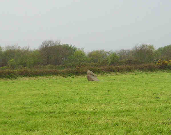
Dolmen du Jogard submitted by TheCaptain on 7th May 2005. Le Jogard, St Germain-des-Vaux, Manche.
I am not 100 percent sure that what I saw and photographed in a downpour here is the remains of this dolmen or not, but it is in the right sort of place.
(View photo, vote or add a comment)
Log Text: A much ruined dolmen just northwest of the village of St Germain-des-Vaux on Cap de la Hague right at the northwestern tip of the Cherbourg peninsular.
I am not 100 percent sure that what I saw and photographed in a downpour was the remains of this dolmen or not but it was in the right sort of place. What I saw was a single stone remaining in a field beside the track beyond the house called Le Jogard. I could not enter the field to see if there were any other stones flat to the ground here and there were several loose cows which came and wanted to inspect me !
Menhir de la Bergerie des Etennevaux
Trip No.202 Entry No.29 Date Added: 26th Mar 2020
Site Type: Standing Stone (Menhir)
Country: France (Normandie:Manche (50))
Visited: Saw from a distance on 26th Apr 2005

Menhir de la Bergerie des Etennevaux submitted by TheCaptain on 7th May 2005. La Bergerie des Etennevaux, menhir, St Germain-des-Vaux, Manche.
Menhir about 2 metres tall right at the northwestern tip of the Cherbourg peninsular, seen from two fields distance in a downpour.
(View photo, vote or add a comment)
Log Text: Menhir about 2 metres tall northwest of the village of St Germain-des-Vaux on Cap de la Hague right at the northwestern tip of the Cherbourg peninsular. I couldn’t get right up to this menhir and could only see it from two fields distance and judged the height from the size of the cows in the field with it.
Hague-Dick
Trip No.202 Entry No.27 Date Added: 26th Mar 2020
Site Type: Misc. Earthwork
Country: France (Normandie:Manche (50))
Visited: Yes on 26th Apr 2005. My rating: Condition 3 Ambience 2 Access 5

Hague-Dick submitted by TheCaptain on 9th May 2005. Several square miles at the northwestern tip of the Cherbourg peninsula, was once defended from the rest of the world by a 2 mile long ditch and bank, which connected between two deep valleys to defend the whole area.
Much of this dyke has now been destroyed, but a good section remains to the northwest of the village of Beaumont Hague, where it can be clearly seen as the roads to Digulleville cut through it.
(View photo, vote or add a comment)
Log Text: Cap de la Hague several square miles at the northwestern tip of the Cherbourg peninsula was once defended from the rest of the world by a 2 mile long ditch and bank which connected between two deep valleys to defend the whole area.
Much of this dyke has now been destroyed but a good section remains to the northwest of the village of Beaumont Hague where it can be clearly seen as the roads to Digulleville cut through it. The bank is generally about 4 metres in height but in places it must be nearer 10 metres tall with small ditches on the landward side. Excavations have shown that the bank was first built in the bronze age but much added to and increased during the time of the Viking occupation in the ninth century.
Broussardière Menhir
Trip No.202 Entry No.36 Date Added: 26th Mar 2020
Site Type: Standing Stone (Menhir)
Country: France (Pays de la Loire:Mayenne (53))
Visited: Yes on 29th Apr 2005. My rating: Condition 4 Ambience 3 Access 4

Broussardière Menhir submitted by TheCaptain on 8th May 2005. La Broussardière menhir, Montaudin, Mayenne.
It is found near the the road from Larchamp to Montflaux, near a little pond beside a stream.
(View photo, vote or add a comment)
Log Text: This menhir is about 2.5 to 3 metres in height and about 1.5 metres in width. It is found just a few yards away from the side of the road from Larchamp to Montflaux near a little pond beside a stream and is easy to see despite the very frisky bullocks in the adjacent field trying to get at me!
La Berthellière
Trip No.202 Entry No.33 Date Added: 26th Mar 2020
Site Type: Polissoir
Country: France (Pays de la Loire:Mayenne (53))
Visited: Yes on 29th Apr 2005. My rating: Condition 4 Ambience 4 Access 4
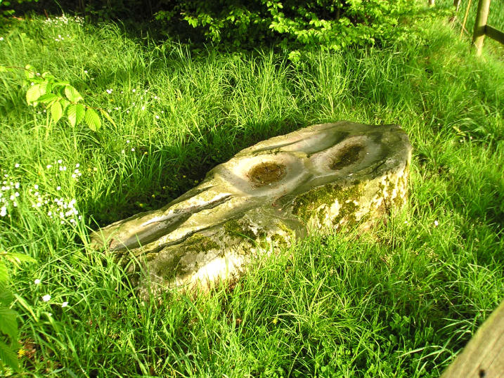
La Berthellière submitted by TheCaptain on 8th May 2005. La Berthellière polissoir, Montenay, Mayenne.
A lovely polissoir stone which has been polished fantastically smooth by thousands of years of stone tool making.
(View photo, vote or add a comment)
Log Text: A lovely polissoir stone found a couple of kilometres southeast of the village of Montenay near to the town of Ernée in Mayenne. The stone is signposted and found in a little wooded area about 50 metres down a lane from the farm of the same name.
The stone is flat on the ground about 2 metres in length and about half to three quarters of a metre wide. It has 3 big polishing bowls several sharpening grooves and several other polished features. It is a very hard looking stone which has been polished fantastically smooth by thousands of years of stone tool making.
I am starting to really like these polissoir stones they really bring the ancient people to life sitting here polishing away at their axes and tools. They say far more than any dolmen or menhir to me.
La Tardivière
Trip No.202 Entry No.35 Date Added: 26th Mar 2020
Site Type: Passage Grave
Country: France (Pays de la Loire:Mayenne (53))
Visited: Yes on 29th Apr 2005. My rating: Condition 3 Ambience 3 Access 4
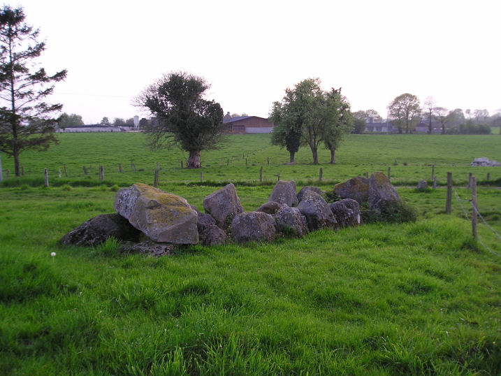
La Tardivière submitted by TheCaptain on 9th May 2005. La Tardivière allée couverte, Ernée, Mayenne.
Another little Mayenne allée couvert about 6 or 7 metres in length facing uphill and eastwards in lovely countryside.
(View photo, vote or add a comment)
Log Text: Another little Mayenne allée couverte about 6 or 7 metres in length facing uphill and eastwards. It is in fairly ruinous condition with only one capstone remaining at the top end of about 8 pairs of upright stones. There is a large end stone at the lower western end.
It is found in open rolling countryside marked on my ign map but not signposted. At the time of my visit it was in an open field about a hundred metres down the farm track from the country lane where I parked. About 30 metres down from the dolmen was a fairly large stone at the side of the farmtrack. Possibly a marker stone for the tomb but I suspect more likely one of the stones from the allée couverte moved away and dumped at some point.
La Contrie du Rocher
Trip No.202 Entry No.34 Date Added: 26th Mar 2020
Site Type: Burial Chamber or Dolmen
Country: France (Pays de la Loire:Mayenne (53))
Visited: Yes on 29th Apr 2005. My rating: Condition 3 Ambience 5 Access 4

La Contrie du Rocher submitted by TheCaptain on 9th May 2005. La Contrie du Rocher
A splendid little Mayenne Allée Couverte found in an enchanting place in a bend in the stream in a bluebell filled wood.
(View photo, vote or add a comment)
Log Text: Another little Mayenne Allée Couverte a couple of kilometres north of Ernée which is signposted from there. It is found in the bottom of a little valley by a bend in a stream in a little woodland a few hundred metres walk along a little track from a farm.
The main chamber consists of 3 very large capstones resting on 6 pairs of uprights aligned on a bearing of 036° which sort of looks along the valley. The remains are about 6 metres in length but there are some remains which take the length of the structure to about 10 metres The entrance appears to be at the northeastern end but it is not definite as that end is quite ruined. It is quite low perhaps not much more than a metre at the current time and about 1.5 metres in width.
Some of the stones are very crude and massive blocks rather than nicely shaped slabs. There are many other large stones scattered around in this lovely little place. I give an ambience rating of 5 because at the time of my visit it was an enchanting place. The sun was going down and the birds were singing loudly. The stream which curves around the tomb was babbling away merrily and the whole wooded area was filled with wildflowers of all sorts bluebells aplenty and lots of purple flowers I didn’t recognise which looked like a sort of crocus. A marvellous little place I wish I could have spent more time at.
Menhir de la Chablère
Trip No.202 Entry No.32 Date Added: 26th Mar 2020
Site Type: Standing Stone (Menhir)
Country: France (Pays de la Loire:Mayenne (53))
Visited: Yes on 29th Apr 2005
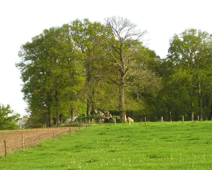
Menhir de la Chablère submitted by TheCaptain on 9th May 2005. Les Bellobières menhir, Oisseau, Mayenne.
I couldnt be quite sure what there is here, although a menhir is marked on my ign map.
Perhaps I completely missed it, maybe there is a ruinous allée couverte here, or perhaps the menhir has had a field clearance cairn made around it.
(View photo, vote or add a comment)
Log Text: Either I missed this menhir marked on my ign map or else there is a ruinous allée couverte here or perhaps the menhir is broken and had a field clearance cairn made around it.
Petit-Vieux-Sou
Trip No.202 Entry No.31 Date Added: 26th Mar 2020
Site Type: Passage Grave
Country: France (Pays de la Loire:Mayenne (53))
Visited: Yes on 29th Apr 2005. My rating: Condition 5 Ambience 4 Access 4
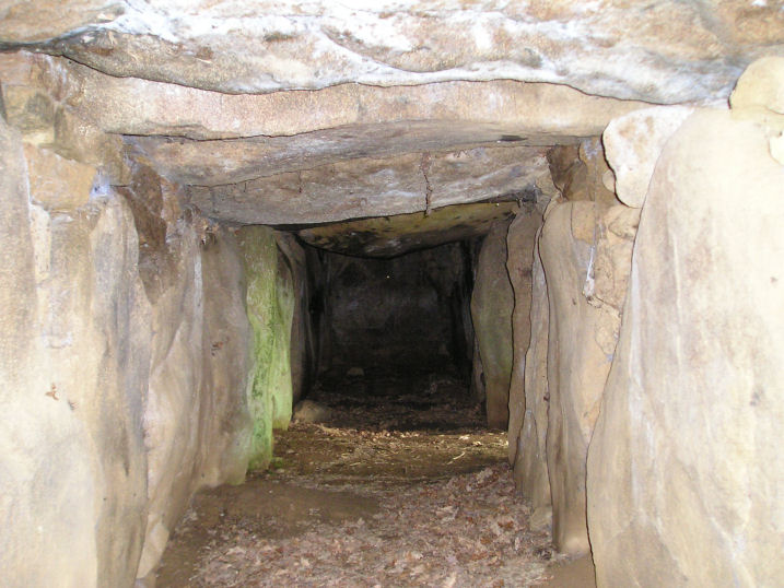
Petit-Vieux-Sou submitted by TheCaptain on 10th May 2005. Le Petit-Vieux-Sou allée couverte, Brecé, Mayenne.
Looking along the inside of this splendid monument, the entrance can be seen on the right where the light is coming in.
(View photo, vote or add a comment)
Log Text: A little Mayenne Allée Couverte 2.5 km southeast of Brecé village which was has been restored. It is found in a little wooded area a few hundred metres south of the country lane by the farm of the same name and is sort of built into the side of a little hillock just above a little stream.
The main chamber consists of 9 capstones on 10 pairs of stones aligned on a bearing of 316° with the lateral entrance central on the south western side. The external dimensions are about 12 m by 4 m with the internal chamber about 1.5 metres in width and height and fully contained within its mound which is built of stone blocks with drystone walling on the SW side and the two ends.
There are quite a few other large stones scattered around in the pleasant little glade full of bluebells and other flowers at the time of my visit which was my first megalithic site in my new campervan. The first of many.
Clivay Menhir
Trip No.202 Entry No.37 Date Added: 28th Mar 2020
Site Type: Standing Stone (Menhir)
Country: France (Pays de la Loire:Mayenne (53))
Visited: Yes on 30th Apr 2005. My rating: Condition 3 Ambience 4 Access 4

Clivay menhir submitted by TheCaptain on 8th May 2005. Clivay menhir, Chailland, Mayenne.
A 2.5 to 3 metre tall menhir in a splendid position near the l’Ernée river below a lovely castle/chateau on top of a bluebell filled wooded hillock.
(View photo, vote or add a comment)
Log Text: A 2.5 to 3 metre tall menhir in a splendid position near the l’Ernée river below a lovely castle/chateau on top of a bluebell filled wooded hillock. It looks as if the top may have been broken off. There are several other large blocks of stone around I wonder if this was once a large boulder that fell from the sort of tor that the chateau is built on that was modified into a menhir.
Menhir du Faix du Diable
Trip No.202 Entry No.38 Date Added: 28th Mar 2020
Site Type: Standing Stone (Menhir)
Country: France (Pays de la Loire:Mayenne (53))
Visited: Yes on 30th Apr 2005. My rating: Condition 4 Ambience 3 Access 5
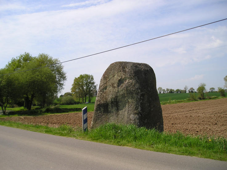
Menhir du Faix du Diable submitted by TheCaptain on 8th May 2005. Faix du Diable, Mayenne.
A massive menhir right beside the road, and standing in the ditch.
(View photo, vote or add a comment)
Log Text: A massive menhir right beside the road and standing in the ditch. It must be well over 4 metres tall 3 metres wide and over a metre thick and it looks to have been smoothed.
La Chaise du Diable
Trip No.202 Entry No.42 Date Added: 28th Mar 2020
Site Type: Natural Stone / Erratic / Other Natural Feature
Country: France (Pays de la Loire:Mayenne (53))
Visited: Yes on 30th Apr 2005

La Chaise du Diable submitted by TheCaptain on 9th May 2005. Le Gasseau Megaliths, or La Chaise du Diable, Sainte Gemmes-le-Robert, Mayenne.
These I could not determine fully, as I could not gain full access to either of the possible sites. It could be some large stones in a wooded area, or alternatively, and I think more likely, a large tor like hillock, with many stones scattered about on its slopes, many of which don’t look to be in natural positions.
(View photo, vote or add a comment)
Log Text: 2 kilometres east of the village of Sainte Gemmes- le-Robert are marked two dolmens or megalithic monuments on my ign map one north and the other south of a little crossroads. The southern one I could not determine fully as I could not gain full access to any of the possible sites. It could be some large stones in a wooded area or alternatively and I think more likely another large tor like hillock with many stones scattered about on its slopes many of which don’t look to be in natural positions.
Pierres dit Palais du Diable
Trip No.202 Entry No.41 Date Added: 28th Mar 2020
Site Type: Natural Stone / Erratic / Other Natural Feature
Country: France (Pays de la Loire:Mayenne (53))
Visited: Yes on 30th Apr 2005. My rating: Condition 2 Ambience 4 Access 4

Pierres dit Palais du Diable submitted by TheCaptain on 9th May 2005. Le Palais au Diable, or Pierres Jumelles, Mayenne.
Perhaps the whole thing is one giant burial mound, which it looks more like as seen here from the north.
It is all covered with trees with lots of birds singing, and a woodpecker pecking away with its loud ratatatatattatt.
(View photo, vote or add a comment)
Log Text: 2 kilometres east of the village of Sainte Gemmes- le-Robert are marked two dolmens or megalithic monuments on my ign map one north and the other south of a little crossroads. The northern one consists of a large mound with many large stones scattered about. It looks at first like it may be the top of a natural to type of thing but the stones are too well laid out in unnatural shapes and alignments. There is one pile of stones which has three flat slabs perched on top of other large blocks in a row. Perhaps the whole thing is one giant burial mound. It is all covered with trees with lots of birds singing and a woodpecker pecking away with its loud ratatatatattatt.
Pierre Aigue, Richebourg
Trip No.202 Entry No.43 Date Added: 28th Mar 2020
Site Type: Passage Grave
Country: France (Pays de la Loire:Mayenne (53))
Visited: Yes on 30th Apr 2005

Pierre Aigue, Richebourg submitted by TheCaptain on 9th May 2005. Pierre Aigue, Richebourg Mayenne.
A nice looking allée couverte down near a stream seen across a large field. There were no signs and I couldn’t see how to get to it without crossing fences and fields.
(View photo, vote or add a comment)
Log Text: Allée couverte down near a stream seen across a large field near Richebourg farmhouse. There were no signs and I couldn’t see how to get to it. The remains of what I saw looked quite long and made from large rounded brown stones.
