Contributory members are able to log private notes and comments about each site
Sites theCAptain has logged. View this log as a table or view the most recent logs from everyone
Spettigue Menhir
Date Added: 18th Sep 2010
Site Type: Standing Stone (Menhir)
Country: England (Cornwall)
Visited: Yes on 27th May 2010
Spettigue Menhir submitted by TheCaptain on 27th May 2010. View northwest from the top of Fox Tor on a long zoom, with Spettigue menhir in the centre.
(View photo, vote or add a comment)
Log Text: None
Sperris Quoit
Date Added: 22nd Jan 2023
Site Type: Burial Chamber or Dolmen
Country: England (Cornwall)
Visited: Yes on 27th Sep 2008. My rating: Condition 2 Ambience 3 Access 3
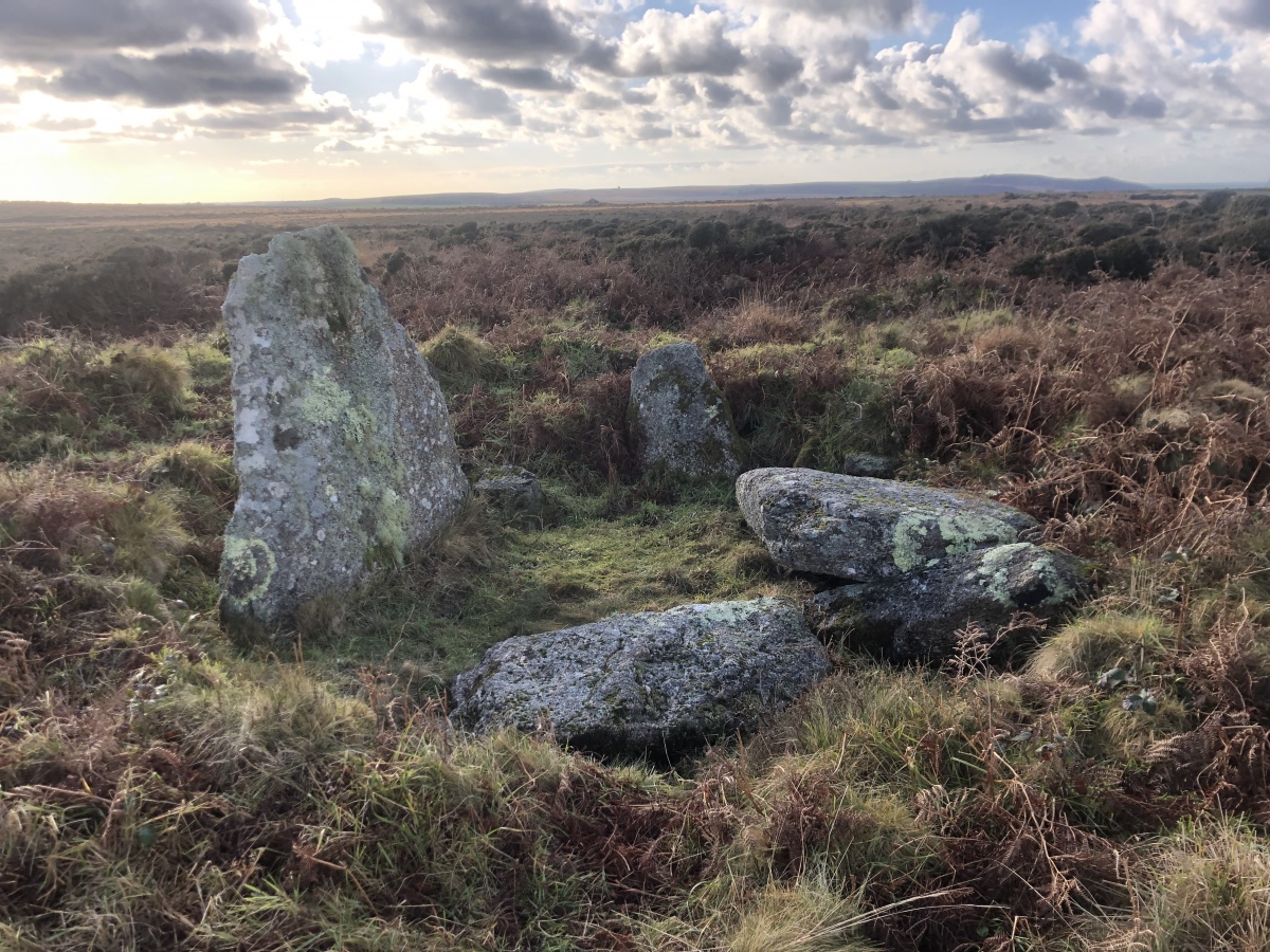
Sperris Quoit submitted by Raze66 on 17th Dec 2022. Photo taken 17/12/22
(View photo, vote or add a comment)
Log Text: I parked in a little lay-by near to the Eagles Nest house, and then took the footpath up onto the moors from there. After a while the path was fairly enclosed within tall bracken and gorse, and near the top of the hill, became fairly difficult to proceed along. Once at the top of the hill, I turned left at the remains of a mine building, and took a “path” towards the natural granite outcropping, from the southern end of which the single standing stone of Sperris Quoit could be seen. However, getting to the stones from here was a bit of a bugger, with chest high gorse, brambles and bracken. Good luck to anyone wishing to visit. The remains which can be found today include a single standing stone, 6 feet high, with a few other slabs laying around the remnants of the chamber. There are also traces of an oval mound, but the whole place was very overgrown when I visited.
Southmead Barrow
Date Added: 2nd Jun 2022
Site Type: Round Barrow(s)
Country: England (Gloucestershire)
Visited: Yes on 2nd Jun 2022. My rating: Condition 4 Ambience 3 Access 4
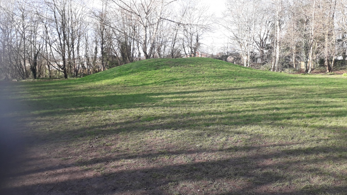
Southmead Barrow submitted by dooclay on 10th Feb 2022. The Tumulus from approx NE
(View photo, vote or add a comment)
Log Text: Remarkably well preserved round barrow now a part of the recently created Badock's Wood nature reserve
Sourton Tors Stone Circle
Date Added: 18th Sep 2010
Site Type: Stone Circle
Country: England (Devon)
Visited: Yes on 7th Jun 2004
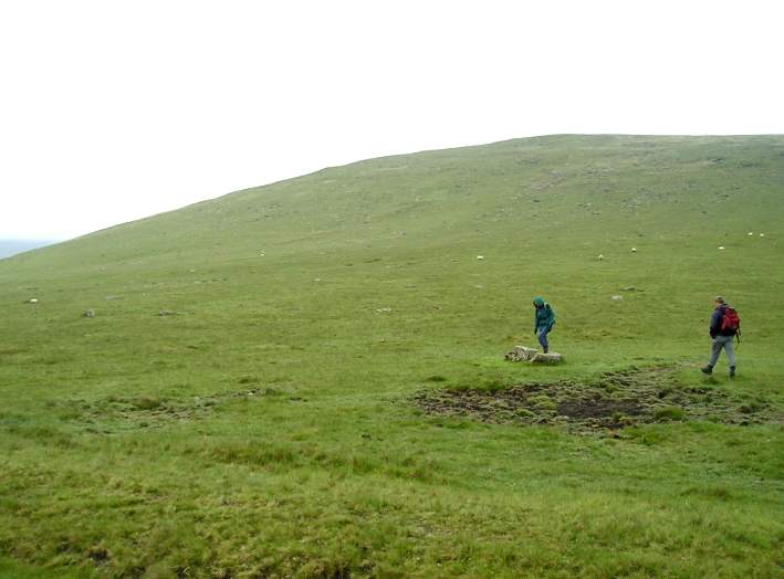
Sourton Tors Stone Circle submitted by TheCaptain on 7th Jun 2004. Sourton Tors Stone Circle, Dartmoor, Devon SX546896
This is the view looking towards Corn Ridge of the remains of this stone circle on the saddle between the slopes of Sourton Tors and Corn Ridge.
The giveaway to finding this circle is that it lies just to the southeast of the remains of half an applecrusher which has been carved from a block of granite, but been left up on the moors.
The centre of the circle is just to the left of centre in this picture on the flat ground, and about 12...
(View photo, vote or add a comment)
Log Text: None
Sourton Tors Ring Cairns
Date Added: 18th Sep 2010
Site Type: Ring Cairn
Country: England (Devon)
Visited: Yes on 7th Jun 2004
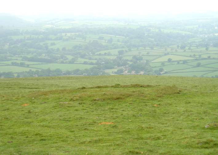
Sourton Tors Ring Cairns submitted by TheCaptain on 7th Jun 2004. Sourton Tors Ring Cairns, Dartmoor, Devon SX544889
The remains of two ring cairns can be seen on the slopes of Sourton Tors, just below the track which continues along from the remains of the tramway beyond the points, at which the railway reversed, the southernmost being slightly larger.
(View photo, vote or add a comment)
Log Text: None
Sourton Tors Cairn
Date Added: 18th Sep 2010
Site Type: Cairn
Country: England (Devon)
Visited: Yes on 7th Jun 2004
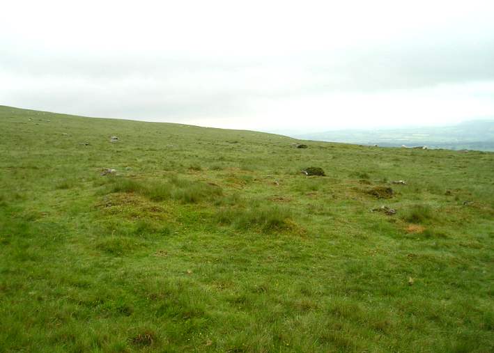
Sourton Tors Cairn submitted by TheCaptain on 7th Jun 2004. Sourton Tors Cairn, Dartmoor, Devon SX546895
The remains of a much destroyed cairn can be seen on the slopes of Corn Ridge, just above the track which passes up over the saddle between Sourton Tors and Corn Ridge.
(View photo, vote or add a comment)
Log Text: None
Sourton Green Saxon Cross
Date Added: 18th Sep 2010
Site Type: Ancient Cross
Country: England (Devon)
Visited: Yes on 10th Sep 2007
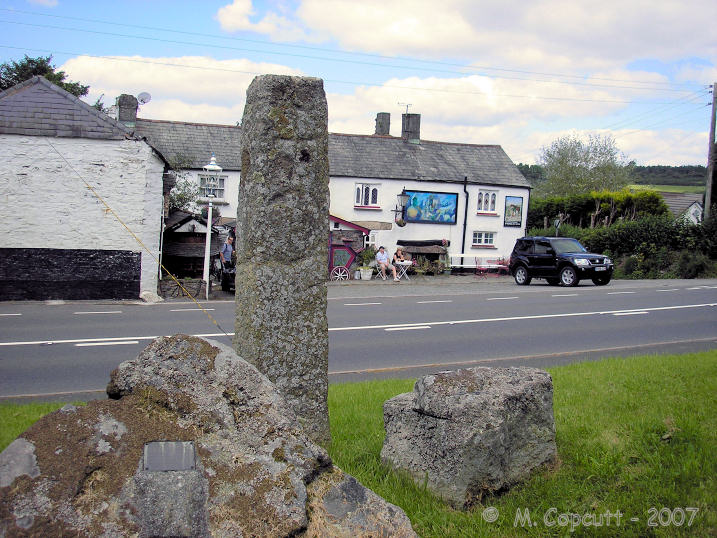
Sourton Green Saxon Cross submitted by TheCaptain on 10th Sep 2007. Saxon cross shaft standing on the Sourtn village green, opposite the bizarre Highwayman Inn.
(View photo, vote or add a comment)
Log Text: None
Source de la Madeleine
Trip No.203 Entry No.87 Date Added: 6th Apr 2020
Site Type: Holy Well or Sacred Spring
Country: France (Aquitaine:Dordogne (24))
Visited: Yes on 20th May 2005. My rating: Condition 4 Ambience 4 Access 4
Source de la Madeleine submitted by TheCaptain on 15th Jan 2011. At the centre of the ancient settlement is a strange spring which only flows in times of great drought due to some sort of capillary action within the stone of the cliff.
This very strange effect has given the place a sort of magic throughout the millennia.
(View photo, vote or add a comment)
Log Text: On a cliff face on the west side of the river Vézère near the village of Tursac is the Troglodytic village which has been inhabited since 50000 years ago and gave its name to an epoch the Madeleinian which was about 12000 years ago. What you mostly see now for your visit money is medieval with several cliff houses built into the terrace on the cliff. There is also a couple of chapels and a gatehouse which guards over where there was a sort of drop bridge which nowadays has a permanent footpath over it. Above the whole lot is the remains of a 12th century castle.
At the centre of the village near a sort of village square is a strange spring which only flows in times of great drought due to some sort of capillary action and the last time in which it flowed was summer 2001. This very strange effect has given the place a sort of magic throughout the millennia.
A bit further along the cliff and down at the base is the original abri shelter within which all the important prehistoric finds were made including the carved bison and the first harpoons.
Source de Fontestorbes
Trip No.200 Entry No.22 Date Added: 17th Jun 2020
Site Type: Holy Well or Sacred Spring
Country: France (Midi:Ariège (09))
Visited: Yes on 24th Apr 2000. My rating: Access 5
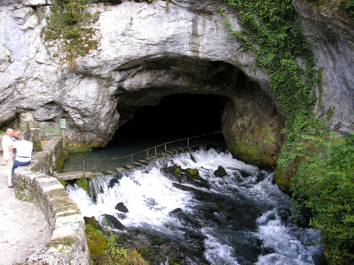
Source de Fontestorbes submitted by thecaptain on 28th Feb 2006. The intermittent Source de Fontestorbes in full flow.
(View photo, vote or add a comment)
Log Text: Lovely sunny day exploring in the Ariege hills. Puivert castle. Fontestorbes intermittent spring fascinating. Montsegur Castle. Pass de ? closed. Plain de ? Ax-les-Thermes, Col de Portel, scary roads. Mas D’Azil. Toulouse late.
Source de Fontestorbes
Trip No.205 Entry No.78 Date Added: 15th Jun 2020
Site Type: Holy Well or Sacred Spring
Country: France (Midi:Ariège (09))
Visited: Yes on 11th Sep 2005. My rating: Condition 4 Ambience 4 Access 5

Source de Fontestorbes submitted by thecaptain on 28th Feb 2006. The intermittent Source de Fontestorbes in full flow.
(View photo, vote or add a comment)
Log Text: This is a very interesting place, one of only a few known examples in the world, with its intermittant spring gushing from a cave in a cliff face beside the road, well signposted a kilometre or so to the south of the little Pyrenean town of Belesta. In the dry summer months, due to a complex and not fully understood syphoning mechanism, the spring alternates between full flowing river, and barely a trickle, on an approximately hourly cycle for about 4 months of the year.
The place has been well done up since I was last here 5 years ago, with new parking area, a pedestrian bridge built over the stream, and a building with shop and cafe facilities, with more planned such as a picnic site and nature walk, and there were quite a lot of people here.
When I arrived, the spring was gushing quite a lot, the water easily covering the little steps across the entrance into the cave, just as it was every other time I have visited here in the past (I think I have been here about 4 times before, and never seen the spring dry up). So I went for a look round the little info centre, which now has a bar and lots of information about various tourist places and things, and was being run by a nice friendly couple, and it even has information leaflets about the spring in English these days. This explains the best understanding of the springs working, and states that it does not start cycling until after a long dry spell in the summer (I had always been in spring or early summer before).
As I left the centre, and had another look at the spring, it seemed to be slowing down. After another 5 minutes, the flow had lowered enough that a chap could walk across the steps and into the cave. Ten minutes later, it had slowed right down to a trickle, allowing people to walk across the stepping stones into the cave. It was not easy to see where the water comes from, it must be somewhere under the floor of the pond.
As would be expected of such a strange place, it has been revered since time immemorial, and of course there are many legends and stories associated with it. Excellent, I have at last seen this thing at work !
Soubise Dolmen 1
Trip No.203 Entry No.246 Date Added: 22nd Apr 2020
Site Type: Burial Chamber or Dolmen
Country: France (Poitou:Charente-Maritime (17))
Visited: Couldn't find on 4th Jun 2005
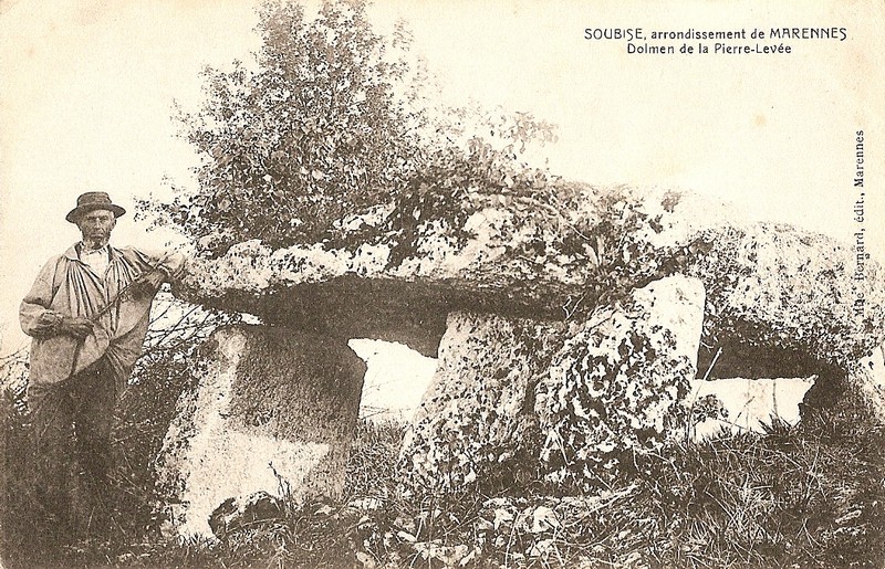
Soubise dolmen 1 submitted by Rubis on 24th Jul 2010. Postcard maybe taken between the two World Wars.
The domens are three. The two well preserved were moved into the military base. The third one is ruined. Only some few stones remain. It is always there where they were all together.
(View photo, vote or add a comment)
Log Text: These two dolmens are within the confines of an airfield, which has a big military base on the northern side of the runway, and a little flying club at the south. I could not get to very near to where the dolmens are marked on my map, so didn’t try very hard to get close enough for a photo.
Soriniere Dolmen
Trip No.203 Entry No.315 Date Added: 29th Apr 2020
Site Type: Burial Chamber or Dolmen
Country: France (Pays de la Loire:Loire-Atlantique)
Visited: Couldn't find on 9th Jun 2005
Soriniere dolmen submitted by TheCaptain on 9th Jun 2011. The dolmen is on the left side of the lane under a thick hedge across a field of barley.
I believe its somewhere under the big tree in this picture.
(View photo, vote or add a comment)
Log Text: Not far from Bergnon are two dolmens marked down a little lane. I walked down the lane but couldn’t really find anything, although I was assured by a passing chap on a bike, that it is possible to access both dolmens. But the barriers, crops and hedges here made it all too much effort for probably little gain, so I didn't try too hard. The first dolmen to be accessed is on the left side of the lane under a thick hedge across a field of barley, which I wasn't going to walk through, and there was no way around.
Soldier's Grave
Date Added: 23rd Oct 2021
Site Type: Round Barrow(s)
Country: England (Gloucestershire)
Visited: Yes on 14th Mar 2009. My rating: Condition 3 Ambience 4 Access 4
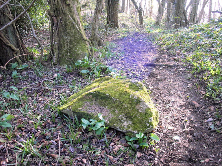
Soldier's Grave submitted by thecaptain on 10th Apr 2009. There are several fairly large bits of stone laying around nearby, which once may have formed part of the structure.
(View photo, vote or add a comment)
Log Text: This large round barrow can be found on the top of the Cotswold escarpment just into the woods at the northwest corner of the country park / picnic area, a couple of hundred yards to the north of Nympsfield long barrow. It is said to be a really unusual round barrow from the Neolithic, and not a Bronze Age round barrow at all! The top of the barrow has a very large depression in it, where it has been cut into in the past. From Grinsell - Barrows in England and Wales, “a boat-shaped hollow lined with dry-stone walling, in which were the remains of up to 44 individuals, mostly unburnt”. There are several fairly large bits of stone laying around nearby, which once may have formed part of the structure.
Sölden menhir
Date Added: 29th Oct 2019
Site Type: Standing Stone (Menhir)
Country: Austria
Visited: Yes on 20th Feb 2015

Sölden menhir submitted by theCaptain on 20th Feb 2015. Within central Sölden, there is a large stone of 3 to 4 metres height just standing there.
I have no idea as to whether this is an ancient menhir, but what else would it be doing here?
(View photo, vote or add a comment)
Log Text: None
Soldats-de-Saint-Cornély
Trip No.204 Entry No.52 Date Added: 11th Jul 2020
Site Type: Stone Row / Alignment
Country: France (Bretagne:Morbihan (56))
Visited: Yes on 13th Jul 2005. My rating: Condition 2 Ambience 2 Access 4

Soldats-de-Saint-Cornély submitted by TheCaptain on 3rd Sep 2013. At the east end of the rows are the remains of two tertre tumuli, which can just about be made out as raised mounds with a few stones protruding, but these have suffered terribly.
One has in fact had a sort of fairground sideshow built on it, while the other, with a large capstone still to be seen, has been surrounded with a fence, and a sort of oven, or fire made on top of it.
(View photo, vote or add a comment)
Log Text: This site consists of three parallel rows of stones, about 140 in all, running southeast to northwest, spaced at about 40 metres from each other, but what a terrible state these poor soldiers have fallen into. Not only has a road junction been built right into the middle of them, and a forest grown over them, but many of them have been taken away to ornament a garden in Lorient. What remains there are have become very overgrown and almost impossible to see, and one of the lines has been ploughed up. The only real way to tell where the stones are is by looking at the rows of hedges and trees.
The central row can be followed eastwards through the forest for about 100 to 200 metres until it gets to a clearing, within which a sort of Asterix the Gaul village complex has been built and abandoned, and is now decaying all around. At this end of the rows are the remains of two tertre tumuli, which can just about be made out as raised mounds with a few stones protruding, but these have suffered terribly. One has in fact had a sort of fairground sideshow built on it, while the other, with a large capstone still to be seen, has been surrounded with a fence, and a sort of oven, or fire made on top of it.
The poor Cornély army is very much in need of getting back into some sort of order. This is perhaps the monument most in need of some TLC and protection that I have ever seen.
Siward's Cross
Date Added: 29th Oct 2019
Site Type: Ancient Cross
Country: England (Devon)
Visited: Yes on 21st Nov 2010
Siward's Cross submitted by TheCaptain on 21st Nov 2010. The northern side and western face of this nice old cross, believed to date back to late Saxon, early medieval times.
On the western face are the words “Boc Lond” which presumably relate to Buckland, or Book Land, connected to the monks of Buckland Abbey.
(View photo, vote or add a comment)
Log Text: None
Sittaford Tor pound
Date Added: 29th Oct 2019
Site Type: Misc. Earthwork
Country: England (Devon)
Visited: Yes on 13th Feb 2019
Sittaford Tor pound submitted by TheCaptain on 13th Feb 2019. An oval shaped enclosure, defined by embanked rubble walls.
The walls are best seen where the old leat cuts through them on the western side.
(View photo, vote or add a comment)
Log Text: None
Sittaford Stone Circle
Date Added: 12th Jun 2014
Site Type: Stone Circle
Country: England (Devon)
Visited: Yes on 11th Jun 2014. My rating: Condition 2 Ambience 5 Access 2

Sittaford Stone Circle submitted by theCaptain on 12th Jun 2014. With the weather turned nice, I took a day off work to walk out to the newly found Sittaford Tor stone circle.
This is a plot from my GPS showing not only the track of my walking around of the circle, but I also created a waypoint for each stone, which are plotted as the little flags.
(View photo, vote or add a comment)
Log Text: With the weather turned nice, I took a day off work to walk out to the newly found Sittaford Tor stone circle, starting out from Fernworthy Reservoir. Having planned the trip in advance, so knowing where to look, the circle was very easy to find, although very wet and boggy. All of the stones have been dug around so they are no longer buried in the mire. Excellent.
Sinodun Camp
Date Added: 18th Sep 2010
Site Type: Hillfort
Country: England (Oxfordshire)
Visited: Yes on 29th Mar 2004

Sinodun Camp submitted by TheCaptain on 29th Mar 2004. Round Hill, Wittenham Clumps, Oxfordshire. SU566927
View of Round Hill looking northeast from Castle Hill. This hill and its surroundings are rich with archaeological remains from the bronze age to the present day
(View photo, vote or add a comment)
Log Text: None
Single Barrow (Hamel Down)
Date Added: 2nd Jan 2023
Site Type: Round Barrow(s)
Country: England (Devon)
Visited: Yes on 6th Dec 2022. My rating: Condition 3 Ambience 4 Access 3
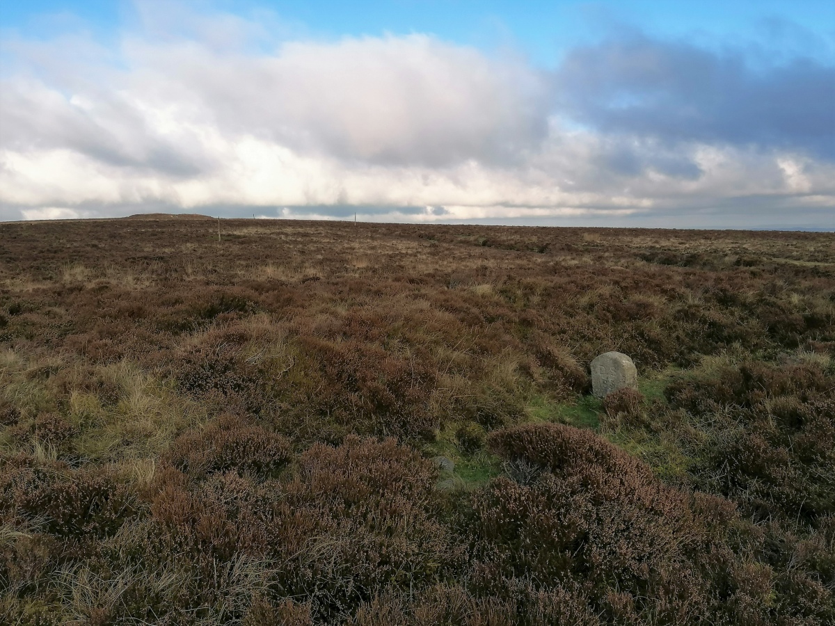
Single Barrow (Hamel Down) submitted by TheCaptain on 2nd Jan 2023. Hamel Down Single Barrow, which is smaller and less obvious than Broad Barrow which can be seen here on the hilltop to the south.
(View photo, vote or add a comment)
Log Text: Further south along the track, and just to the west of it is the next barrow, known as Single Barrow, which is smaller and less obvious than Broad Barrow. It too has one of the Duke Stone boundary markers on top of it.
