Contributory members are able to log private notes and comments about each site
Sites theCAptain has logged. View this log as a table or view the most recent logs from everyone
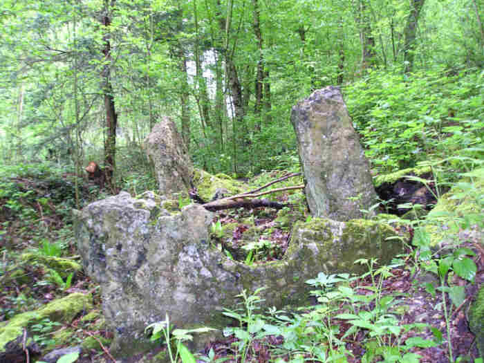
Allée Couverte de Mauny
Trip No.202 Entry No.96 Date Added: 30th Mar 2020
Site Type: Passage Grave
Country: France (Normandie:Seine-Maritime (76))
Visited: Yes on 4th May 2005. My rating: Condition 2 Ambience 2 Access 3

Allée Couverte de Mauny submitted by TheCaptain on 6th May 2005. Mauny Allée Couverte, Eure.
Almost lost in the woods, there is however a very nice half porthole stone which can still be made out.
(View photo, vote or add a comment)
Log Text: A much ruined allée couverte which can be found in woodland beside the D265 road as it climbs the hill from the riverbank below and to the east of Mauny. Almost lost in the woods and currently being used as a junk store it almost looks like its been bulldozed. There is however a very nice half porthole stone which can still be made out. The main chamber is probably about 10 metres long 1.5 metres wide and faces down the valley but most of the remaining stone slabs are just a jumble. Its very much in need of some TLC.
Allée couverte de Mélus
Trip No.203 Entry No.574 Date Added: 28th Oct 2020
Site Type: Passage Grave
Country: France (Bretagne:Côtes-D'Armor (22))
Visited: Yes on 25th Jun 2005. My rating: Condition 3 Ambience 3 Access 4

Allée couverte de Mélus submitted by TheCaptain on 28th May 2007. The monument is now contained within a little walled area in some fields, a couple of hundred metres from a parking area.
(View photo, vote or add a comment)
Log Text: Despite looking very difficult to get to on the maps, this allée couverte is actually very easy to find, as a new housing development has been made, with the roads through it signposted to the allée couverte, and then a little trackway made up to it. The monument is now contained within a little walled area in the fields, a couple of hundred metres from a parking area.
It is about 14 metres long, with an orientation of 110°, with the entrance on the southern side, about two thirds the way along from the western end. The passageway is about 1.5 metres wide and less than a metre high, and still covered with nine capstones. Traces of a mound exist, particularly at the west end.
It looks to me as though it has been messed about with substantially, and maybe rebuilt fairly recently, as lots of the stones have sharpish edges, and don't look weathered right. It is also suffering from being where it is, and it is now a bit of a childrens playground, with the rubbish and suchlike that that entails. Still, it is here with us today.
Allée Couverte de Men Braz
Trip No.204 Entry No.57 Date Added: 11th Jul 2020
Site Type: Passage Grave
Country: France (Bretagne:Morbihan (56))
Visited: Yes on 13th Jul 2005. My rating: Condition 1 Ambience 4 Access 4
Log Text: In the vicinity of the Men-Braz are many other stones, which I am lead to believe are the remains of a much wrecked dolmen.
Allée Couverte de Menez Landu
Trip No.203 Entry No.467 Date Added: 25th May 2020
Site Type: Passage Grave
Country: France (Bretagne:Finistère (29))
Visited: Yes on 17th Jun 2005. My rating: Condition 3 Ambience 2 Access 5
Allée couverte de Menez Landu submitted by thecaptain on 8th Dec 2006. This initially looks like a straightforward simple dolmen beside the busy D.785 road, southwest of Plomeur, but it is almost lost within the undergrowth.
(View photo, vote or add a comment)
Log Text: This looks like a straightforward simple dolmen beside the busy D.785, a kilometre or so southwest of Plomeur. It has a single capstone on top of two side stones, and a large backstone, but it is almost lost within the undergrowth. But it looked a bit to me as if it is the possibly the end of an allée couverte with an end cell, or some other type of passage grave like there are around here.
Allée Couverte de Pinterville
Trip No.202 Entry No.90 Date Added: 30th Mar 2020
Site Type: Passage Grave
Country: France (Normandie:Eure (27))
Visited: Couldn't find on 4th May 2005
Log Text: Despite driving around this village and its environs thoroughly and looking at the village map and having the ign 1:25000 map I could find no signs of this.
Allée Couverte de Roche-Plate
Date Added: 18th Sep 2010
Site Type: Passage Grave
Country: France (Bretagne:Ille-et-Vilaine (35))
Visited: Yes on 29th Nov 2009

allée couverte de Roche-Plate submitted by thecaptain on 29th Nov 2009. Part of the noticeboard at the site.
(View photo, vote or add a comment)
Log Text: None
Allée Couverte de Saint-Eugène
Trip No.205 Entry No.103 Date Added: 9th Nov 2020
Site Type: Passage Grave
Country: France (Languedoc:Aude (11))
Visited: Yes on 14th Sep 2005. My rating: Condition 4 Ambience 4 Access 4

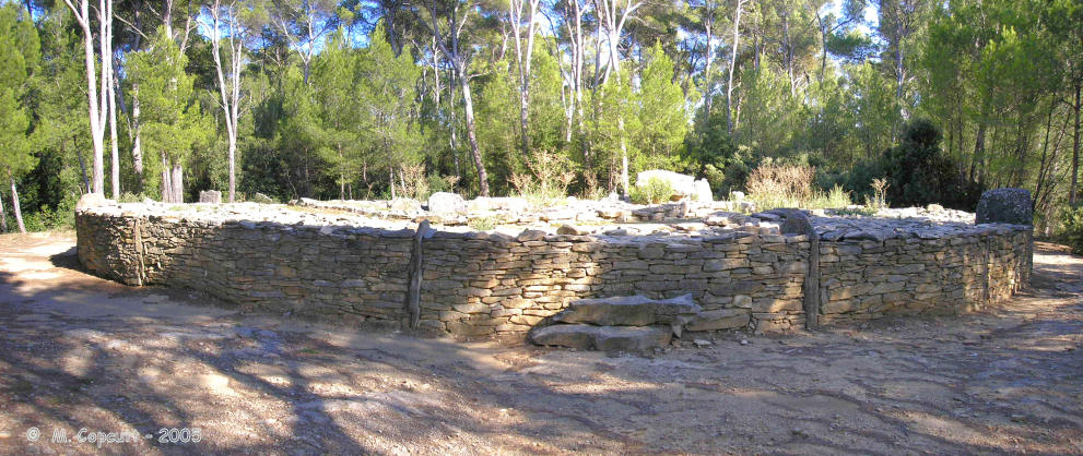
Allée Couverte de Saint-Eugène submitted by thecaptain on 6th Dec 2003. This is what I think is described as les Allees Couvertes de Saint- Eugene, .
However, it was getting late and the roads and map didnt seem to match. I just followed signs to something like fairy hill, and on top of a hill was this amazing site, with a circular walled structure with various chambers and passages in it.
(View photo, vote or add a comment)
Log Text: I have now twice found this only by luck. This time I took a wrong turning (one road too soon) and ended up on a stone track across private land where I could not turn round to go back out, and then I saw a little sign to dolmen, up the hillside I remember. I managed to park the van in a wider part of the track about 500 metres away, and went back on foot to look for the site. Quite how one is meant to get here properly, I do not know !
Up on top of a pine covered hill is an open flattish area, upon which is built this lovely tomb. It has all been much restored, so quite how much is original I do not know. The first thing you see is a circular stone wall containing a stone cairn, about a metre high and about 25 metres in diameter, with upright slabs every 5 metres or so around its circumference. Within this is the remains of a massive structure, and a partitioned chamber. The main chamber is 15 metres long, lined with large slabs, and opens to the southeast at 155°. At the back end it is 4 metres wide, and 5.5 m from the end is the remnants of a stone partition within which the remains of portal entranceway can be seen. The next section is 6 metres long, tapering to 2.5 metres wide, up to the remains of another partition with entranceway. This leaves just 3 metres of tapering corridor to the entrance in the circular wall, just 1 metre in width. Unfortunately there are no cover stones, and the entrance portals are very damaged, to the extent of being almost non existant. In the stone mound there can be seen the remains of two further intermediate circling walls, the first a U shape around the chamber, and the second a concentric circle within the outside wall.
Allée Couverte de Saint-Eugène
Trip No.200 Entry No.63 Date Added: 18th Jun 2020
Site Type: Passage Grave
Country: France (Languedoc:Aude (11))
Visited: Yes on 13th Aug 2000. My rating: Access 4

Allée Couverte de Saint-Eugène submitted by thecaptain on 14th Mar 2006. Up on top of a pine covered hill is an open flattish area, upon which is built this lovely tomb. It has all been much restored, so quite how much is original I do not know.
The first thing you see is a circular stone wall containing a stone cairn, about a metre high and about 25 metres in diameter, with upright slabs every 5 metres or so around its circumference. Within this is the remains of a massive structure, and a partitioned chamber.
(View photo, vote or add a comment)
Log Text: Day out from Toulouse to explore Minerve ancient village, Rock tunnels, Morrel das Fadas, St Eugene. it was getting late and the roads and map didnt seem to match. I just followed signs to something like fairy hill, and on top of a hill was this amazing site, with a circular walled structure with various chambers and passages in it.
Allée Couverte dite de Coguer Neguinan
Trip No.203 Entry No.342 Date Added: 10th May 2020
Site Type: Passage Grave
Country: France (Bretagne:Morbihan (56))
Visited: Yes on 11th Jun 2005. My rating: Condition 3 Ambience 3 Access 5
Allée couverte dite de Coguer Neguinan submitted by thecaptain on 10th May 2006. In an area on top of a hill overlooking a stream is the ancient hamlet of Le Palastre. I found quite a few stones here, but was not sure what the official dolmen is !
There are some significant looking stones built into the chapel yard wall.
(View photo, vote or add a comment)
Log Text: In an area on top of a hill overlooking a stream is the hamlet of Le Palastre, with its dolmen. I found quite a few stones here, but was not sure what the official dolmen is ! There is lots of big stones around, none of which looked too convincingly like a dolmen as opposed to natural. The best fit to the map is a series of three large boulders in a row, in the front of somebodies garden right in the centre of the hamlet. There are also some significant looking stones a bit down the hill beside the chapel yard wall. I have since learned that I dont think I found the dolmen, which is positioned somewhere behind the house.
Allée couverte du Bois de la Plesse (Nord)
Trip No.201 Entry No.2 Date Added: 19th Mar 2020
Site Type: Passage Grave
Country: France (Normandie:Manche (50))
Visited: Yes on 19th Nov 2004. My rating: Condition 2 Ambience 3 Access 4

Allée couverte du Bois de la Plesse (Nord) submitted by thecaptain on 31st Dec 2004. Allée Couverte du Bois de la Plesse (north), near Lithaire in Manche, Normandie.
Looking north at the eastern end of the remains of the northern allée couverte.
(View photo, vote or add a comment)
Log Text: On the slopes of Mont Castré to the southwest of the village of Lithaire can be found a little leisure park surrounding a quarry with lake. From the car park, cross the lake and climb the steep path to the top of the quarry before following the path around the top to the right through the woods. After a few hundred metres you reach an open grassy area within which are the remains of two Allées Couverte, not marked on the IGN maps.
The first to be reached, northern, of these is in a very ruined state, with just some large stones of the central chamber remaining, and most of these are fallen. The length of the chamber can be traced for 9 metres, and some of the stones at the east end, including the eastern end stone, remain standing.
Allée couverte du Bois de la Plesse (Sud)
Trip No.201 Entry No.3 Date Added: 19th Mar 2020
Site Type: Passage Grave
Country: France (Normandie:Manche (50))
Visited: Yes on 19th Nov 2004. My rating: Condition 3 Ambience 3 Access 4

Allée couverte du Bois de la Plesse (Sud) submitted by thecaptain on 3rd Jan 2005. Allée Couverte du Bois de la Plesse (South).
Looking approximately westwards into the main chamber of the southern tomb. Not only do the large stones of the central chamber survive, but also many of hte smaller stones which presumably once made up a kerb to the covering mound, and some sort of entrance facia.
(View photo, vote or add a comment)
Log Text: On the slopes of Mont Castré to the southwest of the village of Lithaire can be found a little leisure park surrounding a quarry with lake. From the car park, cross the lake and climb the steep path to the top of the quarry before following the path around the top to the right through the woods. After a few hundred metres you reach an open grassy area within which are the remains of two Allées Couverte, not marked on my IGN maps.
About 25 metres to the south of the northern site are the remains of the much better preserved southern Allée Couverte. Most of the side stones remain of a 7 metre long central chamber, including the western end stone, but there are none of the covering slabs. Surrounding this chamber are many smaller stones which were probably facing stones for the covering mound, which today form a couple of parallel rows to the sides of the main chamber. At the eastern side is a nice straight row of these stones running across at right angles to the main chamber, perhaps once forming some kind of entrance arrangement. There are many other stones laying around which probably once formed a part of this monument.
Allée couverte du Net dit Clos-et-Bé
Trip No.203 Entry No.340 Date Added: 4th May 2020
Site Type: Passage Grave
Country: France (Bretagne:Morbihan (56))
Visited: Yes on 10th Jun 2005. My rating: Condition 2 Ambience 3 Access 4
Allée couverte du Net dit Clos-et-Bé submitted by thecaptain on 13th May 2006. All that can clearly be seen is a long mound, which is completely overgrown in the middle of its field.
Closer inspection reveals there to be many stones in the mound, and at least two capstones still in position on top of an allée-couverte.
(View photo, vote or add a comment)
Log Text: Just 40 metres from the nearby menhir can be seen a long mound, but which is completely overgrown in the middle of its field, which was empty at the time of my visit. Closer inspection reveals there to be many stones in the mound, and at least two capstones still in position on top of what is a 21 metre long allée-couverte.
Allée Couverte le Rocher Jacquot
Trip No.204 Entry No.326 Date Added: 16th Sep 2020
Site Type: Passage Grave
Country: France (Bretagne:Ille-et-Vilaine (35))
Visited: Yes on 13th Aug 2005. My rating: Condition 3 Ambience 3 Access 4
Allée Couverte le Rocher Jacquot submitted by thecaptain on 24th Feb 2007. At first I thought it was the remains of a dolmen with entry corridor, but further investigation in the undergrowth suggested to me that it is perhaps the remains of a well damaged allée couverte.
Cupules du Rocher Jacquot
One capstone remains in place on top of some largish stones, with the sideslabs of a passageway leading off towards the east.
(View photo, vote or add a comment)
Log Text: The remains of this monument can be found a few kilometres northwest of Fougères, along the D.17 road towards St-Germain-en-Cogles. It is signposted, but not very clearly, and there is a little trackway and fenced off area around it.
At first I thought it was the remains of a dolmen with entry corridor, but further investigation in the undergrowth suggested to me that it is the remains of a well damaged allée couverte. One capstone remains in place on top of some largish stones, with the sideslabs of a passageway leading off towards the east. It looks like there was perhaps another chamber nearby, indeed perhaps the whole thing was once several passageways and chambers within a single mound, of which traces around it survive.
Almsworthy
Date Added: 18th Sep 2010
Site Type: Stone Circle
Country: England (Somerset)
Visited: Yes on 24th Nov 2006
Almsworthy submitted by thecaptain on 24th Nov 2006. Almsworthy Common. This is stated by various sources to be the remains of two concentric ovals, or up to six lines of stones, but I could see no particular pattern.
Here we see about 6 of the little stones poking up above the heather, looking southeast.
(View photo, vote or add a comment)
Log Text: None
Althing
Date Added: 3rd Jan 2011
Site Type: Natural Stone / Erratic / Other Natural Feature
Country: Iceland
Visited: Yes on 21st Apr 1995
Althing submitted by DrewParsons on 10th May 2010. The Law Rock or Lögrétta is a high rock on European side of the chasm and was the site from which laws were passed and trials conducted. April 2010.
(View photo, vote or add a comment)
Log Text: Rent Jeep Cherokee with big wheels. Do the Golden triangle, íngvellir, Geysir and Gullfoss. Back via Bläfjöll Ski area.
Alto de São Bento
Date Added: 11th Nov 2019
Site Type: Ancient Village or Settlement
Country: Portugal (Évora)
Visited: Yes on 13th Oct 2019. My rating: Condition 2 Ambience 5 Access 5

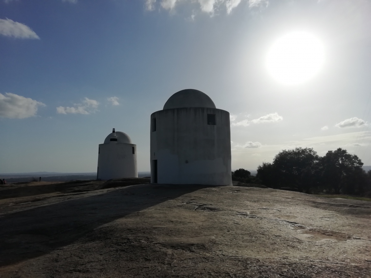
Alto de São Bento submitted by TheCaptain on 11th Nov 2019. Little remains to be seen of the prehistoric settlement which existed on this fine granite hilltop from 7000 years ago, which was the very origins of the fabulous and historic city of Évora.
Today this hilltop is topped with the remains of several windmills, and provides fantastic views over the city of Évora and all around the Alentejo region.
(View photo, vote or add a comment)
Log Text: Little remains to be seen of the prehistoric settlement which existed on this fine granite hilltop from 7000 years ago, which was the very origins of the fabulous and historic city of Évora. Today this hilltop is topped with the remains of several windmills, and provides fantastic views over the city of Évora and all around the Alentejo region. The views over Evora, particularly in this clear late afternoon light are fabulous, the low sun lighting up the large Evora buildings, town walls, the aquaduct and the nearby convent. While back in the other direction, the hilltop castle of Arraiolos can be seen.
Alveston Round Barrow
Date Added: 29th Oct 2019
Site Type: Round Barrow(s)
Country: England (Gloucestershire)
Visited: Yes on 12th May 2016
Alveston Round Barrow submitted by TheCaptain on 12th May 2016. Remains of a round barrow in the middle of a field beside the intriguingly named Vattingstone Lane, opposite the school entrance at the northwest of the village of Alveston.
(View photo, vote or add a comment)
Log Text: None
Amenon Dolmen
Trip No.204 Entry No.307 Date Added: 12th Sep 2020
Site Type: Burial Chamber or Dolmen
Country: France (Pays de la Loire:Sarthe (72))
Visited: Yes on 11th Aug 2005. My rating: Condition 3 Ambience 3 Access 4
Amenon dolmen submitted by theCaptain on 16th Dec 2011. The dolmen remains can be found up a trackway, and can be seen from the road.
There is a little plaque explaining that it is the remains of an Angevin type Allee Couverte, which is a good thing as I would never have known that, as most of the dolmen has been destroyed in the past with having the trackway built right through it.
(View photo, vote or add a comment)
Log Text: The Amenon dolmen is fairly easy to find, along the little roadsouth of the river Loir between Vaas and La Chapelle-aux-Choux. Just after the little stream, the dolmen remains can be found up a trackway, and can be seen from the road. There is a little plaque explaining that it is the remains of an Angevin type Allee Couverte, which is a good thing as I would never have known that, as most of the dolmen has been destroyed in the past with having the trackway built right through it.
It was excavated in the 1970s and is now protected, but perhaps just a little too late ! The remains now are a single capstone sitting defiantly on two side supports about 1.5 metres apart, and lots of other stones in piles around it.
America's Stonehenge
Date Added: 24th Oct 2010
Site Type: Ancient Village or Settlement
Country: United States (New England)
Visited: Yes on 15th Apr 1990. My rating: Condition 4 Ambience 4 Access 4

America's Stonehenge submitted by thecaptain on 14th Dec 2003. One of the chambers at Mystery Hill, also known as America's Stonehenge, near Salem, New Hampshire. There are several of these chambers and other structures at the site as well as the calendar sighting stones
I have to say, despite their best efforts to assure me its 4000 years old, the stones just didnt look weathered enough to me.
(View photo, vote or add a comment)
Log Text: None
Amesbury Cursus (W)
Date Added: 29th Oct 2019
Site Type: Cursus
Country: England (Wiltshire)
Visited: Yes on 27th Aug 2018

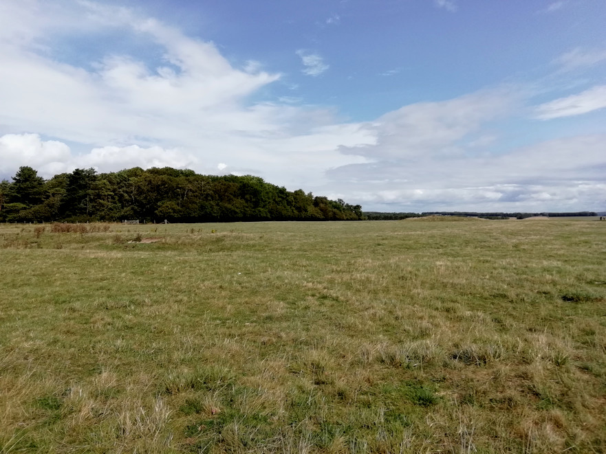
Amesbury Cursus (W) submitted by TheCaptain on 27th Aug 2018. The western end of the Great Cursus at Stonehenge.
Slight remains of the ditches and banks, plus the terminal tump and round barrow can be made out.
(View photo, vote or add a comment)
Log Text: None
