Contributory members are able to log private notes and comments about each site
Sites theCAptain has logged. View this log as a table or view the most recent logs from everyone
White Ridge stone row
Date Added: 4th Jun 2022
Site Type: Stone Row / Alignment
Country: England (Devon)
Visited: Yes on 3rd May 2022. My rating: Condition 2 Ambience 3 Access 2
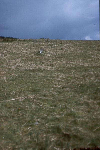
White Ridge stone row submitted by Brian Byng on 7th Feb 2002. White Ridge.
A double row @ SX 6541 8165 167m lg descending the hill from a ruined 8m dia
cairn. 41 stones still show. The cairn is on the skyline when viewed from the
bottom of the row. The end of the row has no obvious termination. The
elevation of the cairn from the bottom of the row is 3 degrees. The true
azimuth of the row is 7 degrees giving a declination of 42. A trawl through
astronomical objects around Bronze Age times suggests that the star Arcturus
would graze the cair...
(View photo, vote or add a comment)
Log Text: From the Stannon Newtake cairn with cist, I head north to the boundary wall where it is indicated on the map that the south end of White Ridge stone row is to be found (before it was discovered to run much further down the hill, which I didn't know at the time). Using my GPS I found the correct spot, and saw a couple of possible stones, then looking back south into the newtake, I could see s cleared strip of land going right down to where the cairn I couldn't get to is situated. Walking northwards, I noticed a sort of pathway which I followed, and found a few small stones, then saw a couple standing out against the horizon, confirming I was walking along the line of the stone row. I followed this north up to the top cairn, which is very denuded, but has several stones which can be made out. I have seen the stone row described as "one of the least impressive stone rows on the moor", but it has a few decent sections, and I have visited much worse.
White Ridge Standing Stone
Date Added: 29th Oct 2019
Site Type: Standing Stone (Menhir)
Country: England (Devon)
Visited: Yes on 12th Feb 2019
White Ridge Standing Stone submitted by TheCaptain on 12th Feb 2019. There is a large elongated slab near to the middle of the ring structure, which looks to me like it should once have been standing.
(View photo, vote or add a comment)
Log Text: None
White Ridge pound
Date Added: 29th Oct 2019
Site Type: Ring Cairn
Country: England (Devon)
Visited: Yes on 13th Feb 2019
White Ridge pound submitted by TheCaptain on 13th Feb 2019. Circular enclosure between 20 and 25 metres in diameter, surrounded by an embanked rubble wall up to a metre in height.
It has an entrance on the western side still with a jamb in place, at which point the walls are easiest to see.
(View photo, vote or add a comment)
Log Text: None
White Ridge cairn
Date Added: 4th Jun 2022
Site Type: Round Cairn
Country: England (Devon)
Visited: Yes on 3rd May 2022. My rating: Condition 2 Ambience 4 Access 2
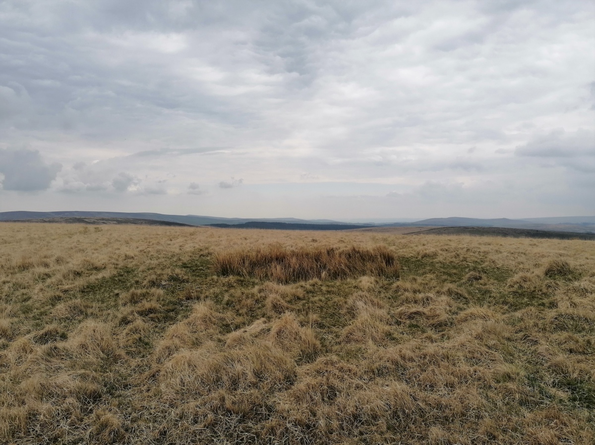
White Ridge cairn submitted by TheCaptain on 30th May 2022. There is clearly a cairn up on top of White Ridge, given away not only by the green stony circle amongst all the pale strawgrass which is everywhere else, but it also has a hollow in the centre, where it has clearly been dug in the past.
There are all around views, here looking southeast.
(View photo, vote or add a comment)
Log Text: After a quick drink on the cairn of the stone row, I head up onto the top of White Ridge for lunch with views all around. There are a few storms blowing in, but thankfully they all avoided me. There is clearly a cairn up here, given away not only by the green stony circle amongst all the pale strawgrass which is everywhere else, but it also has a hollow in the centre, where it has clearly been dug in the past.
White Raise Cairn
Date Added: 15th Mar 2023
Site Type: Cairn
Country: England (Cumbria)
Visited: Yes on 20th Sep 2022. My rating: Condition 3 Ambience 3 Access 3
White Raise Cairn submitted by baz on 3rd May 2003. White Raise Cairn (NY489224). This 20m. long cairn has an exposed central cist.
(View photo, vote or add a comment)
Log Text: I eventually get to the White Raise cairn, MD10, a large roundish mass of stones on top of a small natural hillock. Its not very round, with a few sticking out arms, and it is clear why this became known as "The Starfish Cairn". Clambering up onto the top of it, and the previous notable cairns can be seen in the distance. There is a hollow containing a large cist, fairly big and much deeper than any I have seen on Dartmoor. Near to this cist, on the eastern side, are a couple of large stones, no doubt once the capstones of the cist. There are other stones which may once have formed a ring around the structure.
White Moss SW
Date Added: 29th Oct 2019
Site Type: Stone Circle
Country: England (Cumbria)
Visited: Yes on 16th Oct 2017
White Moss SW submitted by TheCaptain on 16th Oct 2017. White Moss SW viewed looking in a southwesterly direction towards the Irish Sea
(View photo, vote or add a comment)
Log Text: None
White Moss NE
Date Added: 29th Oct 2019
Site Type: Stone Circle
Country: England (Cumbria)
Visited: Yes on 11th Oct 2017
White Moss NE submitted by TheCaptain on 11th Oct 2017. White Moss NE stone circle, viewed looking southwest towards the Irish Sea, with the SW circle just beyond.
(View photo, vote or add a comment)
Log Text: None
White Moor Stone
Date Added: 18th Sep 2010
Site Type: Standing Stone (Menhir)
Country: England (Devon)
Visited: Yes on 12th Jun 2004
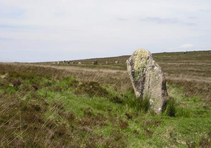
White Moor Stone submitted by TheCaptain on 12th Jun 2004. White Moor Stone, Dartmoor, Devon SX634895
150 metres southeast of White Moor Stone Circle is the Whit Moor Stone, which is more than 5 feet in height, and has been adapted as a parish boundary stone, with its parish marks cut into it. This stone is almost certainly much older than just a boundary stone, and is likely to be associated in some way with the circle.
(View photo, vote or add a comment)
Log Text: None
White Moor Down
Date Added: 24th Apr 2025
Site Type: Stone Circle
Country: England (Devon)
Visited: Yes on 3rd Jun 2004. My rating: Condition 4 Ambience 5 Access 2

White Moor Down submitted by TheCaptain on 12th Jun 2004. White Moor Down Stone Circle, Dartmoor, Devon SX634896
This is a truly lovely stone circle, situated on a flat saddle of land between Little Hound Tor and Hound Tor, miles away from any signs of modern life in the middle of the desolate moor, and there are views for miles around in almost all directions from the site. There are 18 remaining stones of a probable nineteen arranged fairly evenly, in a circle of diameter 20 metres. The stones are arranged flat side inwards, and vary in height bet...
(View photo, vote or add a comment)
Log Text: This is a truly lovely stone circle, situated on a flat saddle of land between Little Hound Tor and Hound Tor, miles away from any signs of modern life in the middle of the desolate moor, and there are views for miles around in almost all directions from the site. There are 18 remaining stones of a probable nineteen arranged fairly evenly, in a circle of diameter 20 metres. The stones are arranged flat side inwards, and vary in height between 2 and 4 feet high. 150 metres southeast of the circle is the Whit Moor Stone, which is more than 5 feet in height, and has been adapted as a parish boundary stone, with its parish marks cut into it. This stone is almost certainly much older than just a boundary stone, and is likely to be associated in some way with the circle. Between this stone and the circle are the remains of a cairn.
White Moor Down
Date Added: 24th Apr 2025
Site Type: Stone Circle
Country: England (Devon)
Visited: Yes on 8th Apr 2025. My rating: Condition 4 Ambience 5 Access 2
White Moor Down submitted by cazzyjane on 20th May 2014. A beautiful circle probably more impressive after doing such a long hike to get here! My first two attempts were aborted after firstly being shrouded in fog and secondly after getting stuck in very boggy marshland!
(View photo, vote or add a comment)
Log Text: Approaching the top of the hill, I was expecting the stone circle to come into view much sooner than it actually did. In fact it is not to be seen until it is fairly close. It’s a lovely circle and on a superb sunny and clear day like today this is a most fabulous place, with extensive views all around. I spend a fair bit of time here taking lots of pictures, including full 360 degree panoramas from within the circle.
White Moor Cairn
Date Added: 18th Sep 2010
Site Type: Cairn
Country: England (Devon)
Visited: Yes on 12th Jun 2004

White Moor Cairn submitted by TheCaptain on 12th Jun 2004. White Moor Cairn, Dartmoor, Devon SX634895
Situated between the stone circle and the Whit Moor Stone are the remains of a cairn.
This is seen here as the darker area in the heather.
(View photo, vote or add a comment)
Log Text: None
White Hill, Devon
Date Added: 19th Apr 2025
Site Type: Ancient Village or Settlement
Country: England (Devon)
Visited: Yes on 8th Apr 2025. My rating: Condition 3 Ambience 4 Access 3
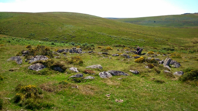
White Hill, Devon submitted by graemefield on 11th Aug 2014. Large hut circle within enclosure.
(View photo, vote or add a comment)
Log Text: I now head northeast to cross the Small Brook running down from the moor, which requires finding a suitable place to jump across, and thankfully it isnt too boggy here today. Now I can head southeast up the hillside towards White Moor stone circle along a fairly reasonable path, which passes the remains of a couple of settlements, with clear hut circles and other features.
Whitby Abbey
Date Added: 27th Nov 2024
Site Type: Early Christian Sculptured Stone
Country: England (Yorkshire (North))
Visited: Yes on 15th Sep 2024

Whitby Abbey submitted by pjlythe1 on 15th Mar 2020. Whitby Abbey
(View photo, vote or add a comment)
Log Text: Whitby Abbey in its bleak windblown position on top of the hill above the harbour is a good visit. It has to be said that I thought the weathering shapes and patterns of the stone remains made it truly memorable. The museum was also fascinating with many items of ancient historic interest.
Whit Stones
Date Added: 18th Sep 2010
Site Type: Standing Stones
Country: England (Somerset)
Visited: Yes on 29th Oct 2006
Whit Stones submitted by thecaptain on 29th Oct 2006. Two large (for Exmoor) stones are sticking out of the deep heather, leaning beyond 45° downhill. They are about 5 metres apart.
(View photo, vote or add a comment)
Log Text: None
Whispering Knights
Date Added: 29th Oct 2019
Site Type: Portal Tomb
Country: England (Oxfordshire)
Visited: Yes on 2nd Mar 2013

Whispering Knights submitted by theCaptain on 2nd Mar 2013. The Whispering Knights at the Rollright Stones.
Picture resurrected from an old negative taken on an Olympus Trip camera in about 1978, probably on Bonusprint film. Negative scanned using a £50 scanner, showing all the failings of the original all these years later.
(View photo, vote or add a comment)
Log Text: None
Westmoorgate circle
Date Added: 8th Oct 2012
Site Type: Stone Circle
Country: England (Cornwall)
Visited: Yes on 22nd Sep 2012

Westmoorgate circle submitted by theCaptain on 6th Oct 2012. I walked around the circle and made a waypoint on my gps for each of the stones.
I have plotted these onto Google Earth
(View photo, vote or add a comment)
Log Text: None
Westmoorgate cairn
Date Added: 8th Oct 2012
Site Type: Cairn
Country: England (Cornwall)
Visited: Yes on 22nd Sep 2012
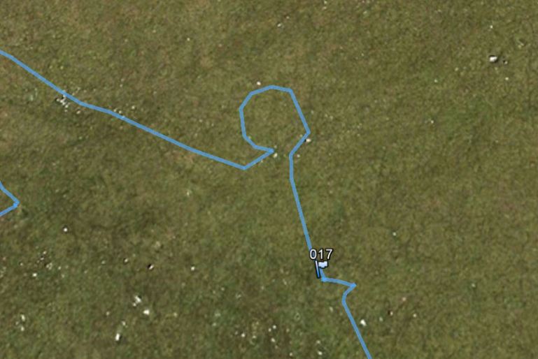
Westmoorgate cairn submitted by theCaptain on 8th Oct 2012. The gps track of my walking to the north of Westmoorgate stone circle, firstly to the cairn (WP17) and then around some significant stones, which have indeed made a rather nice circle.
Plotted onto Google Earth.
(View photo, vote or add a comment)
Log Text: None
Westmoor Cairns
Date Added: 29th Oct 2019
Site Type: Cairn
Country: England (Cornwall)
Visited: Yes on 4th Jul 2017
Westmoor Cairns submitted by TheCaptain on 4th Jul 2017. The most westerly of the three cairns, viewed looking southwest
(View photo, vote or add a comment)
Log Text: None
West Wycombe Camp
Date Added: 18th Sep 2010
Site Type: Hillfort
Country: England (Buckinghamshire)
Visited: Yes on 18th Nov 2003
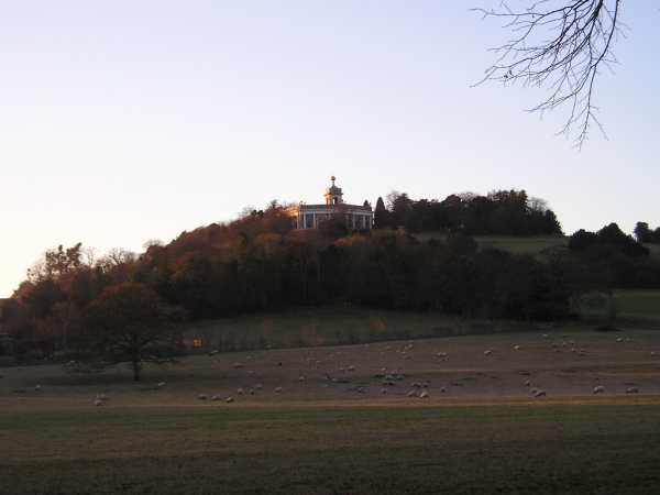
West Wycombe Camp submitted by thecaptain on 18th Nov 2003. View of West Wycombe Hill from the East. On the top, inside the iron age camp is built St Lawrence's Church (with the Golden Ball as used by the Hellfire club) and also the Dashwood Mausoleum. Material for building these, was taken from the caves under the hill
(View photo, vote or add a comment)
Log Text: None
West Tump
Date Added: 10th Jun 2021
Site Type: Long Barrow
Country: England (Gloucestershire)
Visited: Yes on 31st May 2021. My rating: Condition 3 Ambience 4 Access 4
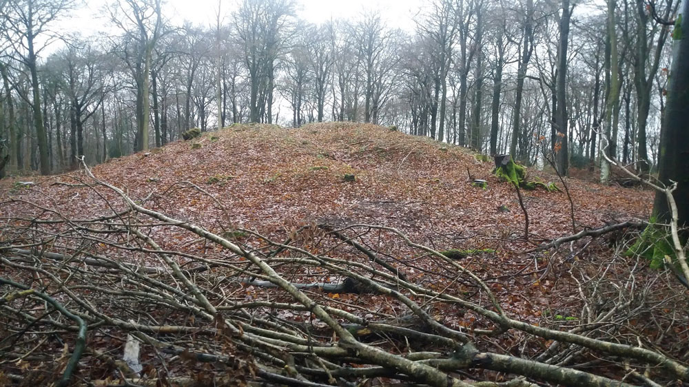
West Tump submitted by Dabberdave on 15th Jan 2017. West Tump long barrow after recent tree clearance.
(View photo, vote or add a comment)
Log Text: Walking a Cooper's Hill Circuit of the Cotswold Way from Cranham, and on the way back to Cranham I made a diversion into the woods to find this long barrow. It’s a massive lump, now mostly cleared of trees, and built in an east to west sense, significantly bigger at the eastern end, which was no doubt the main entrance.
