Contributory members are able to log private notes and comments about each site
Sites theCAptain has logged. View this log as a table or view the most recent logs from everyone
Pierres Pouquelées
Trip No.202 Entry No.30 Date Added: 26th Mar 2020
Site Type: Passage Grave
Country: France (Normandie:Manche (50))
Visited: Yes on 26th Apr 2005. My rating: Condition 3 Ambience 5 Access 4

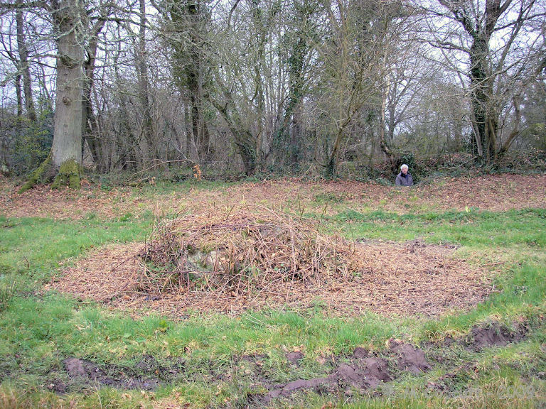
Pierres Pouquelées submitted by thecaptain on 29th Apr 2005. Pierres Pouquelées View looking southish at this much ruined allée couverte on top of the hilly downs to the northwest of the village of Vauville, where the wonderful long beach can just be made out.
(View photo, vote or add a comment)
Log Text: Much ruined allée couverte on top of the hilly downs to the northwest of the village of Vauville. I measured the remains out to about 12 metres in length but I have seen in a guidebook that the remains are said to be 17 metres long. Perhaps there are more stones under the undergrowth than I saw in the flattened grassy area.
There is only any remains of the central chamber of which can be seen about 9 pairs of stones and 2 remaining capstones in place with a couple more fallen in the middle. There is no sign of any outer peristalith and I could not determine where the entrance would have been. The allée couverte is aligned on about 150° and runs slightly downhill with a large perpendicular endstone still in place at the upper end. Looking along the tomb and it seems to align on the top of the large hill over the other side of the valley above the wonderful beach upon which I believe a menhir once stood.
Although the monument is much ruined it really is in a lovely position at the top of a big hill overlooking the sea with the rocky cliffs of Cap de la Hague stretching away to the northwest and the lovely long beach running south from Vauville. The Island of Alderney can be seen out in the sea and the viscious tide race between the mainland and Alderney can be seen in full flow at the right time of day. It can be reached by a longish and steep walk up from Vauville or alternatively it can be driven almost right to by following the road down towards it from the north and then following the unmade tracks from there which are marked on the 1:25000 scale ign maps.
Dolmen du Jogard
Trip No.202 Entry No.28 Date Added: 26th Mar 2020
Site Type: Burial Chamber or Dolmen
Country: France (Normandie:Manche (50))
Visited: Yes on 26th Apr 2005. My rating: Condition 1 Ambience 2 Access 3

Dolmen du Jogard submitted by TheCaptain on 7th May 2005. Le Jogard, St Germain-des-Vaux, Manche.
I am not 100 percent sure that what I saw and photographed in a downpour here is the remains of this dolmen or not, but it is in the right sort of place.
(View photo, vote or add a comment)
Log Text: A much ruined dolmen just northwest of the village of St Germain-des-Vaux on Cap de la Hague right at the northwestern tip of the Cherbourg peninsular.
I am not 100 percent sure that what I saw and photographed in a downpour was the remains of this dolmen or not but it was in the right sort of place. What I saw was a single stone remaining in a field beside the track beyond the house called Le Jogard. I could not enter the field to see if there were any other stones flat to the ground here and there were several loose cows which came and wanted to inspect me !
Menhir de la Bergerie des Etennevaux
Trip No.202 Entry No.29 Date Added: 26th Mar 2020
Site Type: Standing Stone (Menhir)
Country: France (Normandie:Manche (50))
Visited: Saw from a distance on 26th Apr 2005

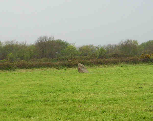
Menhir de la Bergerie des Etennevaux submitted by TheCaptain on 7th May 2005. La Bergerie des Etennevaux, menhir, St Germain-des-Vaux, Manche.
Menhir about 2 metres tall right at the northwestern tip of the Cherbourg peninsular, seen from two fields distance in a downpour.
(View photo, vote or add a comment)
Log Text: Menhir about 2 metres tall northwest of the village of St Germain-des-Vaux on Cap de la Hague right at the northwestern tip of the Cherbourg peninsular. I couldn’t get right up to this menhir and could only see it from two fields distance and judged the height from the size of the cows in the field with it.
Hague-Dick
Trip No.202 Entry No.27 Date Added: 26th Mar 2020
Site Type: Misc. Earthwork
Country: France (Normandie:Manche (50))
Visited: Yes on 26th Apr 2005. My rating: Condition 3 Ambience 2 Access 5

Hague-Dick submitted by TheCaptain on 9th May 2005. Several square miles at the northwestern tip of the Cherbourg peninsula, was once defended from the rest of the world by a 2 mile long ditch and bank, which connected between two deep valleys to defend the whole area.
Much of this dyke has now been destroyed, but a good section remains to the northwest of the village of Beaumont Hague, where it can be clearly seen as the roads to Digulleville cut through it.
(View photo, vote or add a comment)
Log Text: Cap de la Hague several square miles at the northwestern tip of the Cherbourg peninsula was once defended from the rest of the world by a 2 mile long ditch and bank which connected between two deep valleys to defend the whole area.
Much of this dyke has now been destroyed but a good section remains to the northwest of the village of Beaumont Hague where it can be clearly seen as the roads to Digulleville cut through it. The bank is generally about 4 metres in height but in places it must be nearer 10 metres tall with small ditches on the landward side. Excavations have shown that the bank was first built in the bronze age but much added to and increased during the time of the Viking occupation in the ninth century.
St-Benoit polissoir
Trip No.203 Entry No.605 Date Added: 13th Jun 2020
Site Type: Polissoir
Country: France (Normandie:Manche (50))
Visited: Yes on 28th Jun 2005. My rating: Condition 4 Ambience 4 Access 5

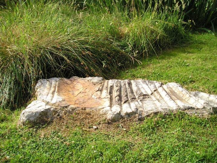
St-Benoit polissoir submitted by thecaptain on 14th Oct 2005. St Benoit polissoir, near St James.
Not a million miles from Mont St Michel, this lovely polissoir stone is nowadays nicely kept in a little garden type area beside the lane.
(View photo, vote or add a comment)
Log Text: I was understanding that this polissoir stone was going to be difficult to find, but thought that I'd give it a go. Luckily for me, since the source of my information was written, it's all been tidied up into a nice little area and signposted. It's about 800m from the village of St Bénoit, up the D.363 to the east, beside the little stream.
The stone itself is a sort of white quartz, about 1.2 metres in length and flat on the ground. In the top face are three polishing bowls, one large, and up to 16 polishing grooves. The little stream which provides its water source to lubricate the polishing is rich in iron ore, and this has caused the stone to stain a rust red colour in its cracks and grooves.
The stone has been dated to 4000BC. Legends have become associated with such a stone, one being that it can cure colic in horses if they are walked around the stone three times, then made to drink the iron rich water within its basins.
Terriffic, I love these polissoir stones.
Geffosses Ecole-des-Filles
Date Added: 18th Sep 2010
Site Type: Standing Stone (Menhir)
Country: France (Normandie:Manche (50))
Visited: Yes on 25th Apr 2007
Geffosses Ecole-des-Filles submitted by thecaptain on 25th Apr 2007. Built into the bottom corner of the old Girls School in the village of Geffosses, just to the south of the churchyard, can be seen this old menhir.
(View photo, vote or add a comment)
Log Text: None
L'Oeuf de Gargantua
Date Added: 18th Sep 2010
Site Type: Standing Stone (Menhir)
Country: France (Normandie:Manche (50))
Visited: Yes on 26th Apr 2007
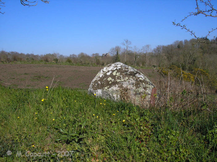
L'Oeuf de Gargantua submitted by thecaptain on 26th Apr 2007. L'Oeuf de Gargantua is a granite stone which looks like a granite egg.
There are many legends and folk tales associated with it.
(View photo, vote or add a comment)
Log Text: None
Droits a l'Homme
Date Added: 18th Sep 2010
Site Type: Modern Stone Circle etc
Country: France (Normandie:Manche (50))
Visited: Yes on 27th Apr 2007
Droits a l'Homme submitted by thecaptain on 27th Apr 2007. This modern granite stone must be almost 8 metres tall, and has a barbed wire collar around it.
My Dad for scale
(View photo, vote or add a comment)
Log Text: None
Gouville-sur-Mer Menhir
Date Added: 18th Sep 2010
Site Type: Standing Stone (Menhir)
Country: France (Normandie:Manche (50))
Visited: Yes on 28th Apr 2007
Gouville-sur-Mer menhir submitted by thecaptain on 28th Apr 2007. The stone is fallen and in a ditch under a little tree, now seemingly in the middle of the swampy fields
(View photo, vote or add a comment)
Log Text: None
Menhir dit Pierre Bottin
Date Added: 18th Sep 2010
Site Type: Standing Stone (Menhir)
Country: France (Normandie:Manche (50))
Visited: Yes on 2nd May 2007
Menhir dit Pierre Bottin submitted by thecaptain on 2nd May 2007. I could see the stone from the road nearby, and estimate it to be about 2 metres tall. It has a similar sized stone laying flat nearby.
(View photo, vote or add a comment)
Log Text: None
Maupertus menhir
Trip No.201 Entry No.12 Date Added: 25th Mar 2020
Site Type: Modern Stone Circle etc
Country: France (Normandie:Manche (50))
Visited: Yes on 22nd Nov 2004. My rating: Access 5

Maupertus menhir submitted by TheCaptain on 27th Sep 2007. On the main street through Maupertus-sur-Mer, is a large granite stone being used as a gatepost.
The stone looks very weathered, and is twice as high as it would need to be for the gatepost function it provides.
Is this one of the many ancient menhirs that used to be in this area reused ?
(View photo, vote or add a comment)
Log Text: On the main street through Maupertus-sur-Mer, just to the north of Cherbourg Airport is a large granite stone being used as a gatepost. The stone looks very weathered, and the edges are curved and worn, not straight or with any quarrying marks. It is also twice as high as it would need to be for the gatepost function it provides. Is this one of the many ancient menhirs that used to be in this area reused ?
St-Malo-de-la-Lande menhir
Date Added: 18th Sep 2010
Site Type: Standing Stone (Menhir)
Country: France (Normandie:Manche (50))
Visited: Yes on 30th Sep 2007

St-Malo-de-la-Lande menhir submitted by TheCaptain on 30th Sep 2007. Beside a track near the top of the hill above the stream, a kilometre or so to the south of St Malo-de-le-Lande, can be found this menhir.
(View photo, vote or add a comment)
Log Text: None
Le Cul du Diable
Date Added: 18th Sep 2010
Site Type: Standing Stone (Menhir)
Country: France (Normandie:Manche (50))
Visited: Yes on 30th Dec 2007

Le Cul du Diable submitted by thecaptain on 30th Dec 2007. The stone is on the Manoir side of the road, perhaps 30 metres to the north of the entrance. Most of the stone is indeed enclosed within the hedgebank, but there is a clear part of it which is visible.
(View photo, vote or add a comment)
Log Text: None
Trigalle dolmen
Date Added: 18th Sep 2010
Site Type: Burial Chamber or Dolmen
Country: France (Normandie:Manche (50))
Visited: Yes on 12th Jan 2008

Trigalle dolmen submitted by thecaptain on 12th Jan 2008. These large stones are in the wall of a barn, near to Trigalle hamlet.
Could this be the remains of the Dolmen de Trigalle, reported to have been destroyed in the early 1800s ?
(View photo, vote or add a comment)
Log Text: None
Table des Fées (Rocheville)
Date Added: 18th Sep 2010
Site Type: Passage Grave
Country: France (Normandie:Manche (50))
Visited: Yes on 5th Apr 2009

Table des Fées (Rocheville) submitted by thecaptain on 5th Apr 2009. La Table des Fées.
My Dad can be seen in the lane, with the gap through to the stone seen.
(View photo, vote or add a comment)
Log Text: None
Millières menhir
Date Added: 18th Sep 2010
Site Type: Standing Stone (Menhir)
Country: France (Normandie:Manche (50))
Visited: Yes on 30th Dec 2009
Millières menhir submitted by theCaptain on 30th Dec 2009. Almost certainly NOT the Millières menhir at La Guillaumerie.
(View photo, vote or add a comment)
Log Text: None
Menhir de Blainville-sur-Mer
Date Added: 18th Sep 2010
Site Type: Standing Stone (Menhir)
Country: France (Normandie:Manche (50))
Visited: Yes on 4th Jan 2010
Menhir de Blainville-sur-Mer submitted by theCaptain on 4th Jan 2010. In the little square beside the Mairie and church of Blainville-sur-Mer, stands a little granite menhir, recently rediscovered during roadworks here in 1992.
(View photo, vote or add a comment)
Log Text: None
Menhir de Gouville
Date Added: 18th Sep 2010
Site Type: Standing Stone (Menhir)
Country: France (Normandie:Manche (50))
Visited: Yes on 20th Jun 2010
Menhir de Gouville submitted by TheCaptain on 20th Jun 2010. Just over 2 metres tall, this nicely shaped granite stone stands in a little tended garden area beside the Coutances road at the junction with Rue du Moulin-a-Vent.
(View photo, vote or add a comment)
Log Text: None
Roche a Trois Pieds
Date Added: 18th Sep 2010
Site Type: Burial Chamber or Dolmen
Country: France (Normandie:Manche (50))
Visited: Yes on 25th Jun 2010
Roche a Trois Pieds submitted by TheCaptain on 25th Jun 2010. The Roche a Trois Pieds is beside a natural outcropping of quartz rock in woodland at the top of the hill.
(View photo, vote or add a comment)
Log Text: None
Les Grises Pierres
Date Added: 29th Oct 2019
Site Type: Standing Stones
Country: France (Normandie:Manche (50))
Visited: Yes on 15th Oct 2010
Les Grises Pierres submitted by TheCaptain on 15th Oct 2010. The second of Les Grises Pierres at Montaigu-la-Brisette.
This one is more well hidden and buried than its partner.
(View photo, vote or add a comment)
Log Text: None
