Contributory members are able to log private notes and comments about each site
Sites theCAptain has logged. View this log as a table or view the most recent logs from everyone
Menhir dit Pierre Debout (Reviers)
Trip No.206 Entry No.6 Date Added: 25th Mar 2020
Site Type: Standing Stone (Menhir)
Country: France (Normandie:Calvados (14))
Visited: Yes on 28th Sep 2006. My rating: Condition 2 Ambience 3 Access 4
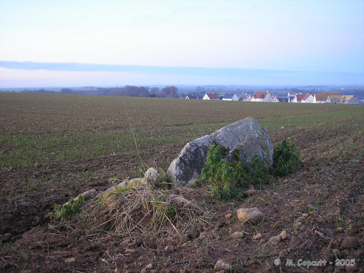
Menhir dit Pierre Debout (Reviers) submitted by thecaptain on 29th Dec 2005. Reviers menhir.
Just inland from the D-Day beaches can be found (when the crops are down) the sad remains of this menhir.
(View photo, vote or add a comment)
Log Text: As I am right here and passing by, thought I may as well stop and take a look in the daylight. The crops in the field are growing, or more likely its been left fallow, but the ploughs have been right up to the stone and its fairly difficult to spot, even with this small growth. The poor stone is in a very sorry state, and could do with some TLC. Shame its so woefully looked after, so close to the well maintained large barrow.
Pierrelaye menhir
Trip No.201 Entry No.6 Date Added: 25th Mar 2020
Site Type: Standing Stone (Menhir)
Country: France (Normandie:Calvados (14))
Visited: Couldn't find on 21st Nov 2004

Pierrelaye menhir submitted by Rida on 6th Feb 2011. Site in Normandie:Calvados (14) France
(View photo, vote or add a comment)
Log Text: On a wet Sunday afternoon, following the disappointment of not getting to see the Pierre Dialan dolmen, my family encouraged me to go and find the nearby Menhir de Pierrelaye, which is marked on the IGN maps to the north of the village of Villers-Bocage.
My first attempt to get to see this 3 metre high stone was via the lane from the southeast, but upon reaching a farmyard there was no further way through. To much amusement getting out from here involved reversing all the way back up this lane to the road junction, a distance of about a mile ! Not to be beaten, I drove round the lanes to try and get a look from the northwest of where the stone is marked. The collection of farms and houses here is known as Pierrelaye, and indeed have signposts to Pierrelaye, but I could see no traces of a Menhir.
While turning round in a farmyard, an old farmer came out to see what was going on, so we asked in bad French where the stone was. After a while, he obviously realised what we were looking for and pointed up the hillside and said “Non monsieur, Fermée” while making arm gestures which made it clear I wasn’t going to see the stone. I assume it is on private land, and he wasn’t going to give me permission to go have a look. I have found information which tells that the stone is 3 metres high, with a base width of 2,5 metres, made of schist. It is situated in the middle of a field in a little valley.
Menhir de la Demoiselle de Bracqueville
Trip No.202 Entry No.4 Date Added: 25th Mar 2020
Site Type: Standing Stone (Menhir)
Country: France (Normandie:Calvados (14))
Visited: Couldn't find on 23rd Apr 2005
Menhir de la Demoiselle de Bracqueville submitted by thecaptain on 11th Oct 2006. la Demoiselle de Bracqueville, near Caen in Calvados. Its about 1.4 metres tall, and leans towards the north.
The farmer has left very little room around it, and it has some very recent scrapes and damage done to it, no doubt from farm machinery.
(View photo, vote or add a comment)
Log Text: Despite being marked on the ign map and having a description of how to find this 1.4 metre tall stone I could find no reasonable place to park down the farm track to Bracqueville before a 500 metre walk so didn’t bother. I could see no sign of the stone from anywhere in the vicinity.
Pierre Tourneresse (Gouvix)
Trip No.202 Entry No.8 Date Added: 25th Mar 2020
Site Type: Standing Stone (Menhir)
Country: France (Normandie:Calvados (14))
Visited: Couldn't find on 23rd Apr 2005
Pierre Tourneresse (Gouvix) submitted by Rida on 29th Jan 2011. Site in Normandie:Calvados (14) France
(View photo, vote or add a comment)
Log Text: Not marked on my ign map and finding no map within the village I gave up without really trying to find the supposed menhir near here. I believe it is in the grounds of the local chateau and wasn’t going to spend a lot of time being unable to find it.
Langrais menhirs
Trip No.212 Entry No.6 Date Added: 26th Mar 2020
Site Type: Standing Stones
Country: France (Normandie:Calvados (14))
Visited: Yes on 7th May 2012. My rating: Condition 4 Ambience 3 Access 4

Langrais menhirs submitted by Rida on 27th Feb 2011. Site in Normandie:Calvados (14) France
(View photo, vote or add a comment)
Log Text: Having had a good look at the IGN 1:25000 map, I saw that there is a trackway running east from the road south of Mont Joly, which runs from the bottom of the hill diagonally up to the approximate position of the stones. Even better, when arriving there for a look, the trackway was open and easily driveable, and so I took this option on this showery afternoon, and when emerging from below the wood at the top of the hill, there was plenty of space to park amongst a large composting area! Left Dad in the car while I went out into the wind and drizzle to find the stones, and there they were, just round the back of the big pile of manure!
The two stones stand at the edge of an open rocky outcrop at the top of the hill, covered in wildflowers at this time of year, but I learned that the stones are not in their original positions, having been moved there by the farmer at some point in the past. The two stones are very different, the larger stone being a whitish quartz type stone, between 3.5 nd 4 metres tall, while its shorter neighbour is a reddish colour, and only about 1.6 metres tall. There are plently of other large lumps of stone laying about here, which may have been broken from the two menhirs, or just other examples of field clearance.
On the way down from the stones, through a gateway into the wood I could see another rocky outcrop with various large stones standing around, a couple of them probably at least 2 metres tall. This was all now made into a nice garden feature, but is there any ancient significance to the stones? Back onto the road, and I noticed it was called Route des Menhirs, and up towards the top of the hill there was another garden with some large rocks standing in it.
Onto the top of Mont Joly, and it is clear that there are large rocks all over the place, and it is easy to imagine that thee was once an alignement of large stones running along the top of the hill into the ancient settlement. Walking along the edge of the field, and then the pathway to the end of the promontary, and large stones can be seen laying around everywhere, many clearly not just a local outcropping of rock, but various shapes, sizes and types of stone. Many of these rocks were now incorporated into garden features, but many more are just laying there, slowly getting buried by the undergrowth. It really is a fascinating area, and I do wonder what a proper survey of this ancient hilltop would turn up.
Mont Joly
Trip No.212 Entry No.8 Date Added: 26th Mar 2020
Site Type: Ancient Village or Settlement
Country: France (Normandie:Calvados (14))
Visited: Yes on 7th May 2012. My rating: Condition 2 Ambience 4 Access 5
Mont Joly submitted by theCaptain on 15th Jan 2014. This promontory site is surrounded on three sides by the steep gorge of the river Laizon, and the eastern end has been defended by ramparts, a little of which can now be seen between the church and water tower.
In this picture a raise in the land can be seen to the left of my Dad.
(View photo, vote or add a comment)
Log Text: What an intriguing place this is, and deserving of much more thorough exploration.
Menhir dit Pierre de la Hoberie
Trip No.202 Entry No.15 Date Added: 26th Mar 2020
Site Type: Standing Stone (Menhir)
Country: France (Normandie:Calvados (14))
Visited: Couldn't find on 23rd Apr 2005
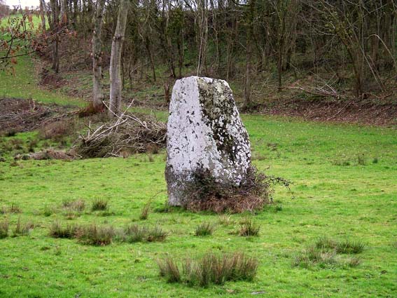
Menhir dit Pierre de la Hoberie submitted by Rida on 27th Feb 2011. Site in Normandie:Calvados (14) France
Menhir dit Pierre de la Hoberie
(View photo, vote or add a comment)
Log Text: This 3.1 metre tall menhir is said to be in the field downhill from the Ferme de Hoberie southwest of the village of Ussy. I could find nowhere to park and see no way through the farm without going through fields of cows so didn’t bother as I was in a rush to get back.
La Loge aux Sarrasins
Trip No.211 Entry No.4 Date Added: 26th Mar 2020
Site Type: Burial Chamber or Dolmen
Country: France (Normandie:Calvados (14))
Visited: Yes on 9th Oct 2011. My rating: Condition 4 Ambience 3 Access 4
la Loge aux Sarrasins submitted by hrun95 on 21st Jun 2011. These photos were taken in 2007, in the garden of the owners. So it's a bit boring because you are in their propriety. I get there by the little path coming by la Chaudronniere.
Site in Normandie:Calvados (14) France
(View photo, vote or add a comment)
Log Text: Having gone to Vire for a Vide Grenier and country show, persuaded Trevor and Sara to visit this stone for another look. Followed the same path as last time, and this time, once at the corner of the garden, the dolmen was clear to be seen in the back garden. At Last!
Its a lovely looking little dolmen. I can only assume that last visit there was a shed in the way, preventing it being seen. To get a better view, went back to the cornfield, and walked along its edge and up along outside the garden. I noticed that a bit further to the west, behind the garage, there was a separate standing stone, a couple of metres tall.
Dolmen du Pech (Cazals)
Trip No.205 Entry No.36 Date Added: 19th Oct 2020
Site Type: Burial Chamber or Dolmen
Country: France (Midi:Tarn-et-Garonne (82))
Visited: Yes on 2nd Sep 2005. My rating: Condition 5 Ambience 3 Access 5

Dolmen du Pech (Cazals) submitted by thecaptain on 17th Jan 2006. View from the western end of the weird Box Tomb of Pech, perhaps over-enthusiastically restored in 1992.
The dimensions of the stone mound are about 10 metres wide by 25 metres long. The back, western, end is curved and not squared.
(View photo, vote or add a comment)
Log Text: Despite not being marked on any ign maps I have seen, this box tomb dolmen is easily found as it is right beside the D.75B between Bourdoncle and Doumerc by the road to Frau. Subject of an excavation in 1989, and reconstruction in 1992, it is now fenced in, presumably for protection, but it looks terribly ugly because of that.
The chamber seems to be of a double type, open to the east, with a large first chamber 4.5 metres by 2.5 metres between two large side slabs, followed by the smaller chamber between side slabs one metre apart. A single large capstone covers the back chamber and a part of the first, and there is a secondary loose stone structure on the top, covering the capstone. The front of the chamber is walled off from the outside. The odd thing about this dolmen is the rectangular mound it is contained within, which has been subject to a perhaps over-enthusiastic reconstruction. There are other rectangular tombs like this, especially in this locality, but somehow this seems too regular and uniform. The dimensions of the stone mound are about 10 metres wide by 25 metres long. The back, western, end is curved and not squared. The whole thing is most odd.
While reversing to try and park the van here, I completely missed seeing a roadsign and flattened the thing completely - luckily it was only loosely held in the ground and did no damage, and was easy to stand up again !
Dolmen de Saillac
Trip No.205 Entry No.37 Date Added: 19th Oct 2020
Site Type: Burial Chamber or Dolmen
Country: France (Midi:Tarn-et-Garonne (82))
Visited: Yes on 2nd Sep 2005. My rating: Condition 2 Ambience 4 Access 4

Dolmen de Saillac submitted by thecaptain on 23rd Jan 2006. This is a bizarrely Christianised dolmen which can be found in the forests to the south of the village of Caylus in Tarn-et-Garonne.
The dolmen is still partially contained within its circular mound, and the remains of two sidestones and a backstone can be seen, with the small capstone balanced on these and a few other bits of stone to make it level.
(View photo, vote or add a comment)
Log Text: This is a bizarrely Christianised dolmen which can be found in the forests to the south of the village of Caylus. From Caylus follow the signs to St-Amans-le-Vieux ancient church, and park in the vicinity of this, from where you take the GR46 Footpath the opposite way from the road towards the southwest for about 500 metres, and the remains of the dolmen can be seen on the left.
This dolmen has been much altered, and at first I had difficulty recognising it, but it is right beside the path with the wall built right through it. On top of the remains of the capstone has been built a stone plinth, with an ornate iron cross protruding from this, the top of which is about 3 metres above the ground. The dolmen is still partially contained within its circular mound, and the remains of two sidestones and a backstone can be seen, with the small capstone balanced on these and a few other bits of stone to make it level.
Tombe du Géant (Septfonds)
Trip No.205 Entry No.35 Date Added: 19th Oct 2020
Site Type: Burial Chamber or Dolmen
Country: France (Midi:Tarn-et-Garonne (82))
Visited: Yes on 2nd Sep 2005. My rating: Condition 4 Ambience 4 Access 3

Tombe du Géant (Septfonds) submitted by thecaptain on 25th Jan 2006. This dolmen is a nice one, still partially within its mound. The chamber is made with two long side slabs, each 5 metres in length, and with a nicely shaped and fitted backstone between them. The capstone has broken, and only half of it now remains.
(View photo, vote or add a comment)
Log Text: The Tombe du Géant is a scheduled historic monument, and as such it is marked on the local maps, both 1:25,000 and 1:100,000, near to the farm of Les Tombes to the southeast of Septfonds. It is however not so easy to find in the real world, with the fields and indeed many of the trackways in this area having recently been thoroughly fenced off, with both barbed wire and electric fences, and new hedges planted. At first, I could find no way through to this dolmen, and as it is in a bit of woodland, there was no way I could see anything from nearby either. Before giving up totally, I thought I would try an approach from a different angle, and indeed, there is a new trackway made, which takes one around the newly fenced off land. It is complex to describe, but starting from a point well to the south of where the dolmen is marked, take the signed PR.1 footpath firstly to the east for a couple of hundred metres, and then having passed the end of the first field and passed into some woods, turn left to the north and follow the trackway for about 500 metres where you will then find the Tombe du Géant in the woodland to the left of the path.
The dolmen is a nice one, still partially within its mound. The chamber is made with two long side slabs, each 5 metres in length, and with a nicely shaped and fitted backstone between them. The capstone has broken, and only half of it now remains. The chamber is 4.5 metres long by 1.5 metres wide internally, and as usual faces to the east. This would be a very pleasant spot, but for all the flies buzzing around and the humming and crackling power lines passing almost directly overhead. There are probably several other dolmens to be found in the locality, judging by certain names on the maps.
Dolmen de Caux-Vieilles
Trip No.205 Entry No.32 Date Added: 19th Oct 2020
Site Type: Burial Chamber or Dolmen
Country: France (Midi:Tarn-et-Garonne (82))
Visited: Yes on 2nd Sep 2005. My rating: Condition 2 Ambience 3 Access 4

Dolmen de Caux-Vieilles submitted by TheCaptain on 6th Nov 2007. A bit to the south of the track running along the southern edge of the airfield, in the scrubland, are several mounds of stones.
One of these mounds has a clear dolmen chamber within it, but was very difficult to photograph with all the trees and bushes around it.
I am lead to believe that there are many dolmens to be found within these woodlands, far more than the three that I found.
(View photo, vote or add a comment)
Log Text: A bit to the south of the track running along the southern edge of the airfield, in the scrubland, are several mounds of stones. One of these mounds has a clear dolmen chamber within it, 3 metres in length by 1.5 metres in width. It consists of two side slabs and a backstone between them, but no capstone. The northern half of the mound still exists right up to the top of the side support, while the southern part is mostly missing. This chamber is very difficult to photograph with all the trees and bushes around it. I am lead to believe that there are many dolmens to be found within these woodlands, far more than the three that I found.
Finelle Dolmen
Trip No.205 Entry No.31 Date Added: 19th Oct 2020
Site Type: Burial Chamber or Dolmen
Country: France (Midi:Tarn-et-Garonne (82))
Visited: Yes on 2nd Sep 2005. My rating: Condition 4 Ambience 3 Access 4
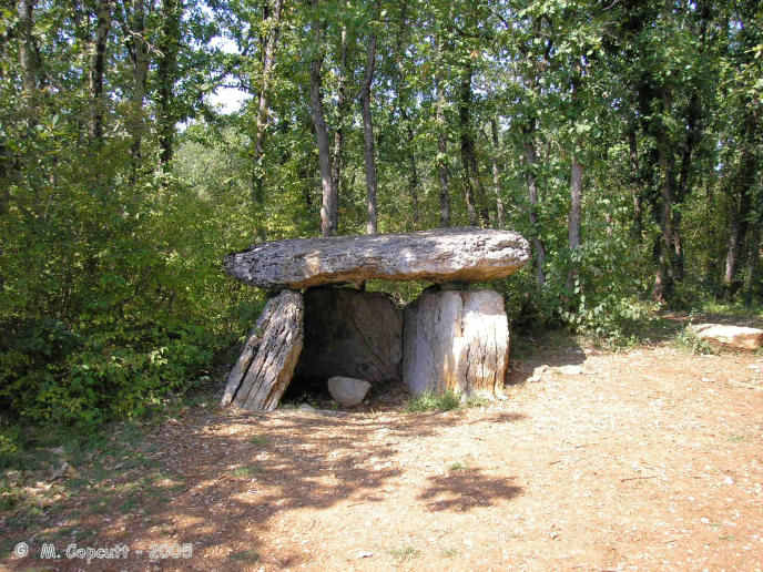
Finelle Dolmen submitted by TheCaptain on 6th Nov 2007. A bit to the west along the track running along the southern edge of the airfield, and you soon come to another dolmen.
This one has lost its mound, which has no doubt been used to build the local walls, and it is standing proud at the edge of a flat area used for dumping rubble etc.
(View photo, vote or add a comment)
Log Text: A bit to the west of the first dolmen, along the track running along the southern edge of the airfield, and you soon come to another dolmen. This one has lost its mound, which has no doubt been used to build the local walls, and it is standing proud at the edge of a flat area used for dumping rubble etc. Its a fairly standard southern French dolmen, with two 4 metre long sideslabs and a backstone between them, topped with a capstone, making a chamber 3 metres by 2 metres. There is some evidence of a front closing stone, and the chamber faces eastwards on a bearing of 095°.
Dolmen de Peyrelevade (Septfonds)
Trip No.205 Entry No.30 Date Added: 19th Oct 2020
Site Type: Burial Chamber or Dolmen
Country: France (Midi:Tarn-et-Garonne (82))
Visited: Yes on 2nd Sep 2005. My rating: Condition 3 Ambience 3 Access 5

Dolmen de Peyrelevade (Septfonds) submitted by TheCaptain on 6th Nov 2007. Right beside the track is the first dolmen you come to. It is still mostly within its mound of loose stone, and quite a large one.
(View photo, vote or add a comment)
Log Text: To the west of the village of Septfonds, and to the south of the little airfield are several dolmens in the woodlands. There are signposts to "dolmens" and down a little track is a parking place and more signs. Right beside this track is the first dolmen you come to. It is still mostly within its mound of loose stone, and quite a large one. The 5 metres by 4 metres capstone sits on top of a chamber 4 metres in length, by 2 metres wide, made with the usual 2 large sideslabs and a back stone, but these stones are completely below ground level. The chamber opens to the east, on a bearing of about 080°. To the west of the main dolmen are a couple of other long side set slabs near to the roadside, where the mound has been cut away. Perhaps this is the remains of a secondary burial chamber ? The mound diameter is about 15 metres. There are lots of strange red topped mushrooms / toadstools poking up through the ground here. Very interesting.
Bruniquel Cave
Trip No.200 Entry No.70 Date Added: 18th Jun 2020
Site Type: Cave or Rock Shelter
Country: France (Midi:Tarn-et-Garonne (82))
Visited: Saw from a distance on 27th Aug 2000
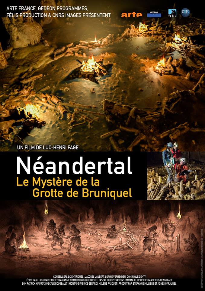
Bruniquel Cave submitted by TheCaptain on 26th Mar 2019. From Portail des Mégalithes de la Francophonie
At The 11Ème Festival International du Film d'Archéologie de Nyon, archaeological news will be in the spotlight with the presentation, in preview, of the film "the mystery of the cave of bruniquel". this documentary presents the recent research that allowed the dating of a structure made by neanderthal man in a cave 175 000 years ago: it would therefore be the oldest human construction known to this day.
Director Luc-Henri Fage will b...
(View photo, vote or add a comment)
Log Text: Drive north from Toulouse to explore Bruniquel, Penne, Gorges d’Aveyron, Caussade
Piquecos tumulus
Trip No.200 Entry No.45 Date Added: 17th Jun 2020
Site Type: Chambered Tomb
Country: France (Midi:Tarn-et-Garonne (82))
Visited: Couldn't find on 28th May 2000
Log Text: Drive north from Toulouse to explore Montauban, Castelsarrasin, Caussade. Had a quick look for these things marked on my map, but found nothing
Autel Druidique de Saint-Jean
Trip No.200 Entry No.46 Date Added: 17th Jun 2020
Site Type: Holed Stone
Country: France (Midi:Tarn-et-Garonne (82))
Visited: Couldn't find on 28th May 2000
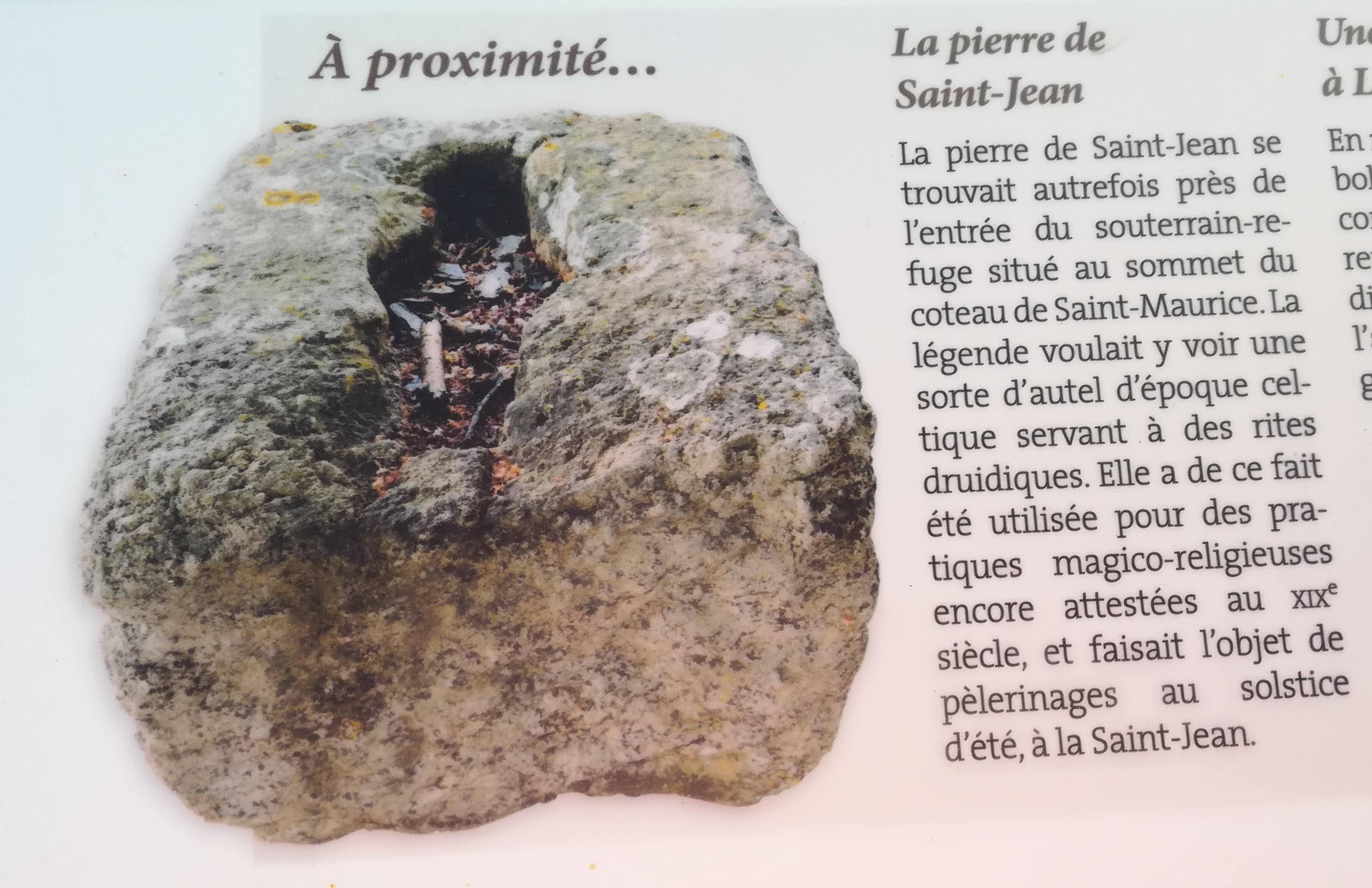
Autel Druidique de Saint-Jean submitted by lafemmedepierre on 22nd Jun 2019. Site in Midi:Tarn-et-Garonne (82) France
(View photo, vote or add a comment)
Log Text: Drive north from Toulouse to explore Montauban, Castelsarrasin, Caussade. Had a quick look for these things marked on my map, but found nothing
Dolmen de Bartalbenque 1
Trip No.205 Entry No.33 Date Added: 18th Jun 2020
Site Type: Burial Chamber or Dolmen
Country: France (Midi:Tarn-et-Garonne (82))
Visited: Couldn't find on 2nd Sep 2005

Dolmen de Bartalbenque 1 submitted by weirwolf on 25th Jan 2006. This tomb is complete except for its disappeared capstones which, as seems to have been the rule in W. Europe, sat above the mound or cairn.
(View photo, vote or add a comment)
Log Text: Marked on my map are two dolmens not too far from the road between Dardenne water tower and Bartelbenque. However, this area of land has recently all been divided up and fenced off for what looks like new housing projects. In the scrubland behind the fences it was not possible to see any dolmens. I wonder what their fate is to be.
Dolmen de Bartalbenque 2
Trip No.205 Entry No.34 Date Added: 18th Jun 2020
Site Type: Burial Chamber or Dolmen
Country: France (Midi:Tarn-et-Garonne (82))
Visited: Couldn't find on 2nd Sep 2005
Log Text: Marked on my map are two dolmens not too far from the road between Dardenne water tower and Bartelbenque. However, this area of land has recently all been divided up and fenced off for what looks like new housing projects. In the scrubland behind the fences it was not possible to see any dolmens. I wonder what their fate is to be.
Peyralade Dolmen
Trip No.200 Entry No.3 Date Added: 17th Jun 2020
Site Type: Burial Chamber or Dolmen
Country: France (Midi:Tarn (81))
Visited: Yes on 19th Mar 2000. My rating: Condition 4 Ambience 3 Access 5

Peyralade Dolmen submitted by thecaptain on 6th Dec 2003. The Dolmen de Peyralade, near to the village of Vaur, Tarn Southwest France.
This dolmen is on the top of the plateau which the Aveyron river cuts through in a splendid gorge.
(View photo, vote or add a comment)
Log Text: A day driving NE from Toulouse. L’Isle-sur-Tarn, Gaillac, Cordes-sur-Ciel, Vaour, 2 Dolmens, Castelnau-de-Montmiral. The Dolmen de Peyralade, is near to the village of Vaur, Tarn Southwest France. This dolmen is on the top of the plateau which the Aveyron river cuts through in a splendid gorge.
