Contributory members are able to log private notes and comments about each site
Sites theCAptain has logged. View this log as a table or view the most recent logs from everyone
Plateau de Mons
Trip No.205 Entry No.259 Date Added: 13th Dec 2020
Site Type: Barrow Cemetery
Country: France (Auvergne:Cantal (15))
Visited: Saw from a distance on 26th Sep 2005
Log Text: On top of the plateau is a large collection of earthen barrows dating to the iron age which can be seen from the track.
Planàs Dolmen
Trip No.205 Entry No.159 Date Added: 15th Nov 2020
Site Type: Burial Chamber or Dolmen
Country: France (Languedoc:Gard (30))
Visited: Yes on 19th Sep 2005. My rating: Condition 5 Ambience 3 Access 5

Planàs Dolmen submitted by regina on 11th Dec 2009. Site in Languedoc: Gard (30) France:
(View photo, vote or add a comment)
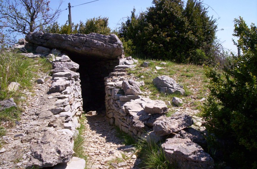
Log Text: Take the road towards Blandas from Montdardier, and after a few kilometres there is a big junction of ways. Right at the junction in a little enclosure to the right of the road can be found this nicely restored dolmen. It is completely within its cairn, and the fence is close, which makes photos difficult. The mound is about 12 metres in diameter and 2 metres high. The chamber in the centre is mostly made of dry stone walls, but with a large slab at the back, and topped by a 3 m by 2.5 m capstone, on top of the same sized chamber. There is an entry passageway about 5 metres long, and half a metre wide, which opens to the southwest at 235°.
Planàs cromlech
Trip No.205 Entry No.161 Date Added: 15th Nov 2020
Site Type: Stone Circle
Country: France (Languedoc:Gard (30))
Visited: Yes on 19th Sep 2005. My rating: Condition 1 Access 5
Planàs cromlech submitted by LaDragonne on 23rd Aug 2018. Cromlech de Planas:Gard (30) France
une des pierres couchée à quelques dizaines de cm de son lieu d'implantation
(View photo, vote or add a comment)
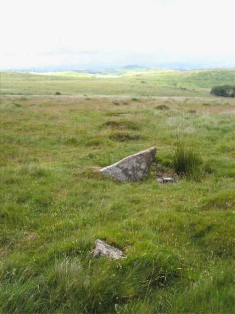
Log Text: Destroyed many years ago during construction of the road, just a few stumps and fallen stones of this cromlech remain scattered around near the junction. What was once a fine stone circle is now just a large road junction in the middle of nowhere.
Plainsfield Camp
Date Added: 29th Oct 2019
Site Type: Misc. Earthwork
Country: England (Somerset)
Visited: Yes on 25th May 2018
Plainsfield Camp submitted by TheCaptain on 25th May 2018. Plainsfield Camp. View south along the east bank from the entrance to the southeast corner.
(View photo, vote or add a comment)
Log Text: None
Pitray Allée couverte
Trip No.203 Entry No.224 Date Added: 21st Apr 2020
Site Type: Passage Grave
Country: France (Aquitaine:Gironde (33))
Visited: Yes on 2nd Jun 2005. My rating: Condition 3 Ambience 3 Access 1

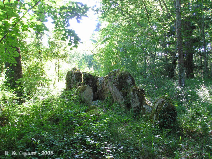
Pitray Allée couverte submitted by thecaptain on 9th Jan 2006. Pitray Allée couverte.
The remains are 10 metres in length with large side slabs up to 1.7 metres high placed about 1.2 metres apart making a chamber with an orientation of 074° but there are no cover stones.
(View photo, vote or add a comment)
Log Text: Well what a find this was. I found Pitray on the village map outside the Mairie and when I got there I found a long driveway up to a chateau with a couple of men working logging in the woodland who told me that they knew of the dolmen and that I should go and ask at the chateau. In the grounds surrounding the chateau a charming lady looking after her baby grandson came to talk to me who spoke good English and told me that she knew of the dolmen well and that she had known of it for many years but hadn’t seen it in a while and that we had best go ask her son in law the master of the chateau if I could go and see it. Another very pleasant man who seemed pleased that somebody was interested in the dolmen in his grounds. I was taken to the remains of the dolmen and on the way it was spoken about that they thought that they should probably clear them up as they are getting very overgrown and crumbling but they were not sure what they are allowed or are supposed to do with them. They are quite difficult to find being as overgrown as they are in some dense woodland and it took a while to find it. I was told that a couple of men from CNES had been round and taken measurements about 20 years ago and had told the owners that there was probably nothing of interest to be found as it would have been fully dug out last century.
The remains are 10 metres in length with large side slabs up to 1.7 metres high placed about 1.2 metres apart making a chamber with an orientation of 074° but there are no cover stones. The back stone is about 2.3 metres in width and the side stones are graded in height with the tallest at the back. There are 3 big and 2 medium sized stones on the northern side and 3 big 3 medium sized stones along the southern side with some smaller stones curving away towards the path into the woods. Some of the stones have strange holes in them which seem to be perhaps more than just weathering. Not far away towards the northeast is a strange arrangement of smaller stones in a double parallel row which align directly to the entrance of the allée couverte.
The owner has no idea what these are or whether they are related or not but interesting nevertheless. These stones are even more overgrown. I was told that the chateau often has Scouts stay within the grounds and that recently a lot of girl scouts had been staying there had found the allée couverte and had rigged up a shower within the chamber complete with makeshift shower curtain! They had not been too impressed when told that they had made their shower within an ancient tomb !
These megalithic remains are on very private land and I was privileged to be allowed into the woods and shown them. A visit should not be attempted without permission.
Piskey’s Hall – The Fairy’s Fogou
Date Added: 1st Aug 2022
Site Type: Souterrain (Fogou, Earth House)
Country: England (Cornwall)
Visited: Yes on 16th Jun 2022. My rating: Condition 3 Ambience 3 Access 4

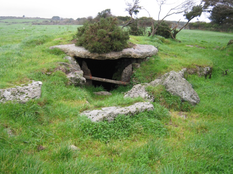
Piskey’s Hall – The Fairy’s Fogou submitted by coin on 3rd Nov 2013. So... Getting to this site is a welcome voyage, arriving at the gate (higher than a normal one) I read a friendly sign- warning me of a bull... So the landowner obviously doesn't want people visiting this site. Climbing over the gate I am affronted with another welcoming feature- electric fence. Slipping under the offending wire, and edging around the field keeping an eye out for the bull of terror, I approach the mound if earth and stones. When I reach it, I am presented with another electric f...
(View photo, vote or add a comment)
Log Text: I want to stop for my pasty at the Piskeys Hall fogou, but it takes me several attempts to find it, and only then I have to climb over a gate into a thankfully empty field, but see nothing like any of the pictures I have seen. It must be over by the far edge of the field somewhere, but there's nothing obvious, just a very overgrown clump. Its all very overgrown, and at first I cannot find anything to see, but then I do see a stone lined entrance amongst the gorse and brambles which I am just about able to get to. Yes, I have found the main structure and am able to get down into it. This one seems more like a large entrance grave than the other fogous I have seen, but who am I to argue.
Piquecos tumulus
Trip No.200 Entry No.45 Date Added: 17th Jun 2020
Site Type: Chambered Tomb
Country: France (Midi:Tarn-et-Garonne (82))
Visited: Couldn't find on 28th May 2000
Log Text: Drive north from Toulouse to explore Montauban, Castelsarrasin, Caussade. Had a quick look for these things marked on my map, but found nothing
Piprais menhir
Trip No.204 Entry No.15 Date Added: 4th Jul 2020
Site Type: Standing Stone (Menhir)
Country: France (Bretagne:Morbihan (56))
Visited: Yes on 10th Jul 2005. My rating: Condition 4 Ambience 3 Access 4

Piprais menhir submitted by TheCaptain on 29th Jun 2007. This 4.5 metre tall menhir can be found in a field just to the northeast of the village of Monterrein.
(View photo, vote or add a comment)
Log Text: This 4.5 metre tall menhir can be found in a field of sweetcorn just to the northeast of the village of Monterrain, near to a roadside cross. The menhir, a white quartz looking stone, seems to be splitting into two. Apparently there is another fallen stone nearby, but hidden from view by the maize.
Pipers (nr Merry Maidens)
Date Added: 18th Sep 2010
Site Type: Standing Stones
Country: England (Cornwall)
Visited: Yes on 24th Feb 2004

Pipers (nr Merry Maidens) submitted by TheCaptain on 24th Feb 2004. The Pipers of Boleigh, with both of the massive stones in the same picture.
These two massive stones are said to be the Pipers playing the music to which the Merry Maidens were dancing, before they all got turned to stone.
(View photo, vote or add a comment)
Log Text: None
Piles Hill W
Date Added: 18th Sep 2010
Site Type: Multiple Stone Rows / Avenue
Country: England (Devon)
Visited: Yes on 30th Jun 2004

Piles Hill W submitted by TheCaptain on 30th Jun 2004. Piles Hill Avenue, Dartmoor, Devon SX651611 to SX659611
Rainbow over the western end terminal stone.
(View photo, vote or add a comment)
Log Text: None
Piles Hill NE
Date Added: 18th Sep 2010
Site Type: Multiple Stone Rows / Avenue
Country: England (Devon)
Visited: Yes on 30th Jun 2004

Piles Hill NE submitted by TheCaptain on 30th Jun 2004. Piles Hill Avenue, Dartmoor, Devon SX651611 to SX659611
Looking down the eastern end of the avenue. Corringdon Ball with all its features in the near distance.
(View photo, vote or add a comment)
Log Text: None
Piles Hill Cairns
Date Added: 18th Sep 2010
Site Type: Cairn
Country: England (Devon)
Visited: Yes on 8th Aug 2004

Piles Hill Cairns submitted by thecaptain on 8th Aug 2004. On the top of Piles Hill, to the north of the large summit cairn is a smaller, but more well defined cairn about 15m diameter, which has at some point in time been remodelled into a shelter. It has a reasonably well defined ring of stones around its perimeter.
(View photo, vote or add a comment)
Log Text: None
Pig Hill (S)
Date Added: 18th Sep 2010
Site Type: Standing Stones
Country: England (Devon)
Visited: Yes on 18th Mar 2007
Pig Hill (S) submitted by thecaptain on 18th Mar 2007. Some of the stones at the lower, western, end of the oval.
(View photo, vote or add a comment)
Log Text: None
Pig Hill (N)
Date Added: 18th Sep 2010
Site Type: Standing Stones
Country: England (Devon)
Visited: Yes on 20th Mar 2007
Pig Hill (N) submitted by thecaptain on 20th Mar 2007. The northern stone of Pig Hill (N) stone setting seen here in its position within the Exmoor landscape looking west.
I believe that the two bits of stone this side of the standing stone have been broken from it, while the slab on the far side was once another stone of this stone setting which has been moved and placed there from its original position elsewhere.
(View photo, vote or add a comment)
Log Text: None
Pierres Tournantes (Néretz)
Trip No.201 Entry No.17 Date Added: 25th Mar 2020
Site Type: Standing Stones
Country: France (Normandie:Manche (50))
Visited: Couldn't find on 22nd Nov 2004
Log Text: Marked on the IGN Top 25 map as being beside a lane in a wooded area near to the Château de Néretz just to the west of the village of Teutheville-Hague, are these two menhirs, said to be 3 metres in height. However, the lane shown on the map turned out to be a gated private driveway, and so I spent no further time looking for these stones.
Pierres Pouquelées
Trip No.202 Entry No.30 Date Added: 26th Mar 2020
Site Type: Passage Grave
Country: France (Normandie:Manche (50))
Visited: Yes on 26th Apr 2005. My rating: Condition 3 Ambience 5 Access 4

Pierres Pouquelées submitted by thecaptain on 29th Apr 2005. Pierres Pouquelées View looking southish at this much ruined allée couverte on top of the hilly downs to the northwest of the village of Vauville, where the wonderful long beach can just be made out.
(View photo, vote or add a comment)
Log Text: Much ruined allée couverte on top of the hilly downs to the northwest of the village of Vauville. I measured the remains out to about 12 metres in length but I have seen in a guidebook that the remains are said to be 17 metres long. Perhaps there are more stones under the undergrowth than I saw in the flattened grassy area.
There is only any remains of the central chamber of which can be seen about 9 pairs of stones and 2 remaining capstones in place with a couple more fallen in the middle. There is no sign of any outer peristalith and I could not determine where the entrance would have been. The allée couverte is aligned on about 150° and runs slightly downhill with a large perpendicular endstone still in place at the upper end. Looking along the tomb and it seems to align on the top of the large hill over the other side of the valley above the wonderful beach upon which I believe a menhir once stood.
Although the monument is much ruined it really is in a lovely position at the top of a big hill overlooking the sea with the rocky cliffs of Cap de la Hague stretching away to the northwest and the lovely long beach running south from Vauville. The Island of Alderney can be seen out in the sea and the viscious tide race between the mainland and Alderney can be seen in full flow at the right time of day. It can be reached by a longish and steep walk up from Vauville or alternatively it can be driven almost right to by following the road down towards it from the north and then following the unmade tracks from there which are marked on the 1:25000 scale ign maps.
Pierres Plates (Locmariaquer)
Trip No.203 Entry No.356 Date Added: 10th May 2020
Site Type: Burial Chamber or Dolmen
Country: France (Bretagne:Morbihan (56))
Visited: Yes on 11th Jun 2005. My rating: Condition 4 Ambience 5 Access 4

Pierres Plates (Locmariaquer) submitted by ermine on 27th Jun 2004. Les Pierres Plates
(View photo, vote or add a comment)
Log Text: This famous angled passage grave with its many sculpted stones is right at the end of the Locmariaquer peninsular overlooking the sea, and still mostly within a small covering mound. The chamber turns about 45 degrees to the left after about 6 metres, with a side chamber bisecting the angle. From this corner, there is about another 10 metres of passage to the final chamber, seperated from the widening passage by a nicely carved stone. The carvings on the passageway side supports get more exotic the further you get into the monument.
Although the entire passageway is covered, I think most of the stones used are modern replacements. Take a good torch with you to see the details of all the carved stones. Unfortunately, my camera started misbehaving here, and the flash would not work properly, and so I couldn't get any decent pictures from within the tomb. However, this place is thoroughly documented in many other places.
Pierres Meslières Menhirs
Trip No.204 Entry No.66 Date Added: 3rd Oct 2020
Site Type: Standing Stones
Country: France (Pays de la Loire:Loire-Atlantique)
Visited: Yes on 14th Jul 2005. My rating: Condition 2 Ambience 3 Access 4
Pierres Meslières menhirs submitted by Dipo on 26th Oct 2008. Site in Pays de la Loire: Loire-Atlantique:
(View photo, vote or add a comment)
Log Text: Pierres Meslières, menhir 1: This is a squat little menhir, half hidden in the hedge and bank between the railway and the vineyard. It is possible that ground level is now much higher here than it was, the railway line being about 10 metres lower. As I write, a TGV whizzes past. The remaining menhir is about 1.5 metres above track level, and looks lost in the hedge, almost like a field clearance stone.
Pierres Meslières Menhirs
Trip No.204 Entry No.67 Date Added: 3rd Oct 2020
Site Type: Standing Stones
Country: France (Pays de la Loire:Loire-Atlantique)
Visited: Yes on 14th Jul 2005. My rating: Condition 3 Ambience 3 Access 4
Pierres Meslières menhirs submitted by Dipo on 26th Oct 2008. Site in Pays de la Loire: Loire-Atlantique:
(View photo, vote or add a comment)
Log Text: Pierres Meslières, menhir 2: This menhir is between 3 and 4 metres tall, with a lot of ivy growing on it, besides the trackway at the bottom of the vineyard to the south of the rock outcrop. It is in need of a haircut.
Pierres Folles du Follet
Trip No.203 Entry No.32 Date Added: 2nd Apr 2020
Site Type: Standing Stones
Country: France (Pays de la Loire:Vendée (85))
Visited: Yes on 15th May 2005. My rating: Condition 4 Ambience 3 Access 5

Pierres Folles du Follet submitted by thecaptain on 30th Nov 2005. The Pierres Folle de Follet are two large menhirs both about 3.5 metres tall positioned one each side of a little lane like giant gateposts.
(View photo, vote or add a comment)
Log Text: The Pierres Folle de Follet are two large menhirs both about 3.5 metres tall positioned one each side of a little lane like giant gateposts at the hamlet of the same name just to the south of the D19 a couple of kilometres south of the village of Rosnay.
There is a legend associated with them, which is printed on a little sign nearby, but which I cannot translate adequately. Something about Gargantua playing quoits here, and destroying houses and the flocks, and causing terror in the region. One day, he crushed a dozen sheep while playing near Rosnay, and the sheepdogs got fed up, and threw two quoits back at him, which stuck in the ground here forming the Pierres Folles.
