Contributory members are able to log private notes and comments about each site
Sites theCAptain has logged. View this log as a table or view the most recent logs from everyone
Shortwood Hill barrow
Date Added: 9th Sep 2020
Site Type: Round Barrow(s)
Country: England (Gloucestershire)
Visited: Yes on 30th May 2020. My rating: Condition 2 Ambience 2 Access 4
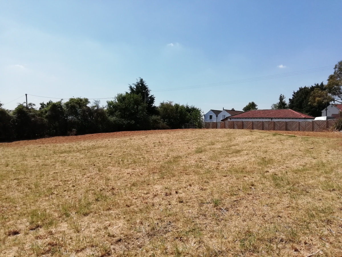
Shortwood Hill barrow submitted by TheCaptain on 30th May 2020. A long walk during the supposed lockdown (end May 2020) took me through this field and over the barrow for the first time in many years. Despite the field being cleared and shorn of vegetation, the barrow was more disappointing to see than I remembered.
(View photo, vote or add a comment)
Log Text: A long walk during the lockdown (end May 2020) took me through this field and over the barrow for the first time in many years. Despite the field being cleared and shorn of vegetation, the barrow was more disappointing to see than I remembered.
The Toots (Oldbury)
Date Added: 9th Sep 2020
Site Type: Hillfort
Country: England (Gloucestershire)
Visited: Yes on 3rd Jun 2020. My rating: Condition 3 Ambience 3 Access 4
The Toots (Oldbury) submitted by 4clydesdale7 on 4th Jul 2011. The best evidence of the Fort - the NNE rampart looking SE
(View photo, vote or add a comment)
Log Text: At the end of a walk along the Severn estuary and all round the old Oldbury Nuclear Powerstation, I walked back to Oldbury-on-Severn right through the Toots camp. Nice roadsign leading to it, and some information boards have now been put up in the village.
Haresfield Beacon tumulus
Date Added: 9th Sep 2020
Site Type: Round Barrow(s)
Country: England (Gloucestershire)
Visited: Yes on 31st Aug 2020. My rating: Condition 3 Ambience 5 Access 4
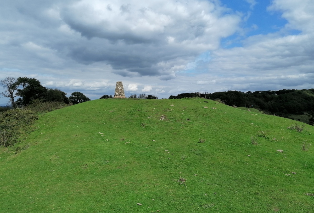
Haresfield Beacon tumulus submitted by TheCaptain on 3rd Sep 2020. The tumulus with trig point on top, at the western end of Haresfield Beacon.
(View photo, vote or add a comment)
Log Text: Walk around the Bruce Friendship Trail, which takes in the superb Haresfield Beacon with its remnants of promontory hillfort with a round tumulus at the western point, with a trig point on the top. Superb views over the Severn Vale
Haresfield Beacon and Ring
Date Added: 9th Sep 2020
Site Type: Hillfort
Country: England (Gloucestershire)
Visited: Yes on 31st Aug 2020. My rating: Condition 3 Ambience 5 Access 4
Haresfield Beacon and Ring submitted by 4clydesdale7 on 24th Jun 2011. From the same spot looking NNW over the inside of the Fort
(View photo, vote or add a comment)
Log Text: Walk around the Bruce Friendship Trail, which takes in the superb Haresfield Beacon with its remnants of promontory hillfort with a round tumulus at the western point, with a trig point on the top. Superb views over the Severn Vale
Drakestone Camp
Date Added: 9th Sep 2020
Site Type: Misc. Earthwork
Country: England (Gloucestershire)
Visited: Yes on 23rd Aug 2020. My rating: Condition 2 Ambience 5 Access 3
Drakestone Camp submitted by 4clydesdale7 on 6th Jul 2011. One of the middle banks and ditches
(View photo, vote or add a comment)
Log Text: Walk round the Korea Friendship Trail from Dursley on a bright and breezy Sunday afternoon with a pint in the Old Spot afterwards. The views up here are tremendous, and with various other nearby viewpoints you get a full 360 degrees. Even on this not very clear day, as well as almost the entire length of the Cotswold Edge, I could make out the Mendip Hills, Bristol Channel, Black Mountains, Malvern Hills.
Old Sodbury
Date Added: 9th Sep 2020
Site Type: Hillfort
Country: England (Gloucestershire)
Visited: Yes on 31st Jul 2020. My rating: Condition 4 Ambience 3 Access 4
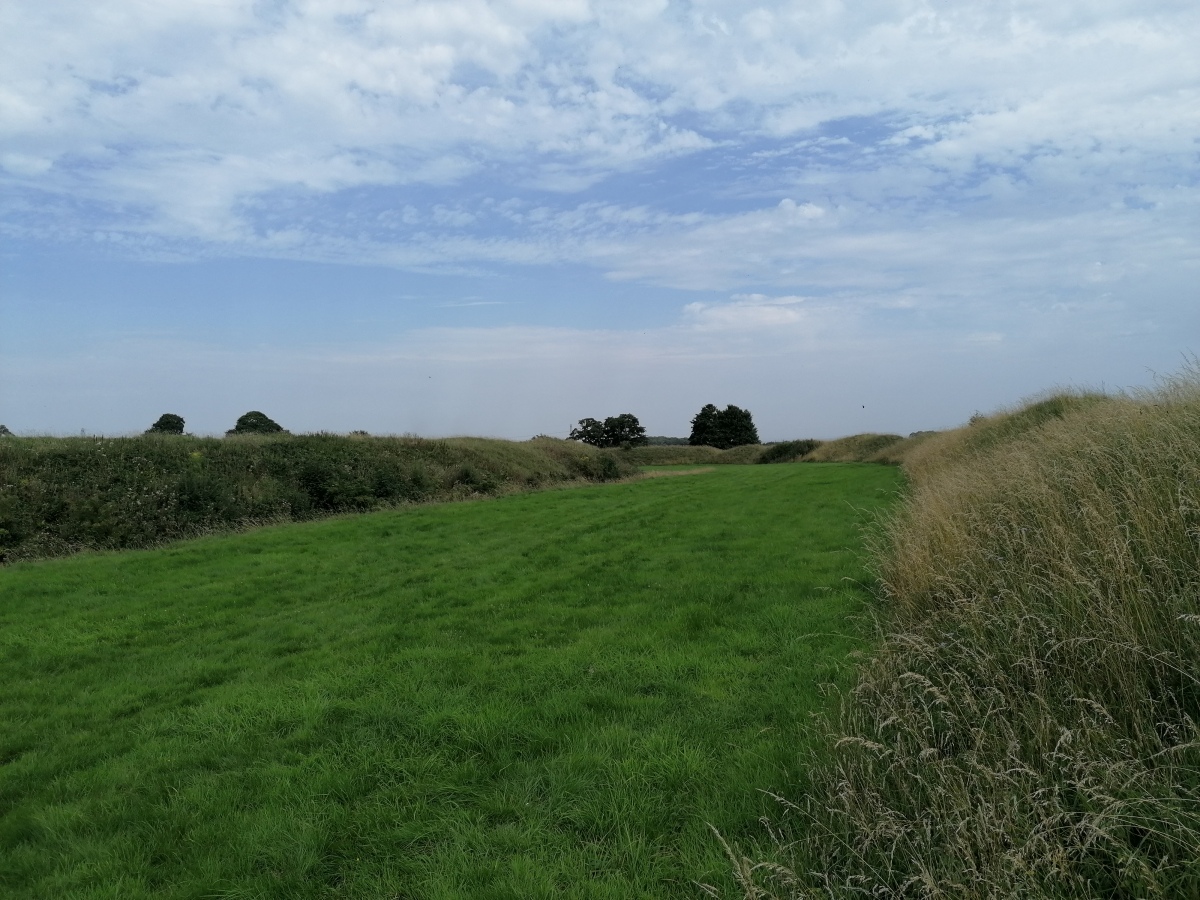
Old Sodbury submitted by TheCaptain on 4th Aug 2020. View east between the fortifications from the outer bank of Old Sodbury Camp
(View photo, vote or add a comment)
Log Text: Friday afternoon 10k walk, north from Old Sodbury along the Cotswold Edge through two ancient forts, past three old churches and lots of big houses to Horton Court. Back over fields through Little Sodbury. Stopped for a pint at the Dog afterwards.
Horton Camp
Date Added: 9th Sep 2020
Site Type: Hillfort
Country: England (Gloucestershire)
Visited: Yes on 31st Jul 2020. My rating: Condition 3 Ambience 5 Access 4
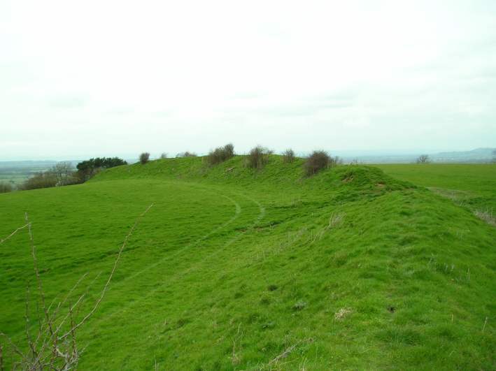
Horton Camp submitted by TheCaptain on 29th Mar 2004. Horton Camp Hillfort, South Gloucestershire, ST765845, March 2004.
View looking northwest along the remaining bank across the top of the hill. There is no sign of a ditch. The "inside" of the camp is to the left.
I may well be wrong, but I think that this bank may be a former internal division of what was once a much bigger camp taking in the entire promontary, not just the southern end.
(View photo, vote or add a comment)
Log Text: Friday afternoon 10k walk, north from Old Sodbury along the Cotswold Edge through two ancient forts, past three old churches and lots of big houses to Horton Court. Back over fields through Little Sodbury. Stopped for a pint at the Dog afterwards.
Oldbury Standing Stone
Date Added: 9th Sep 2020
Site Type: Standing Stone (Menhir)
Country: England (Gloucestershire)
Visited: Yes on 3rd Jun 2020. My rating: Condition 3 Ambience 3 Access 4

Oldbury Standing Stone submitted by TheCaptain on 8th May 2016. On a warm sunny afternoon, I went for a good look for this, but found nothing to match the description. In fact, at some time in the past (since 1953) a whole load of drainage and seawall flood protection work has been done, which now contains the Oldbury Naite Rhine within substantial banks, with any of its little tributaries in the area now in underground culverts emptying through flap doors into the Rhine. The height of the banking is now well above what it would have been.
(View photo, vote or add a comment)
Log Text: Went for a look for this stone on a hot sunny June afternoon as part of a walk around Oldbury. Despite being 99% sure where it was to be found, I initially didn't find it as it was totally overgrown, and not under the new footpath gate, but an old wooden bit of fence to the side. With a bit of trampling on the long grass, I got to see the whole stone. Great to see it, it would be a splendid standing stone.
Gray Hill summit cairn
Date Added: 9th Sep 2020
Site Type: Round Cairn
Country: Wales (Monmouthshire)
Visited: Yes on 5th Sep 2020. My rating: Condition 2 Ambience 5 Access 3

Gray Hill summit cairn submitted by TheCaptain on 2nd Apr 2004. Grey Hill or Gray Hill, Monmouthshire. Cairn atop hill at ST434936
Right on the top of the hill, with spectacular views all around is the remains of an ancient, but well worn cairn. I could have been imagining it, but did this cairn once have a kerbed ring around it, and some internal structures ?
(View photo, vote or add a comment)
Log Text: Breezy but sunny afternoon walk up Gray Hill to check out the old stones, then a walk around Wentwood Forest. Beautiful views all around from the cairn at the top of the hill
Gray Hill stone row
Date Added: 9th Sep 2020
Site Type: Standing Stone (Menhir)
Country: Wales (Monmouthshire)
Visited: Yes on 5th Sep 2020. My rating: Condition 3 Ambience 4 Access 3
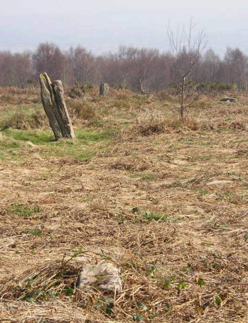
Gray Hill stone row submitted by TheCaptain on 2nd Apr 2004. Grey Hill or Gray Hill Stone Row, Monmouthshire, ST437936 - ST438935
Looking to the south down the hill, is a fairly reasonable alignment of 5 stones in a row, which sort of joins between the jumbled stone remains on the top of the hill and the stone circle.
(View photo, vote or add a comment)
Log Text: Breezy but sunny afternoon walk up Gray Hill to check out the old stones, then a walk around Wentwood Forest. Much of the top of the hill has become very overgrown, and it was initially difficult to find the stone row leading down to the circle. I disturbed at least three fallow deer on my way through. However, the bracken and gorse on the slopes around the stones is mostly cleared, so it was easy to find the big stones of the row, and two of the stumps.
Gray Hill circle
Date Added: 9th Sep 2020
Site Type: Stone Circle
Country: Wales (Monmouthshire)
Visited: Yes on 5th Sep 2020. My rating: Condition 3 Ambience 4 Access 3
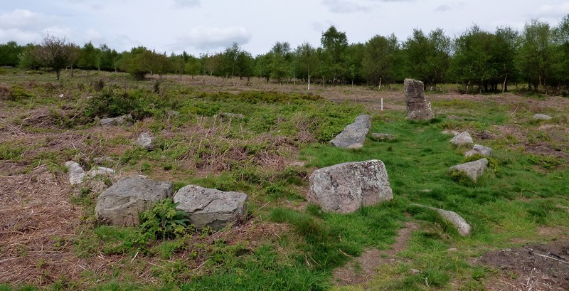
Gray Hill circle submitted by SandyG on 6th Jan 2019. Kerbed cairn/stone circle and stone 6. View from south west (Scale 1m).
(View photo, vote or add a comment)
Log Text: Breezy but sunny afternoon walk up Gray Hill to check out the old stones, then a walk around Wentwood Forest. Much of the top of the hill has become very overgrown, and it was initially difficult to find the stone row leading down to the circle. I disturbed at least three fallow deer on my way through. However, the bracken and gorse on the slopes around the stones is mostly cleared, so it was easy to find the big stones of the row, and the circle beside the lower of the big stones, although most of the circle is well overgrown with brambles bracken and gorse, and my legs got ripped to shreds.
Forresters' Oaks Round Barrow
Date Added: 9th Sep 2020
Site Type: Round Barrow(s)
Country: Wales (Monmouthshire)
Visited: Yes on 5th Sep 2020. My rating: Condition 2 Ambience 3 Access 4
Forresters' Oaks Round Barrow submitted by thehappydruid on 11th Aug 2020. Forresters' Oaks Round Barrow
(View photo, vote or add a comment)
Log Text: Breezy but sunny afternoon walk up Gray Hill to check out the old stones, then a walk around Wentwood Forest. Just before the end of the walk, this round barrow can be found, with views up to Gray Hill.
La Pierre Clouée (Andonville)
Trip No.204 Entry No.251 Date Added: 6th Sep 2020
Site Type: Burial Chamber or Dolmen
Country: France (Centre:Loiret (45))
Visited: Yes on 6th Aug 2005. My rating: Condition 3 Ambience 3 Access 4
La Pierre Clouée (Andonville) submitted by theCaptain on 7th Aug 2012. When I got there the field it stands in was being ploughed, so I nearly gave up. However, I asked the farmer and he told me it was OK to go and look
(View photo, vote or add a comment)
Log Text: La Pierre Clouée dolmen can be found in a field to the south of the village of Andonville, beside the little road to Annemont. It was a bugger to get to, with shut roads and suchlike. When I got there the field it stands in was being ploughed, so I nearly gave up. However, I asked the farmer and he told me it was OK to go and look, and told me about the polissoir as well.
The dolmen is falling apart a bit, but the basics are still there to be seen. It has a rectangular chamber, about 4.5 metres by 3 metres, with large side slabs and a back slab still in place. The capstone has broken, but the back end is still sat on top of its supports. It seems to open to the north, and whether there was any sort of entranceway is hard to tell.
On the outside of the eastern side slab are the polished grooves of a stone used as a polissoir - three of them. This is something of a rarity, as it's unusual to find the actual stones of a burial chamber re-used in this way. A nice find.
Menhir de la Croix Saint Jacques
Trip No.204 Entry No.248 Date Added: 6th Sep 2020
Site Type: Standing Stone (Menhir)
Country: France (Ile-de-France:Seine-et-Marne 77)
Visited: Yes on 6th Aug 2005. My rating: Condition 3 Ambience 3 Access 4
Menhir de la Croix Saint Jacques submitted by thecaptain on 23rd Feb 2007. Menhir de la Croix Saint Jacques can be found in a field just to the south of the village of Tousson.
(View photo, vote or add a comment)
Log Text: This menhir can be found in a field just to the side of the D.410 road, about 500 metres to the south of the village of Tousson. It stands about 3.3 metres tall, and is a rectangular section lump of sarsen. I found it difficult to park here.
Pierre de l'Armoire
Trip No.204 Entry No.247 Date Added: 6th Sep 2020
Site Type: Burial Chamber or Dolmen
Country: France (Ile-de-France:Seine-et-Marne 77)
Visited: Yes on 6th Aug 2005. My rating: Condition 4 Ambience 4 Access 4
Pierre de l'Armoire submitted by thecaptain on 23rd Feb 2007. Pierre de l'Armoire can be found a couple of kilometres north of the village of Rumont.
It looks to be an Angevin type dolmen, with a rectangular chamber 4 metres long by 2.5 metres in width, and it is covered by a large capstone of irregular shape.
(View photo, vote or add a comment)
Log Text: This dolmen can be found a couple of kilometres north of the village of Rumont, along the D.16a road. There is then a signpost to it, and it's about a kilometres walk from the road along a farm track.
The dolmen is within a cropped field, but has a reasonable area left around it, and is in the remains of a mound. it looks to be an Angevin type dolmen, with a rectangular chamber 4 metres long by 2.5 metres in width, and it is covered by a large capstone of irregular shape, up to 6 m by 4m, and it has a large hole in the west end. The entrance opens to the east at 115°, but there is not much of a porchway left, except some fallen stones. This was a nice find after all the recent poor dolmens, and nice to have it signposted.
La Pierre Clouée (Nanteau)
Trip No.204 Entry No.244 Date Added: 6th Sep 2020
Site Type: Standing Stone (Menhir)
Country: France (Ile-de-France:Seine-et-Marne 77)
Visited: Yes on 6th Aug 2005. My rating: Condition 4 Ambience 3 Access 4
La Pierre Clouée (Nanteau) submitted by thecaptain on 17th Feb 2007. La Pierre Clouée, or Pierre Fitte, is a 4.5 metre tall menhir which can be found in a field south of the village of Villemarechal.
It has been ploughed very close to, and in fact is suffering from various collisions with agricultural machinery. There are also many old nails hammered into it.
(View photo, vote or add a comment)
Log Text: This is a 4.5 metre tall menhir which can be found in a field south of the village of Villemarechal. Its near enough a kilometres walk from the roadside, but can easily be seen from there. It has been ploughed very close to, and in fact is suffering from various collisions with agricultural machinery. There are also several nails hammered into it. It also suffers from many overhead powerlines buzzing away, but it is still here after thousands of years, proudly overlooking the local landscape.
La Pierre Clouée translates roughly as the nailed stone - and it is an old folk tale that if one circles the stone seven times saying magic words, and then nails a bouquet to the stone, true love will be found.
Monte à Peine menhir
Trip No.204 Entry No.242 Date Added: 6th Sep 2020
Site Type: Standing Stone (Menhir)
Country: France (Centre:Loiret (45))
Visited: Yes on 6th Aug 2005. My rating: Condition 3 Ambience 3 Access 5
Monte à Peine menhir submitted by thecaptain on 16th Feb 2007. Monte à Peine menhir is right beside the road, but almost lost in bushes and undergrowth.
It's just over 2 metres tall, and looks to be a lump of sarsen type stone.
(View photo, vote or add a comment)
Log Text: Take Rue du Menhir east from the village of Pers-en-Gâtinais, and just after the first road junction the road bears round to the right. The menhir is right beside the road, but almost lost in bushes and undergrowth. It's just over 2 metres tall, and is a lump of sarsen type stone.
Menhir dit la Grande Roche
Trip No.204 Entry No.238 Date Added: 5th Sep 2020
Site Type: Standing Stone (Menhir)
Country: France (Centre:Loiret (45))
Visited: Yes on 5th Aug 2005. My rating: Condition 3 Ambience 4 Access 3
Menhir dit la Grande Roche submitted by thecaptain on 16th Feb 2007. To the west of the village of Pers-en-Gâtinais can be found this 2.5 metre tall menhir in a field beside the small road to Merville.
(View photo, vote or add a comment)
Log Text: To the west of the village of Pers-en-Gâtinais can be found this 2.5 metre tall menhir in a field beside the small road to Mérinville. It is in the middle of a freshly ploughed field, so I didn't go right up to it, but it is only 50 metres from the roadside.
Pierre de Minuit Menhir
Trip No.204 Entry No.237 Date Added: 5th Sep 2020
Site Type: Standing Stone (Menhir)
Country: France (Centre:Loiret (45))
Visited: Yes on 18th Feb 2007. My rating: Condition 5 Ambience 4 Access 4
Pierre de Minuit Menhir submitted by thecaptain on 18th Feb 2007. Approaching the Pierre de Minuit.
It's a kilometre or so west of the village of Louzouer, behind the Chaise farmhouse.
(View photo, vote or add a comment)
Log Text: I wouldn't have bothered with this one, but was told I should visit it by the farmers wife at Coinche. And my thanks must again go to her. It is a wonderful stone, the tallest menhir in the Departement of Loiret. It is almost 5 metres tall, up to 2 metres wide and very variable in thickness. The stone is half a sort of holed and pitted sarsen like stone, on the west face, while the east face is a puddingstone conglomerate of flints and gravel. Most lovely. Much of the puddingstone face is crumbling, and now makes wonderful shapes, with bits sticking out here and there.
Where the puddingstone layer is thin, there are a couple of holes right through the menhir. It is said that women wanting to become mothers should sit in the chair at the top of the stone. Fantastic. This stone can be found a kilometre or so west of the village, behind the Chaise farmhouse, and can easily be seen from the road.
Coinche polissoir
Trip No.204 Entry No.236 Date Added: 5th Sep 2020
Site Type: Polissoir
Country: France (Centre:Loiret (45))
Visited: Yes on 12th Feb 2007. My rating: Condition 4 Ambience 3 Access 3
Coinche polissoir submitted by thecaptain on 12th Feb 2007. Coinche polissoir stones can be seen here in the ploughed field.
The Coinche menhir stands in the field of sunflowers beyond the polissoir stones, towards the top end of the wood.
(View photo, vote or add a comment)
Log Text: About 80 metres from the menhir are several large rocks laying flat in the next field. One of these stones has three lovely polishing grooves in the top at one side, each about 50 cm long, and a big cuvette basin for polishing the flat sides. As for the menhir, these stones are in a cropped field, and not normally possible to find, but I was again taken to them. There were more polishing grooves elsewhere on the rocks, but these have been broken off when the rocks were partly broken several hundred years ago to build houses. Somebody has a house with polishing grooves incorporated in their walls !
It is now all very dry land round here, but in the past this was an area of swamp and marsh, which would have provided the water necessary for the polishing task. The ancient people didn't live here, but had a village a bit further down the valley.
Also found near here in the past was a portable polishing stone, which is now in the safe keeping of a museum somewhere.
These two stones would have been impossible for me to find and see had it not been for the kindness and help of the farmers wife. And although she spoke quick French, I gained a lot of information from her that I would otherwise never have been able to find out. She is obviously very proud to have these stones on her land, and interested in them. Many thanks to her.
