Contributory members are able to log private notes and comments about each site
Sites theCAptain has logged. View this log as a table or view the most recent logs from everyone
Pierre Cesée
Trip No.204 Entry No.317 Date Added: 12th Sep 2020
Site Type: Burial Chamber or Dolmen
Country: France (Pays de la Loire:Maine-et-Loire 49)
Visited: Yes on 12th Aug 2005. My rating: Condition 4 Ambience 4 Access 5
Pierre Cesée submitted by theCaptain on 2nd Mar 2012. view of this large Angevine dolmen from the northwest.
(View photo, vote or add a comment)
Log Text: Although it looks a bit difficult to get to, this dolmen is actually very easy to visit, either by driving down the little trackway to the parking area right by it (which is signposted from the road), or by walking along the path along the banks of the river Loir. Its about a kilometre to the west of Seiches-sur-le-Loir as the crow flies, but not so straight forward by vehicle. The dolmen sits on the flood plain of the river Loir, which is just 150 metres distant, and is in a tremendous little spot.
Unfortunately, as is nearly always the case, it has suffered from vandalism in the form of graffitti and fires. The dolmen is a large Angevine dolmen, with its main chamber a rectanglar 8 metres by 4 metres, oriented 075° and high enough to stand up in. The single massive capstone is now unfortunately cracked into two pieces, as is the massive side slab on the south side. The north side has two large stones, and there is the usual single backstone. The porchway entrance, as is often the case, is a bit damaged and destroyed, there being only one front stone to the chamber, and one standing entranceway stone. The other is laying broken nearby, and there is no capstone.
I was thinking of not even trying to find this, as it looks a bit out of the way. Very glad I did, all thanks, as is so often the case, to looking at the 1:25,000 maps in the local supermarket !
Pierre Butée
Date Added: 29th Oct 2019
Site Type: Standing Stone (Menhir)
Country: France (Normandie:Manche (50))
Visited: Yes on 18th Jan 2015

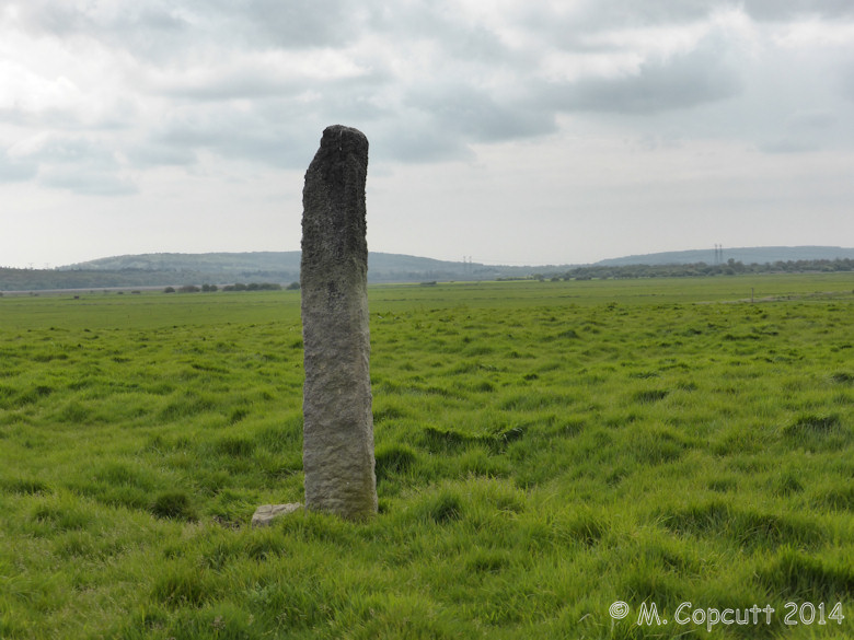
Pierre Butée submitted by theCaptain on 18th Jan 2015. Menhir on the Ile de Crosville, in the marais to the southwest of St Sauveur-Le-Vicomte the Cotentin peninsula.
(View photo, vote or add a comment)
Log Text: None
Pierre Brune Dolmen
Trip No.205 Entry No.19 Date Added: 14th Oct 2020
Site Type: Burial Chamber or Dolmen
Country: France (Poitou:Vienne (86))
Visited: Couldn't find on 31st Aug 2005
Log Text: A bit further to the south of Pierre-Soupèze along the same little farm road is a farm called Pierre Brune. There are no obvious signs of any dolmen, but there are lumps and bumps in the fields, and piles of stones in the fields.
Pierre Blanche (Pocé-les-Bois)
Date Added: 18th Sep 2010
Site Type: Standing Stone (Menhir)
Country: France (Bretagne:Ille-et-Vilaine (35))
Visited: Yes on 29th Jun 2010
Pierre Blanche (Pocé-les-Bois) submitted by TheCaptain on 29th Jun 2010. The Pierre Blanche of Pocé-les-Bois, south of Vitré, is a nice 4 metre tall menhir. It has a nice pointy top, and I wouldn’t be surprised if it has been hit and broken by lightning on occasion.
(View photo, vote or add a comment)
Log Text: None
Pierre Bercé (Naillat)
Trip No.204 Entry No.177 Date Added: 20th Aug 2020
Site Type: Standing Stone (Menhir)
Country: France (Limousin:Creuse (23))
Visited: Yes on 22nd Jul 2005. My rating: Condition 3 Ambience 3 Access 4
Pierre Bercé (Naillat) submitted by TheCaptain on 6th Nov 2010. The Pierre Bercé is on a little spur of land to the east of the village of Naillat, and looks out over the stream below. It is about 3 metres high.
(View photo, vote or add a comment)
Log Text: Signposted south from Colondannes, it was however only the one signpost and then 5 kilometers of guessing the way ! From the village of Naillat take the road out to the east at the back of the village, turn left at the cemetary, cross over the river and then go to the left. The Pierre Bercé is then to be found in a fenced off field about 40 metres from the road at a bend. It is on a little spur and looks out over the stream below, and is about 3 metres high.
Pierre au Rey
Trip No.201 Entry No.18 Date Added: 25th Mar 2020
Site Type: Burial Chamber or Dolmen
Country: France (Normandie:Manche (50))
Visited: Yes on 22nd Nov 2004. My rating: Condition 3 Ambience 4 Access 5

Pierre au Rey submitted by thecaptain on 6th Dec 2004. La Pierre au Rey dolmen on the clifftops at Flamanville in Normandie, seen in its cafe garden from the southeast. The stones in the foreground are thought to have once been part of an entrance structure.
(View photo, vote or add a comment)
Log Text: Perched high on the cliff top near Cap de Flamanville can be found this strange antiquity, situated in the small garden behind a café, right on the cliff edge. Easily found to the west of Flamanville, just follow signs to “Semaphore” and where the road runs out there is a car park and picnic site as well as the café.
It consists of four large rounded rocks, and doesn’t look like any other dolmen I have ever seen. At first, the rocks look like natural big rounded pebbles, in some kind of pile, but how did they get there like that ? Closer inspection reveals several other stones on the landward side, obviously placed in their position, which would have at one point formed some kind of entranceway to the main chamber, which consists of three large rocks forming a triangular shape, with the fourth rock balanced on top.
A couple of the large rocks have carvings on them, including a human form on the top boulder, but it is unknown as to whether these carvings are ancient or from more modern times, when it was used as a lookout point by the customs men. Some theories suggest that this is not a dolmen in the usual sense of the word, but some kind of ancient seagoing navigational mark.
There were in years gone past, other megalithic monuments in this area, in the form of large menhirs now destroyed, but of which the names and records survive. One of these called La Pierre-aux-Serpents, was 9 metres in height, but was destroyed around 1725 during construction of the chateau. Another, to the southeast at Percaillerie, was 5 metres in height but destroyed in 1890. It is also thought that there may once have been another of these cliff top dolmens at Corb to the north, destroyed before 1880 and of which no trace remains today under the nuclear power station.
Pierre Aigue, Richebourg
Trip No.202 Entry No.43 Date Added: 28th Mar 2020
Site Type: Passage Grave
Country: France (Pays de la Loire:Mayenne (53))
Visited: Yes on 30th Apr 2005

Pierre Aigue, Richebourg submitted by TheCaptain on 9th May 2005. Pierre Aigue, Richebourg Mayenne.
A nice looking allée couverte down near a stream seen across a large field. There were no signs and I couldn’t see how to get to it without crossing fences and fields.
(View photo, vote or add a comment)
Log Text: Allée couverte down near a stream seen across a large field near Richebourg farmhouse. There were no signs and I couldn’t see how to get to it. The remains of what I saw looked quite long and made from large rounded brown stones.
Pierre a Sacrifice (Putifay)
Trip No.204 Entry No.320 Date Added: 12th Sep 2020
Site Type: Polissoir
Country: France (Pays de la Loire:Maine-et-Loire 49)
Visited: Yes on 12th Aug 2005. My rating: Condition 2 Ambience 3 Access 5
Pierre a Sacrifice (Putifay) submitted by theCaptain on 8th Sep 2011. Near to the dolmen de Putifay, and right beside the road can be found this stone once thought to be a sacrificial stone.
(View photo, vote or add a comment)
Log Text: Near to the dolmen de Putifaie, and right beside the road can be found this stone once thought to be a sacrificial stone. It's now known that the grooves and channels in the stone are the result of it being used to polish axes and other implements. I have to say that I couldn't see anything much in the way of polishing surfaces, the various shapes in the stone looked more natural to me. Perhaps the polishing grooves are under the tree roots etc which are growing on one side of the stone.
Pierre à l'Eau
Trip No.204 Entry No.229 Date Added: 4th Sep 2020
Site Type: Polissoir
Country: France (Bourgogne:Yonne (89))
Visited: Yes on 5th Aug 2005. My rating: Condition 4 Ambience 4 Access 3
Pierre à l'Eau submitted by theCaptain on 5th Aug 2011. A lovely polissoir stone deep in Lancy Forest, with its own source of water in the form of a couple of deep basins, and it is not far from a little stream.
The stone has five well worn grooves and a couple of flat basins for polishing.
(View photo, vote or add a comment)
Log Text: This is much more like it, a lovely polissoir stone, with its own source of water in the form of a couple of deep basins which I assume are natural, and it is not far from a little stream. The stone is sort of triangular, about 2 m by 1.5 m, and has five well worn grooves and a couple of flat basins for polishing. It is found from the D.110 road through Lancy Forest, south of the Pavillon-de-Lancy. There is a parking place and signposted walk of 650 metres from there to the east.
Pierre a Cupules (Arnac)
Trip No.204 Entry No.169 Date Added: 20th Aug 2020
Site Type: Standing Stone (Menhir)
Country: France (Limousin:Haute-Vienne (87))
Visited: Yes on 22nd Jul 2005. My rating: Condition 5 Ambience 3 Access 5
Pierre a Cupules (Arnac) submitted by theCaptain on 27th Jul 2012. On the northern face, also flattened, the whole stone is covered with these cupules, loads and loads of them. There must be at least a hundred.
(View photo, vote or add a comment)
Log Text: On a green grassy area at the southern edge of the village of Arnac, is found this nice standing stone, standing about 2.5 metres tall. But the noticeable thing about this stone are all the cupules, or cupmarks, engraved into it.
Not immediately obvious in the mid day sunshine, but the first marks to stand out are on the southeast edge, where there appears to be a couple of rows of 35 mm diameter holes running in a line up the edge. Closer inspection shows a very flat southern face - possibly with checkerboard markings on it, and cupules running up the edges from top to bottom. On the northern face, also flattened, the whole stone is covered with these cupules, loads and loads of them. There must be at least a hundred. There does not appear to be anything on the two sides of the stone.
Picws Du
Date Added: 10th Apr 2023
Site Type: Cairn
Country: Wales (Carmarthenshire)
Visited: Yes on 20th Jul 2017. My rating: Condition 2 Ambience 5 Access 2
Picws Du submitted by TheCaptain on 9th Sep 2017. Seen from the path along the westerly edge of Fan Foel, view of Picws Du at 749m, which is topped by an ancient cairn.
(View photo, vote or add a comment)
Log Text: From Fan Brycheiniog we set off back northwards and then headed off in a westerly direction across the open boggy moorland, which would not have been a good idea in weather any worse, but it was now quite bright and I was able to pick a reasonable route between the bogs and peat hags! Once onto the path along the westerly edge of Fan Foel, it was steeply down and then slowly up the steep slope to the top of Picws Du at 749m, which is once again topped by an ancient cairn. The remains of this one are in a better, more natural condition than the others up here, no doubt helped by a lesser number of visitors, as the path here is much less worn and eroded. The remains are probably still abut a metre in height, and topped by a modern walkers cairn. Around the outside it was possible to make out a nice circle of kerbstones. From here it is possible to see down to Llyn y Fan Fach in the hollow below, the glacial lake which is the home to the Lady of the Lake legend. With the winds swirling around the mountains, it does indeed make all sorts of patterns on the surface of the lake, as if it is bubbling and boiling away heralding an appearance. It is really fabulous up here, the views extending southwards to the Bristol Channel and beyond, while northwards over the cliff edge up to the Cambrian Mountains. There are many heavy storms moving around across the landscape but thankfully we are missed by the worst of them for the rest of the day. It is of interest to see them tracking over in a north-easterly direction, the shadows of the clouds making constantly moving patterns on the moorland below. There are many ravens flying around, usually in pairs, making their deep cawing calls to each other, which can be heard from miles away.
Picket Barrow
Date Added: 8th Oct 2020
Site Type: Round Barrow(s)
Country: England (Wiltshire)
Visited: Yes on 4th Oct 1998

Picket Barrow submitted by Thorgrim on 13th Oct 2003. Picket Barrow is a fine bell-barrow standing within the Causewayed enclosure of Windmill Hill.
(View photo, vote or add a comment)
Log Text: Visit lots of ancient sites on a long off road cycle tour from Avebury to Windmill Hill, along the Wansdyke and back up Kennet Avenue
Peyro-Hitto
Date Added: 26th Oct 2020
Site Type: Standing Stone (Menhir)
Country: France (Midi:Haute-Garonne (31))
Visited: Couldn't find on 9th Sep 2005
Log Text: Drive north up the Garonne to St Gaudens. Its still not too late so I head on, and decide to head for St Girons. I miss a turn and end up in St Martory, I think there's a stone here. Having spent ages trying to park, I wasn't thinking straight because it was getting late and I had a fairly long way to travel.
No mention of it on the village maps, and I didn’t read my notes first, and thought it to be near the bridge, but found nothing. I didn’t think of looking at the obvious place by church, where it supposedly is.
It is a nice old bridge though.
Peyro Dreta
Trip No.205 Entry No.90 Date Added: 28th Oct 2020
Site Type: Standing Stone (Menhir)
Country: France (Languedoc:Pyrénées-Orientales 66)
Visited: Yes on 12th Sep 2005. My rating: Condition 2 Ambience 3 Access 4

Peyro Dreta submitted by thecaptain on 3rd Mar 2006. This fallen and broken menhir, once more than 4 metres tall, has beautiful views over the Fenouillades valley to the north, with Queribus castle and Tautavel clearly visible.
(View photo, vote or add a comment)
Log Text: This fallen and broken menhir, once more than 4 metres tall, has beautiful views over the Fenouillades valley to the north, with Queribus castle and Tautavel clearly visible. The menhir can be found about a kilometres walk down a dirt track amongst the vines, about 0.7 kilometres to the west of the Col de Bataille. The start of the track is easy to find, as it is marked with a large menhir like stone at the junction beside the vineyards. Perhaps this stone itself was once a proper menhir, which has now been re-erected.
Peyro Clabado
Trip No.200 Entry No.80 Date Added: 18th Jun 2020
Site Type: Rock Outcrop
Country: France (Midi:Tarn (81))
Visited: Yes on 24th Sep 2000. My rating: Condition 4 Ambience 4 Access 4

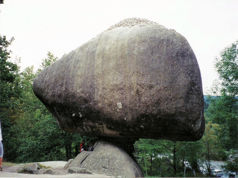
Peyro Clabado submitted by TheCaptain on 9th Apr 2016. Le Peyro Clabado, an extremely large (780 tonnes) and celebrated balanced rock to the east of Castres.
(View photo, vote or add a comment)
Log Text: Extremely large (780 tonnes) and celebrated balanced rock, in an area abounding with many odd rock shapes to the east of Castres. Some of these have been revered since history began.
Peyrefitte
Trip No.203 Entry No.233 Date Added: 22nd Apr 2020
Site Type: Standing Stone (Menhir)
Country: France (Aquitaine:Gironde (33))
Visited: Yes on 3rd Jun 2005. My rating: Condition 5 Ambience 3 Access 5

Peyrefitte submitted by thecaptain on 15th Jan 2006. Large menhir near to the Dordogne river in the commune of St-Sulpice-de-Faleyrens in Gironde. Signposted from all around, and with a little parking area, this huge and nicely shaped menhir stands in a little field amongst the vines.
(View photo, vote or add a comment)
Log Text: Signposted from all around, and with a little parking area, this huge and nicely shaped menhir stands in a little field amongst the vines. This is the largest standing stone in southwest France, and it is 5.2 metres tall, 3 metres wide and less than a metre thick, with the bottom part of it chipped away to make the distinctive shape. There is a little hollow in the bottom of it, apparently made for offerings to be placed in during the middle ages.
Estimated to weigh 50 tonnes, the stone has been brought to this position from at least 2.5 kilometres away. It has been dated to 2500 BC, contemporary with the various allée-couvertes to be found in the region.
It is said by legend to mark an entry to the subterranean world, can cure rheumatism, and is good for curing a limp. But while I am here, a massive thunderstorm has arrived, and I must rush back to the van quickly.
Peyrebrune megalith
Trip No.203 Entry No.92 Date Added: 6th Apr 2020
Site Type: Standing Stone (Menhir)
Country: France (Aquitaine:Dordogne (24))
Visited: Couldn't find on 20th May 2005

Peyrebrune megalith submitted by LaDragonne on 2nd Mar 2024. La Peyre Brune à côté de gravats, sur un site dominant le paysage, Sainte-Orse, Site in Aquitaine: Dordogne (24) France
(View photo, vote or add a comment)
Log Text: Near the hamlet of Rozas to the east of Saint-Orse is the farm called Peyre Brune where there are some megalithic remains. I understand it is a large menhir but with stories surrounding it that it is a meteorite which has crashed to earth. On the tiny roads in this area I could find nowhere to park or indeed turn round so gave up perhaps a bit too easily.
Peyrebrune (Seyssac)
Trip No.203 Entry No.64 Date Added: 5th Apr 2020
Site Type: Burial Chamber or Dolmen
Country: France (Aquitaine:Dordogne (24))
Visited: Yes on 17th May 2005. My rating: Condition 3 Ambience 4 Access 3
Peyrebrune (Seyssac) submitted by theCaptain on 17th May 2012. A kilometre or so down a rough track called Chasse de Pierre Brune from the D109 near Segonzac can be found the remains of this rectangular chambered dolmen.
(View photo, vote or add a comment)
Log Text: A kilometre or so down a rough track called Chasse de Pierre Brune from the D109 near Segonzac can be found the remains of this rectangular chambered dolmen. The chamber has dimensions of about 3 m by 2 m and made with well positioned stone blocks. There is a capstone which only covers the western end.
It’s a pity about the chestnut trees growing in it.
Peyre-Crabère
Trip No.205 Entry No.53 Date Added: 25th Oct 2020
Site Type: Standing Stone (Menhir)
Country: France (Midi:Hautes-Pyrénées (65))
Visited: Yes on 6th Sep 2005. My rating: Condition 3 Ambience 2 Access 5

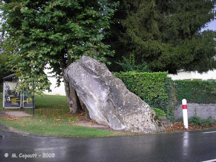
Peyre-Crabère submitted by thecaptain on 22nd Jan 2006. Right beside the D.940 road as it enters the northern boundary of the town of Lourdes from Pau direction, can be found this large leaning menhir.
It sits right at the corner of a little housing road, Rue Peyre-Crabère, and has a bus shelter and garden hedge for company on its other two sides.
(View photo, vote or add a comment)
Log Text: Right beside the D.940 road as it enters the northern boundary of the town of Lourdes from Pau direction, can be found this large leaning menhir. It sits right at the corner of a little housing road, Rue Peyre-Crabère, and has a bus shelter and garden hedge for company on its other two sides. The stone is about 3 metres tall, and leans almost 30° from vertical. While I was stopped here, it was thundering, pouring with rain, and very busy with traffic.
Peyre Levade (La Borie Rouge)
Trip No.203 Entry No.213 Date Added: 21st Apr 2020
Site Type: Burial Chamber or Dolmen
Country: France (Midi:Lot (46))
Visited: Yes on 17th Jan 2012. My rating: Condition 2 Ambience 2 Access 4
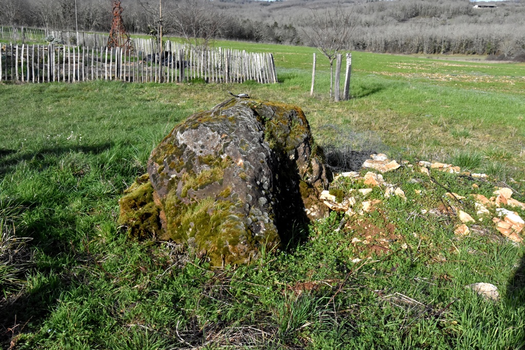
Peyre Levade (La Borie Rouge) submitted by theCaptain on 17th Jan 2012. Remains of a small dolmen in a garden just to the north of Lalbenque.
(View photo, vote or add a comment)
Log Text: Remains of a small dolmen in a garden just to the north of Lalbenque. It is not well cared for and has had a large hedge planted between it and the roadside to presumably stop people like me having a look. In fact it looks as if one of the side slabs has recently been split.
