Contributory members are able to log private notes and comments about each site
Sites theCAptain has logged. View this log as a table or view the most recent logs from everyone
Starveall
Date Added: 11th Jun 2021
Site Type: Chambered Tomb
Country: England (Gloucestershire)
Visited: Yes on 7th Aug 2015. My rating: Condition 2 Ambience 3 Access 4

Starveall submitted by TheCaptain on 11th Jun 2021. Now all shorn of the trees a decade ago, all we have now is an elongated mound in the field, but it is at least fenced off for protection.
(View photo, vote or add a comment)
Log Text: I revisited this barrow August 2015 to see what sort of state it is now in. What a disappointment and disgrace. The poor thinghas been shorn of all growth on it and looks to be much smaller than the pictures of 4clydesdale7 from 2011. It's no doubt slowly (or rapidly on a longbarrow lifespan timescale) just becoming a part of the field here and will soon be all gone.
Lineover
Date Added: 16th Jun 2021
Site Type: Chambered Tomb
Country: England (Gloucestershire)
Visited: Yes on 14th Jun 2021. My rating: Condition 2 Ambience 3 Access 4
Lineover submitted by 4clydesdale7 on 17th Nov 2011. The Barrow from the South (taken from the N verge of the A436)
(View photo, vote or add a comment)
Log Text: Cotswold Way walk north around Cheltenham from Seven Springs to Cleeve Hill. Small detour for a look at the remains of Lineover longbarrow, in a field of cows
Cleeve Hill (Gloucestershire)
Date Added: 20th Jun 2021
Site Type: Hillfort
Country: England (Gloucestershire)
Visited: Yes on 14th Jun 2021. My rating: Condition 3 Ambience 4 Access 3

Cleeve Hill (Gloucestershire) submitted by h_fenton on 29th Mar 2009. Cleeve Hill - Hillfort.
Kite Aerial Photograph, 29 March 2009
(View photo, vote or add a comment)
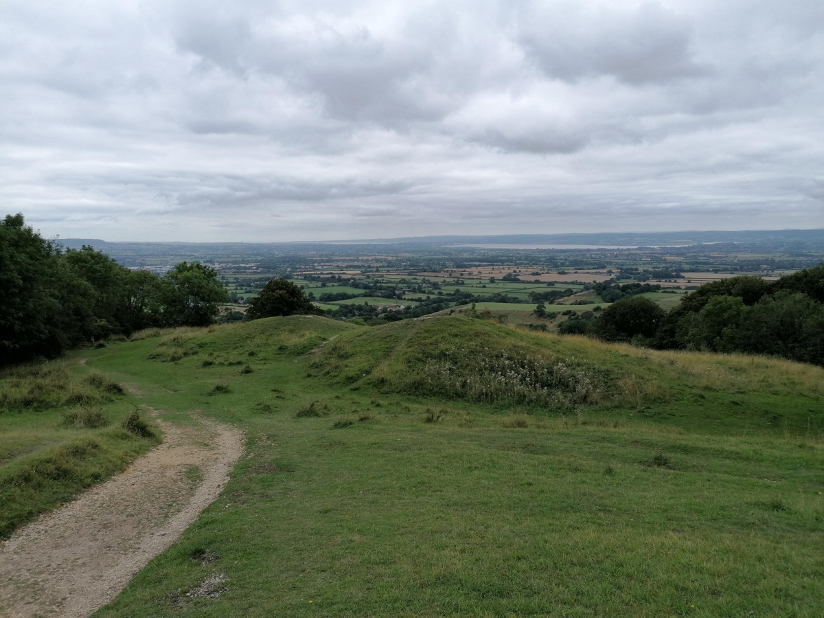
Log Text: Cotswold Way walk north around Cheltenham from Seven Springs to Cleeve Hill. Walk all around the ramparts of what is left of this hillfort, much of the western side of which has been quarried away. Fabulous views over Cheltenham.
Cleeve Hill Cross Dyke
Date Added: 20th Jun 2021
Site Type: Misc. Earthwork
Country: England (Gloucestershire)
Visited: Yes on 14th Jun 2021. My rating: Condition 3 Ambience 3 Access 3

Cleeve Hill Cross Dyke submitted by h_fenton on 19th Nov 2011. Cleeve Hill Cross Dyke, photographed from the east.
Kite Aerial Photograph
13 November 2011
(View photo, vote or add a comment)
Log Text: Cotswold Way walk north around Cheltenham from Seven Springs to Cleeve Hill. Walk through and have a quick look at the cross dyke, around the southern edge of the peak with the trig point.
The Ring (Gloucestershire)
Date Added: 20th Jun 2021
Site Type: Ancient Village or Settlement
Country: England (Gloucestershire)
Visited: Yes on 14th Jun 2021. My rating: Ambience 3 Access 3

The Ring (Gloucestershire) submitted by h_fenton on 19th Nov 2011. The Ring, enclosure on Cleeve Hill (Cleeve Common) Gloucestershire.
Kite Aerial Photograph from the north west.
13 November 2011 @ 2.35pm
(View photo, vote or add a comment)
Log Text: Cotswold Way walk from Seven Springs to Cleeve Hill. After visiting the trig point, dropped down to the carpark and golf club for a beer. Walked right by The Ring and forgot to have a look and take note. Beer was needed!
Painswick Beacon
Date Added: 19th Jul 2021
Site Type: Hillfort
Country: England (Gloucestershire)
Visited: Yes on 14th Jul 2021. My rating: Condition 4 Ambience 4 Access 4

Painswick Beacon submitted by h_fenton on 3rd Mar 2011. Looking northwards over the ramparts of Painswick Beacon (hillfort), with Gloucester beyond and the Malvern Hills on the horizon (the other side of the Severn Valley).
Kite Aerial Photograph
12 February 2011
(View photo, vote or add a comment)
Log Text: Cotswold Way loop walk north from Painswick, across the golf course and through woods to Cranham Corner before turning back for a pint at the Royal William. Then over the hill and west before turning back to the top of Painswick Beacon, before descending to the east through Paradise along the Wysis Way, and then back to Painswick along the river and up the hill for a pint at the Royal Oak.
Leckhampton Hill
Date Added: 7th Aug 2021
Site Type: Hillfort
Country: England (Gloucestershire)
Visited: Yes on 4th Aug 2021. My rating: Condition 3 Ambience 4 Access 4

Leckhampton Hill submitted by h_fenton on 10th Nov 2011. Leckhampton Hill hillfort / promontory fort, Gloucestershire. Viewed from the south-west.
Kite Aerial Photograph
6 November 2011
(View photo, vote or add a comment)
Log Text: Cotswold Way walk around Leckhampton Hill from Seven Springs, wonderful views all over Cheltenham and the Severn valley all the way round, with an exploration of the hillfort, trig point and quarry with the Devil's Chimney. Then south to Ullenwood, turning east past Cuckoopen Farm and then down past the big old longbarrow to Coberley and heading back north to the Seven Springs for a pint.
Coberley
Date Added: 7th Aug 2021
Site Type: Chambered Tomb
Country: England (Gloucestershire)
Visited: Yes on 4th Aug 2021. My rating: Condition 3 Ambience 4 Access 4

Coberley submitted by TheCaptain on 7th Aug 2021. Substantial remains of a longbarrow beside a lovely old green trackway partway down a ridge on the downslope from the top of the Cotswold Hills above the small village of Coberley
(View photo, vote or add a comment)
Log Text: Cotswold Way walk around Leckhampton Hill from Seven Springs, south to Ullenwood, turning east past Cuckoopen Farm and then down past the substantial remains of a longbarrow beside a lovely old green trackway partway down a ridge on the downslope from the top of the Cotswold Hills above the small village of Coberley.
Seven Springs (Gloucestershire)
Date Added: 7th Aug 2021
Site Type: Holy Well or Sacred Spring
Country: England (Gloucestershire)
Visited: Yes on 4th Aug 2021. My rating: Condition 3 Ambience 3 Access 5

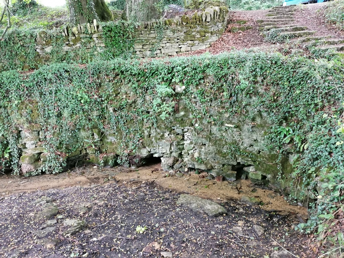
Seven Springs (Gloucestershire) submitted by TheCaptain on 6th Aug 2021. Seven Springs can claim to be the true source of the River Thames. Clear water gushes through several gaps underneath a large drystone wall in a pleasant wooded hollow.
(View photo, vote or add a comment)
Log Text: Cotswold Way walk around Leckhampton Hill from Seven Springs. Seven Springs, just 4 miles from central Cheltenham up on the Cotswold Hills, can claim to be the true source of the River Thames. Clear water gushes through several gaps underneath a large drystone wall in a pleasant wooded hollow beside the busy A436, under which it then flows in a pipe into a small lake the other side of the road.
Tytherington Camp
Date Added: 16th Aug 2021
Site Type: Promontory Fort / Cliff Castle
Country: England (Gloucestershire)
Visited: Yes on 14th Aug 2021. My rating: Condition 3 Ambience 3 Access 3
Tytherington Camp submitted by 4clydesdale7 on 6th Sep 2011. The Inner Camp looking towards the NW entrance
(View photo, vote or add a comment)
Log Text: Afternoon wander around Tytherington village and up to and around the old hillfort / castle. Chap in his garden nearby told me he part owned the land and I could go and have a proper look if I wanted, so I did. There is a lot of broken rock in the remaining ramparts, which surprised me by their completeness (those which hadn't been lost due to the quarrying). Saw a couple of foxes and loads of rabbits.
Shenberrow Hillfort
Date Added: 11th Sep 2021
Site Type: Hillfort
Country: England (Gloucestershire)
Visited: Yes on 1st Sep 2021. My rating: Condition 3 Ambience 4 Access 3

Shenberrow Hillfort submitted by HarryTwenty on 12th Jul 2018. Looking over the northern ramparts towards the west.
(View photo, vote or add a comment)
Log Text: Cotswold Way walk starting with the steam train from Toddington to Broadway, a beer at the Crown & Trumpet, then walk back south along the Cotswold Way to Stanway, stopping for further refreshment at the Mount Inn, Stanton, below the fortified encampment of Shenberrow Hillfort where I ate my lunch admiring the view.
Beckbury Camp
Date Added: 16th Sep 2021
Site Type: Hillfort
Country: England (Gloucestershire)
Visited: Yes on 15th Sep 2021. My rating: Condition 3 Ambience 4 Access 3

Beckbury Camp submitted by h_fenton on 2nd Feb 2013. Beckbury Camp, viewed from the east.
Kite Aerial Photograph
2 February 2013
(View photo, vote or add a comment)
Log Text: Cotswold Way walk starting by taking the steam train from Toddington to Winchcombe, then walk back northeast to Toddington stopping at Hailes Abbey and Beckbury hillfort. Lovely
Kiftsgate Stone
Date Added: 16th Sep 2021
Site Type: Holed Stone
Country: England (Gloucestershire)
Visited: Yes on 6th Sep 2021. My rating: Condition 2 Ambience 3 Access 5

Kiftsgate Stone submitted by geraldaf on 15th Mar 2013. Stone fett warm
(View photo, vote or add a comment)
Log Text: Cotswold Way walk from Chipping Campden to Broadway, making sure to have a look at the Kiftsgate Stone, which was well hidden amongst undergrowth, despite being just to the side of the road. Looked to me like it might possibly have once been part of a longbarrow chamber.
Campden Lane gatepost
Date Added: 26th Sep 2021
Site Type: Marker Stone
Country: England (Gloucestershire)
Visited: Yes on 15th Sep 2021. My rating: Condition 3 Ambience 3 Access 4
Campden Lane gatepost submitted by 4clydesdale7 on 1st Sep 2011. The substantial gatepost on Campden Lane (Ancient Track)
(View photo, vote or add a comment)
Log Text: Steam train from Toddington to Winchcombe, then Cotswold Way walk back north to Toddington stopping at Hailes Abbey and Beckbury hillfort. Beside the ancient trackway known as Campden Lane, is a substantial stone gatepost, one of a few in the locality of Beckbury Camp, which makes the mind think of possible previous uses.
Shortwood Barrows
Date Added: 27th Sep 2021
Site Type: Round Barrow(s)
Country: England (Gloucestershire)
Visited: Yes on 27th Aug 2021. My rating: Condition 3 Ambience 3 Access 4

Shortwood Barrows submitted by TheCaptain on 27th Sep 2021. There are barrows marked below the topograph on the information boards, and indeed a few large circular mounds which don't look like the quarrying scars nearby.
(View photo, vote or add a comment)
Log Text: Cotswold Way loop walk, filling in the bit between Stonehouse and Standish woods. There are barrows marked below the topograph on the information boards, and indeed a few large circular mounds which don't look like the quarrying scars nearby.
Randwick Long Barrow
Date Added: 27th Sep 2021
Site Type: Long Barrow
Country: England (Gloucestershire)
Visited: Yes on 27th Aug 2021. My rating: Condition 4 Ambience 4 Access 4

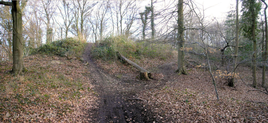
Randwick Long Barrow submitted by thecaptain on 13th Apr 2009. The massive bulk of Randwick longbarrow viewed from the north.
The remaining mound is about 55 metres in length, up to half as wide, and still 4 metres in height.
(View photo, vote or add a comment)
Log Text: Cotswold Way loop walk, filling in the bit between Stonehouse and Standish woods. Up into the woods at Randwick, and in amongst all the mountain biking trails is the remains of this huge longbarrow, now all shorn of its overgrowth
Randwick Barrows
Date Added: 27th Sep 2021
Site Type: Round Barrow(s)
Country: England (Gloucestershire)
Visited: Yes on 27th Aug 2021. My rating: Condition 2 Ambience 3 Access 4
Randwick Barrows submitted by 4clydesdale7 on 20th Jun 2011. The NE Round Barrow of the pair.
(View photo, vote or add a comment)
Log Text: Up in the woods at Randwick, and in amongst all the mountain biking trails north of the longbarrow can be found a couple of low round barrows, which would be difficult to find if not using my GPS.
Randwick Cross Dyke
Date Added: 27th Sep 2021
Site Type: Misc. Earthwork
Country: England (Gloucestershire)
Visited: Yes on 27th Aug 2021. My rating: Condition 3 Ambience 3 Access 4
Randwick Cross Dyke submitted by 4clydesdale7 on 20th Jun 2011. The Cross Dyke looking SE from the Cotswold Way.
(View photo, vote or add a comment)
Log Text: Up in the woods at Randwick, and beyond the mountain biking trails and longbarrow, there is a crossdyke across the wooded ridge, basically a couple of banks with ditch between
Nympsfield
Date Added: 2nd Oct 2021
Site Type: Long Barrow
Country: England (Gloucestershire)
Visited: Yes on 29th Sep 2021. My rating: Condition 3 Ambience 3 Access 5

Nympsfield submitted by AngieLake on 11th Oct 2015. A magical double rainbow (you can't see the upper arc here) over Nympsfield longbarrow, viewed from the rear of the mound. 22nd Sept.
(View photo, vote or add a comment)
Log Text: Fabulous loop walk from Coaley Peak picnic area, starting with a look at Nympsfield long barrow, then down through and past the lakes of Woodchester Park, back up through the vineyards to Selsey Common, before turning back along the Cotswold Way through the lovely woodland on the edge of the hills.
Bown Hill Long Barrow
Date Added: 2nd Oct 2021
Site Type: Long Barrow
Country: England (Gloucestershire)
Visited: Couldn't find on 29th Sep 2021
Bown Hill Long Barrow submitted by 4clydesdale7 on 17th Jun 2011. Approaching from the riding School/Livery Stables this Long Barrow is impressive.
(View photo, vote or add a comment)
Log Text: Fabulous loop walk from Coaley Peak picnic area, starting at Nympsfield long barrow, down through Woodchester Park, back up through the vineyards to Selsey Common, and back along the Cotswold Way through the lovely woodland on the edge of the hills. Hoping to get a glimpse of this longbarrow over a couple of fields, but no such luck or obvious way through towards it, and I have a long way to go so not adding on any extra!
