Contributory members are able to log private notes and comments about each site
Sites theCAptain has logged. View this log as a table or view the most recent logs from everyone
Warcombe Water row
Date Added: 18th Sep 2010
Site Type: Stone Row / Alignment
Country: England (Devon)
Visited: Yes on 12th May 2010
Warcombe Water row submitted by TheCaptain on 12th May 2010. I found a very definite row of several tiny stones, each about 6 inches high, but very solid in the ground. Walking along the row, I first found four stones, with a gap and then two more stones. The stones were spaced fairly evenly, at about 4 metres from each other.
(View photo, vote or add a comment)
Log Text: None
Warbstow Bury
Date Added: 18th Sep 2010
Site Type: Hillfort
Country: England (Cornwall)
Visited: Yes on 14th Jul 2010
Warbstow Bury submitted by TheCaptain on 14th Jul 2010. At the centre of the fort is a large mound, 22 metres long known as the Giant's Grave or King Arthur's Tomb, which is possibly the remains of a neolithic long barrow, or perhaps a medieval rabbit warren.
Sorry for the horrid wet and foggy weather this day in November 2008
(View photo, vote or add a comment)
Log Text: None
Wansdyke
Date Added: 8th Oct 2020
Site Type: Misc. Earthwork
Country: England (Wiltshire)
Visited: Yes on 4th Oct 1998

Wansdyke submitted by Thorgrim on 9th Jun 2005. Section of the Wansdyke where it crosses the road between Fyfield and Alton Priors. Wansdyke stretches for 45 miles from Bristol to Marlborough and can be walked for much of the way. As it is still quite high, it is free from 4x4 off road vandalism and can be a much pleasanter walk than the unfortunate and much abused Ridgeway.
(View photo, vote or add a comment)
Log Text: Visit lots of ancient sites on a long off road cycle tour from Avebury to Windmill Hill, along the Wansdyke from SU040666 to SU099647, then back up Kennet Avenue
Wambarrows
Date Added: 18th Sep 2010
Site Type: Barrow Cemetery
Country: England (Somerset)
Visited: Yes on 25th Oct 2006
Wambarrows submitted by thecaptain on 25th Oct 2006. There are three large barrows on top of Winsford Hill, known as the Wambarrows.
The one nearest the top of the hill is about 20 metres in diameter and up to 2.5 metres in height.
(View photo, vote or add a comment)
Log Text: None
Wallaston Green
Date Added: 29th Oct 2019
Site Type: Barrow Cemetery
Country: Wales (Pembrokeshire)
Visited: Yes on 11th Dec 2015
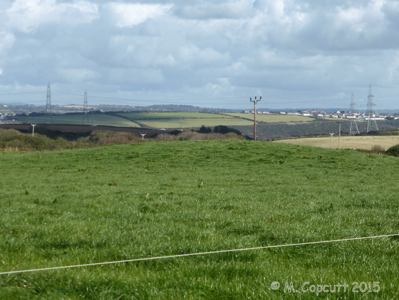
Wallaston Green submitted by TheCaptain on 11th Dec 2015. Four barrows are marked on the OS maps just to the south of Wallaston Green to the north of the B4320 road along the Angle peninsula west of Pembroke.
Stopping for a quick look and a couple of bumps can be seen in the fields.
(View photo, vote or add a comment)
Log Text: None
Wain's Hill
Date Added: 29th Oct 2019
Site Type: Promontory Fort / Cliff Castle
Country: England (Somerset)
Visited: Yes on 18th Aug 2015
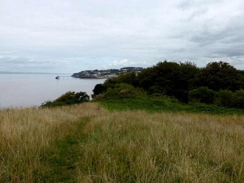
Wain's Hill submitted by TheCaptain on 18th Aug 2015. The northeastern corner of Wain's Hill showing part of the ramparts outside the woodland. Clevedon Pier in the background.
(View photo, vote or add a comment)
Log Text: None
Vira (Hvar)
Date Added: 18th Sep 2010
Site Type: Barrow Cemetery
Country: Croatia
Visited: Yes on 30th Sep 2004
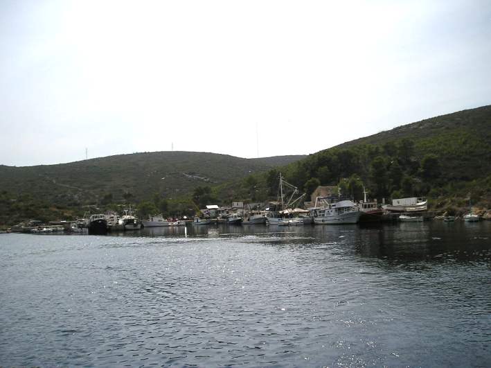
Vira (Hvar) submitted by TheCaptain on 30th Sep 2004. At the small fishing village of Vira, near the northwestern tip of Hvar Island, can be found a bronze age barrow cemetery.
Although the fishing fleet was in, it looks from this photo that the barrows had gone out !
(View photo, vote or add a comment)
Log Text: None
Viols Musée de Préhistoire
Trip No.205 Entry No.191 Date Added: 25th Nov 2020
Site Type: Museum
Country: France (Languedoc:Hérault (34))
Visited: Saw from a distance on 20th Sep 2005
Log Text: Once a prehistory museum in the little town of Viols-le-Fort, but now closed with the building used for something else. The collection includes the statue menhir found at nearby prehistoric village of Truc de Marti.
Ville-Tinguy dolmen
Trip No.203 Entry No.594 Date Added: 10th Jun 2020
Site Type: Burial Chamber or Dolmen
Country: France (Bretagne:Côtes-D'Armor (22))
Visited: Yes on 27th Jun 2005. My rating: Condition 3 Ambience 3 Access 3

Ville-Tinguy dolmen submitted by thecaptain on 20th Dec 2008. Despite supposedly having a footpath to it, and being only 80 metres to the east of the D.768 road between Créhen and Trégon, this dolmen proved difficult for me to get right up to, in its field of barley.
(View photo, vote or add a comment)
Log Text: Despite supposedly having a footpath to it, and being only 80 metres to the east of the D.768 road between Créhen and Trégon, this dolmen proved difficult for me to get right up to, in its field of barley. I have seen it described as an allée couverte, but it looked more like a simple dolmen to me, unless there is much of it ruined and not visible amongst the crops. At least one capstone is held up proudly in place for all to see as they drive past.
Ville-Tinguy dolmen
Date Added: 12th Jun 2020
Site Type: Burial Chamber or Dolmen
Country: France (Bretagne:Côtes-D'Armor (22))
Visited: Yes on 19th Sep 1992

Ville-Tinguy dolmen submitted by thecaptain on 20th Dec 2008. I have seen this described as an allée couverte, but it looked more like a simple dolmen to me, unless there is much of it ruined and not visible amongst the crops. At least one capstone is held up proudly in place for all to see as they drive past.
(View photo, vote or add a comment)
Log Text: Cycling camping trip round Emerald Coast, day 2, Dinan, Corseul, St Caste. Roman tower, dolmens, Lunch at Le Guildo castle.
Ville Pichard Cairn
Trip No.203 Entry No.588 Date Added: 10th Jun 2020
Site Type: Chambered Cairn
Country: France (Bretagne:Côtes-D'Armor (22))
Visited: Yes on 27th Jun 2005. My rating: Condition 2 Ambience 5 Access 3
Ville Pichard cairn submitted by theCaptain on 29th Jun 2012. The view looking northwest from this cairn
(View photo, vote or add a comment)
Log Text: High up on the clifftop near Pléneuf-Val-André overlooking the sea in two directions can be found this very overgrown cairn. Despite getting near after a very long walk round the coastal path, I could not get to the actual cairn through the gorse and brambles. Supposedly the remains of three dolmenic chambers with entry passages can be seen in the mound with drystone chambers, but there was no chance of seeing any of that for me on my visit. But what a fantastic place this is.
Ville Hamon Dolmen
Trip No.203 Entry No.590 Date Added: 10th Jun 2020
Site Type: Burial Chamber or Dolmen
Country: France (Bretagne:Côtes-D'Armor (22))
Visited: Yes on 27th Jun 2005. My rating: Condition 2 Ambience 3 Access 5
Ville Hamon Dolmen submitted by theCaptain on 30th Jun 2012. It was probably a very large dolmen with entry passage, but the stones have mostly broken into a heap.
(View photo, vote or add a comment)
Log Text: This poor thing is a bit of a mess. Difficult to find without a detailed map, but only a few dozen metres from a track, on top of a good sized mound, to the east of the town of Erquy. What remains is basically a large jumble of stones on top of a mound. It was probably a very large dolmen with entry passage, but the stones have mostly broken into a heap. One large section of capstone still sits on two bits of upright, but the rest is all on the ground. The stones cover an area about 6m by 6m, and several edge set slabs can be made out. Thankfully it is all tended to, and the undergrowth had been recently cut when I visited.
Ville Génouhan allée couverte
Trip No.203 Entry No.592 Date Added: 10th Jun 2020
Site Type: Passage Grave
Country: France (Bretagne:Côtes-D'Armor (22))
Visited: Yes on 27th Jun 2005. My rating: Condition 3 Ambience 3 Access 4
Ville Génouhan allée couverte submitted by theCaptain on 20th Mar 2014. Remains of a fairly standard looking allée couverte 12 metres long with still 6 capstones in place. Most of the sidestones seem to have collapsed inwards, making much of it look like not much more than a long pile of stones.
(View photo, vote or add a comment)
Log Text: Just to the south of the busy D.786 road between ND de Guildo and Trégon can be found the remains of this allée couverte. I find it strange that although it is signposted, has got a little parking area, is kept within a little grassed area within a field of maize, and has got several hundred metres of well tended footpath to it, the monument itself is left to become thoroughly overgrown.
It's the remains of a fairly standard looking allée couverte 12 metres long with orientation 125°, and there are still 6 capstones in place. Most of the sidestones seem to have collapsed inwards, making much of it not much more than a long pile of stones.
Ville Génouhan allée couverte
Date Added: 12th Jun 2020
Site Type: Passage Grave
Country: France (Bretagne:Côtes-D'Armor (22))
Visited: Yes on 19th Sep 1992
Ville Génouhan allée couverte submitted by theCaptain on 20th Mar 2014. Remains of a fairly standard looking allée couverte 12 metres long with still 6 capstones in place. Most of the sidestones seem to have collapsed inwards, making much of it look like not much more than a long pile of stones.
(View photo, vote or add a comment)
Log Text: Cycling camping trip round Emerald Coast, day 2, Dinan, Corseul, St Caste. Roman tower, dolmens, Lunch at Le Guildo castle.
Ville Bellanger allée couverte
Trip No.203 Entry No.589 Date Added: 10th Jun 2020
Site Type: Passage Grave
Country: France (Bretagne:Côtes-D'Armor (22))
Visited: Yes on 27th Jun 2005. My rating: Condition 3 Ambience 3 Access 5
Ville Bellanger allée couverte submitted by theCaptain on 19th Mar 2014. Just beside the D.52 road can be found this allée couverte, either in somebody's garden, or a little public area beside.
(View photo, vote or add a comment)
Log Text: Just beside the D.52 road, 3 km north of the village, and a km south of La Bouille and all its industrial sites, can be found this allée couverte, either in somebodies garden, or a little public area besides. The remains are a bit of a jumble, but an allée almost 10 metres long aligned at 050° is clear. Whether it has an external cell at the western end, or whether its a fallen capstone I can not be sure, but the chamber appears to be divided. A pleasant little find, and lots of nice foxgloves growing here at the time of my visit.
Villaigue Dolmen 2
Trip No.204 Entry No.160 Date Added: 17th Aug 2020
Site Type: Burial Chamber or Dolmen
Country: France (Poitou:Vienne (86))
Visited: Yes on 21st Jul 2005. My rating: Condition 2 Ambience 3 Access 4
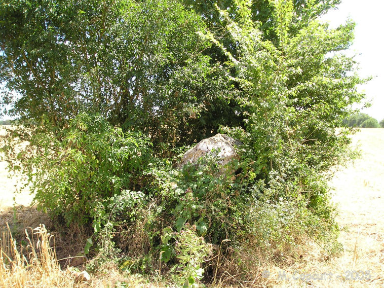
Villaigue Dolmen 2 submitted by thecaptain on 14th Nov 2008. Remnants of a dolmen in the community of St-Martin-l'Ars.
It is thickly overgrown, the remnants of the capstone sits in the bushes at an angle, partly on the ground.
(View photo, vote or add a comment)
Log Text: Well, I just HAD to come here, to the village of St Martin l'Ars, didn't I. All those years ago, when I started researching and cataloging French megalithic sites, I found two dolmens recorded in the community of St Martin l'Ars, possibly via the Merimee online database. Some time later, I had decided to quit work and go on a 6 month odyssey around France looking for old stones - in particular trying to find many of the little know ones. So, it became one of the main objectives of my trip to hunt these two down, as I have been called an Ars on more than one occasion, particularly with respect to going on this expedition, so in a way these were my dolmens !
So, it happened that on 21st July 2005, I got to the village of St Martin l'Ars, which is 40 to 50 kilometres southeast of Poitiers. I have to admit that I had no idea where to find the dolmens, but the French villages often have maps of the locality at their Mairie, sometimes with items of historical interest marked on them. Unfortunately, that was not the case here. It should also be said, that in most of France, their megalithic heritage is not known, and the public usually have no idea about such matters, so asking people is more often than not met with blank looks.
St Martin l'Ars is a nice little village, with a castle and a leisure park. After initially not finding any indication of where the dolmens were, I went and had a picnic lunch beside the lake in the leisure park, where there is a nice beach for swimming, and battery powered galleons which can be rented out ! Within the leisure park I found a map with some local walks marked on it, and to my great joy there was a route marked which passed by the dolmens. So after my lunch and an ice cream on this very hot day, I was able to have a go to try to find them.
A couple of kilometres north of the village, I parked between the hamlets of Vilaigre and Bars, just to the east of the little river, then was able to walk down the obvious track to the south for a couple of hundred metres. The remains of the two dolmens were to be found under the bushes in the field on the left. Both dolmens were thoroughly overgrown, and had been ploughed very close to, and I have to say that both were not much more than a capstone sitting on top of a jumble of other stones. It was impossible to make out any more details of what was once here. I have to say, although there are only two dolmens recorded in the French monuments record, it wouldn't surprise me at all if there were ruined remains of several others hereabouts. There are dotted about other clumps of bushes which might harbour ancient stones, and there are many hedgerows which could hide the odd bit of dolmen. As with much of France, there is probably a lot here to find - it just needs somebody with an interest, and a lot of time on their hands.
The remains of the dolmens are found under the bushes in the field on the left. Dolmen B is about 50 metres to the east of its neighbour, and is in an even worse state. It too has been ploughed very close to, and is more thickly overgrown. Other than a pile of stones, the remnants of the capstone sits in the bushes at an angle, partly on the ground. Again, it was impossible to make out any more details of what was once here.
Villaigue Dolmen 1
Trip No.204 Entry No.159 Date Added: 17th Aug 2020
Site Type: Burial Chamber or Dolmen
Country: France (Poitou:Vienne (86))
Visited: Yes on 21st Jul 2005. My rating: Condition 2 Ambience 3 Access 4

Villaigue Dolmen 1 submitted by thecaptain on 14th Nov 2008. In the community of St-Martin-l'Ars are the remains of two dolmens.
Well, I just HAD to visit these, didn't I ! One of the main objectives of my 6 month trip after I had found them referred to !
Villaigue Dolmen 1
(View photo, vote or add a comment)
Log Text: Well, I just HAD to come here, to the village of St Martin l'Ars, didn't I. All those years ago, when I started researching and cataloging French megalithic sites, I found two dolmens recorded in the community of St Martin l'Ars, possibly via the Merimee online database. Some time later, I had decided to quit work and go on a 6 month odyssey around France looking for old stones - in particular trying to find many of the little know ones. So, it became one of the main objectives of my trip to hunt these two down, as I have been called an Ars on more than one occasion, particularly with respect to going on this expedition, so in a way these were my dolmens !
So, it happened that on 21st July 2005, I got to the village of St Martin l'Ars, which is 40 to 50 kilometres southeast of Poitiers. I have to admit that I had no idea where to find the dolmens, but the French villages often have maps of the locality at their Mairie, sometimes with items of historical interest marked on them. Unfortunately, that was not the case here. It should also be said, that in most of France, their megalithic heritage is not known, and the public usually have no idea about such matters, so asking people is more often than not met with blank looks.
St Martin l'Ars is a nice little village, with a castle and a leisure park. After initially not finding any indication of where the dolmens were, I went and had a picnic lunch beside the lake in the leisure park, where there is a nice beach for swimming, and battery powered galleons which can be rented out ! Within the leisure park I found a map with some local walks marked on it, and to my great joy there was a route marked which passed by the dolmens. So after my lunch and an ice cream on this very hot day, I was able to have a go to try to find them.
A couple of kilometres north of the village, I parked between the hamlets of Vilaigre and Bars, just to the east of the little river, then was able to walk down the obvious track to the south for a couple of hundred metres. The remains of the two dolmens were to be found under the bushes in the field on the left. Both dolmens were thoroughly overgrown, and had been ploughed very close to, and I have to say that both were not much more than a capstone sitting on top of a jumble of other stones. It was impossible to make out any more details of what was once here. I have to say, although there are only two dolmens recorded in the French monuments record, it wouldn't surprise me at all if there were ruined remains of several others hereabouts. There are dotted about other clumps of bushes which might harbour ancient stones, and there are many hedgerows which could hide the odd bit of dolmen. As with much of France, there is probably a lot here to find - it just needs somebody with an interest, and a lot of time on their hands.
The remains of the first dolmen is found under the bushes in the field on the left. Dolmen A has been ploughed very close to, and I have to say that it is not much more than a capstone about 4 m by 2 m sitting on top of a jumble of other stones, aligned to the northeast.
Village Préhistorique de Cambous
Trip No.205 Entry No.184 Date Added: 25th Nov 2020
Site Type: Ancient Village or Settlement
Country: France (Languedoc:Hérault (34))
Visited: Yes on 20th Sep 2005. My rating: Condition 5 Ambience 4
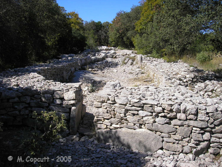
Village Préhistorique de Cambous submitted by thecaptain on 18th Jul 2008. Some of the houses in the second group of this 5000 year old village, near Viols-Le-Fort.
(View photo, vote or add a comment)
Log Text: This is a 5000 year old village with two groups of houses found at Viols Laval, just to the south of St Martin-de-Londres, and is easily found because it is signposted from all around. To get there, park in the village and it is about an 800 metre walk to the site, but unfortunately for me towards the end of September, it had just shut last weekend and would not be open again until next easter !
However, despite not being able to get into the fenced off site, I could see some of the excavated houses through the fence. In two main groups, the houses consist of very long buildings arranged side by side. There a reconstructed dwelling a bit further into the complex, which I could not get to see properly. This was all a big shame, as this was one of the sites I have been particularly looking forwards to seeing throughout my entire trip.
Village de la Madeleine
Trip No.203 Entry No.86 Date Added: 6th Apr 2020
Site Type: Ancient Village or Settlement
Country: France (Aquitaine:Dordogne (24))
Visited: Yes on 20th May 2005. My rating: Condition 4 Ambience 4 Access 4
Village de la Madeleine submitted by TheCaptain on 15th Jan 2011. On the west side of the river Vézère near the village of Tursac is the Troglodytic village of La Madeleine, which has been inhabited since 50000 years ago and given its name to an epoch, the Madeleinian, which was about 12000 years ago.
(View photo, vote or add a comment)
Log Text: On a cliff face on the west side of the river Vézère near the village of Tursac is the Troglodytic village which has been inhabited since 50000 years ago and gave its name to an epoch the Madeleinian which was about 12000 years ago.
What you mostly see now for your visit money is medieval with several cliff houses built into the terrace on the cliff. There is also a couple of chapels and a gatehouse which guards over where there was a sort of drop bridge which nowadays has a permanent footpath over it. Above the whole lot is the remains of a 12th century castle. At the centre of the village near a sort of village square is a strange spring which only flows in times of great drought due to some sort of capillary action and the last time in which it flowed was summer 2001. This very strange effect has given the place a sort of magic throughout the millennia.
A bit further along the cliff and down at the base is the original abri shelter within which all the important prehistoric finds were made including the carved bison and the first harpoons.
Vieux-Moulin Alignement
Trip No.203 Entry No.433 Date Added: 23rd May 2020
Site Type: Stone Row / Alignment
Country: France (Bretagne:Morbihan (56))
Visited: Yes on 15th Jun 2005. My rating: Condition 4 Ambience 4 Access 4

Vieux-Moulin alignement submitted by JJ on 9th Nov 2002. Vieux-Moulin alignement
(View photo, vote or add a comment)
Log Text: This is a nice little row of 6 menhirs, up to 4 metres in height, standing on the slopes of a field just near to the busy D.781 Carnac to Erdeven road, just to the north of Plouharnel station. These are nicely shaped and positioned stones.
