Contributory members are able to log private notes and comments about each site
Sites theCAptain has logged. View this log as a table or view the most recent logs from everyone
Font-de-Gaume
Trip No.203 Entry No.71 Date Added: 5th Apr 2020
Site Type: Cave or Rock Shelter
Country: France (Aquitaine:Dordogne (24))
Visited: Yes on 18th May 2005. My rating: Condition 5 Ambience 5 Access 4
Font-de-Gaume submitted by TheCaptain on 29th Jun 2010. The cliff face within which the spectacular Font-de-Gaume cave with its wonderful paintings is to be found.
(View photo, vote or add a comment)
Log Text: Walk quickly the 2km from Les Eyzies to the entrance building for the cave, and am just in time to be a part of the 10:00 trip. Hooray. It is fantastic.
The colours don't seem so vivid as I recall, (probably from seeing pictures), but I am actually in the cave with these paintings, and could almost touch them if I wanted) strictly forbidden!) they are that close and available. They are said to date from 14000 years ago, dated by means of calcite build up dating methods as there is no charcoal in any of the paintings. There are bison, horses, reindeer, normal deer, a mammoth... Superb. In red and black but they look totally different with the lights on and off.
Entering the cave from the old entrance, the animals would have passed you by as you proceeded into the cavern, it is intended as a moving picture. These people could paint with perspective, something which became lost until the renaissance period only 500 years ago. Some of the animals are painted on flat surfaces. Some are made to fit the cave features. Some have been carved. The two deer, one licking the other, are amazing. I want to rate this place as 10 out of 5.
Font-de-Gaume
Date Added: 21st Oct 2020
Site Type: Cave or Rock Shelter
Country: France (Aquitaine:Dordogne (24))
Visited: Yes on 18th Sep 1978
Font-de-Gaume submitted by ocdolmen on 26th May 2006. Site in Aquitaine: Dordogne (24)
Entrance of Font de Gaume cave, Dordogne, France.
The entrance is on the right on the photo (the cave on the left is a dead end and presents no drawing)
Inside the cave, a great number of buffalos and horses drawings and some engraved drawings.
Magdalenian period (about 20.000 BCE)
One of the rare prehistoric cave with drawings still open to public.
(View photo, vote or add a comment)
Log Text: Hitch Hiking Trip round France in the summer of 1978. Camped for a couple of days at Les Eyzies to visit and wonder at the ancient sites here.
Fontaine de Trois Seigneurs tumulus
Trip No.205 Entry No.50 Date Added: 25th Oct 2020
Site Type: Chambered Tomb
Country: France (Midi:Hautes-Pyrénées (65))
Visited: Yes on 6th Sep 2005. My rating: Condition 3 Ambience 3 Access 4
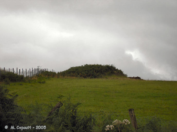
Fontaine de Trois Seigneurs tumulus submitted by thecaptain on 23rd Jan 2006. Remains of a large round mound, probably with a chambered tomb inside, which can be seen near to the more well known Pouey-Majou, a few kilometres to the southwest of Tarbes in southwestern France.
There are many of these large mounds around on the hills here, but many more have been destroyed in the last century. This one has recently been attacked with earthmoving equipment on its far side, some of which can be seen by the steep side on the right, and the loose earth to the side.
(View photo, vote or add a comment)
Log Text: When at the Fontaine de Trois Seigneurs, instead of turning left towards the Pouey-Majou dolmen continue southwest for a few hundred yards along the farmtrack, and there is a large mound at the top of the hill. It can be clearly seen against the skyline while walking towards it from quite some distance off, all covered in bracken and scrub. Unfortunately, it has all been fenced off, so I couldnt get a closer look. It looks to be about 20 metres in diameter, by 3 metres high. The northwest side looks to have been recently cut away with earth moving equipment. In fact, it is in such a badly cared for state, that at first I assumed that it might be just a modern mound of earth, for some reason piled there by the farmer. But it is indeed an ancient burial mound, which is in desperate need of some proper care. It wouldn't be the only one of these large burial mounds round here to be destroyed in recent times, as one was ploughed out less than 10 years ago.
Fontaine des Chartreux
Trip No.203 Entry No.214 Date Added: 21st Apr 2020
Site Type: Holy Well or Sacred Spring
Country: France (Midi:Lot (46))
Visited: Yes on 1st Jun 2005. My rating: Access 4
Fontaine des Chartreux submitted by theCaptain on 16th Jan 2012. Cross the wonderful Pont Valentré from the old town of Cahors, contained within its loop of the Lot river, and walk south along the riverside for a few hundred metres, and you will find this huge spring in the cliffside, with the crystal clear water surging out.
(View photo, vote or add a comment)
Log Text: Cross the wonderful Pont Valentré from the old town of Cahors, contained within its loop of the Lot river, and walk south along the riverside for a few hundred metres, and you will find this huge spring in the cliffside, with the crystal clear water surging out. Two thousand years ago, the Fontaine des Chartreux was used for the worship of Divona, or Divona Cadurcorum, "Divona of the Cadurci," a Celtic people of Gaul before the Roman conquest in the 50s BC. Many coins, minted between 27 BC and AD 54 and thrown into the water as offerings, have been discovered by archaeologists here.
Fontaine Saint Gré
Trip No.203 Entry No.277 Date Added: 24th Apr 2020
Site Type: Holy Well or Sacred Spring
Country: France (Pays de la Loire:Vendée (85))
Visited: Yes on 6th Jun 2005. My rating: Ambience 3 Access 4

Fontaine Saint Gré submitted by thecaptain on 10th Dec 2005. This is an ancient spring with little pond in amongst some large granite blocks near to the village of Avrillé.
The spring water seeps into the pond from out of a fissure in one of the granite slabs at the side, from quite well above the water line.
(View photo, vote or add a comment)
Log Text: This is an ancient spring and little pond in amongst some large granite blocks. The spring water seeps into the little pond from out of a fissure in one of the granite slabs at the side, from quite well above the water line.
There are two menhirs, a tumulus and ruined dolmen within a hundred metres of the spring, although they are quite difficult to determine amongst the natural stone in the area. The Fontaine is signposted from nearby and in the village.
Fontaine Saint Gré menhirs
Trip No.203 Entry No.279 Date Added: 24th Apr 2020
Site Type: Standing Stones
Country: France (Pays de la Loire:Vendée (85))
Visited: Yes on 6th Jun 2005. My rating: Condition 3 Ambience 3 Access 4

Fontaine Saint Gré menhirs submitted by thecaptain on 10th Dec 2005. Near to the Fontaine Ste Gré spring there are two menhirs to be seen.
In the hedge beside the lane which leads to the Fontaine Ste Gré, just beside the entrance to the field within which the spring is, can be found this menhir, about 2.5 metres tall, but very well hidden and overgrown within the hedge.
(View photo, vote or add a comment)
Log Text: In the hedge beside the little lane which leads to the Fontaine Ste Gré, just beside the entrance to the field within which the spring is, can be found this menhir. It is about 2.5 metres tall, but very well hidden and overgrown within the hedge.
The other menhir is somewhere in a hedge beside the big pond below the spring, inside a private garden. I couldn’t find this one.
Fontaine Saint Gré tumulus
Trip No.203 Entry No.278 Date Added: 24th Apr 2020
Site Type: Chambered Cairn
Country: France (Pays de la Loire:Vendée (85))
Visited: Yes on 6th Jun 2005. My rating: Ambience 3 Access 4
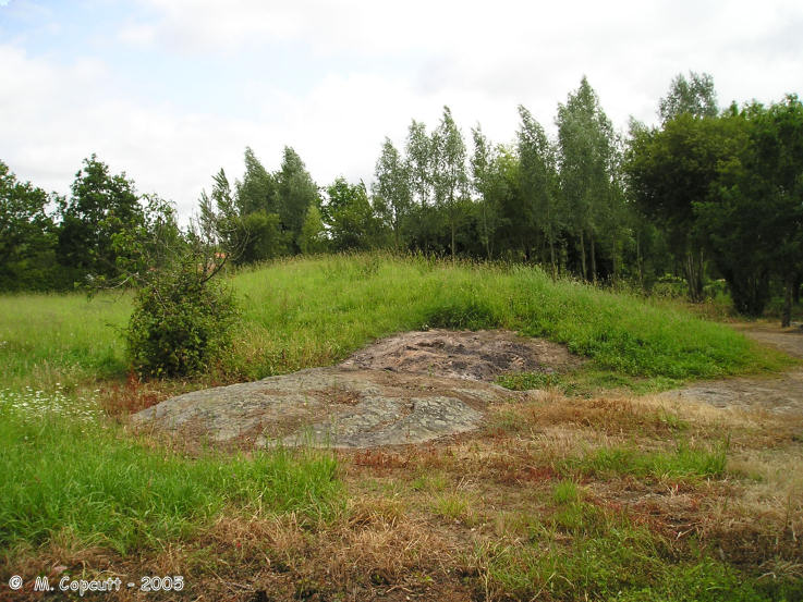
Fontaine Saint Gré tumulus submitted by thecaptain on 10th Dec 2005. Not far from the Fontaine Saint Gré spring, is the remains of a large long mound.
At the eastern end of this mound is a large granite slab, which is the remains of a burial chamber.
(View photo, vote or add a comment)
Log Text: Not far from the Fontaine Ste Gré spring is the remains of a large long mound. At the eastern end of this mound is a large granite slab, which is the remains of a burial chamber.
Fontaine St Jean-du-Doigt
Trip No.193 Entry No.23 Date Added: 13th Jul 2020
Site Type: Holy Well or Sacred Spring
Country: France (Bretagne:Finistère (29))
Visited: Yes on 1st Sep 1992. My rating: Access 5
Log Text: Cycling camping trip of north Brittany, day 3. Breton Corniche, Treburden, Lannion, Corniche Armorique to Primel Tregastel.
Ellie of course wanted to see St John the Baptist's finger, but I think the church was closed and we couldn't see it. Wonderful camp-site right on the Pointe de Primel, and meal round the other side of the bay at Le Diben, where I made the waitress laugh because of my Quebec accent and expressions!
Fontaine St Michel
Trip No.203 Entry No.412 Date Added: 21st May 2020
Site Type: Holy Well or Sacred Spring
Country: France (Bretagne:Morbihan (56))
Visited: Yes on 14th Jun 2005. My rating: Condition 4 Ambience 4 Access 3
Fontaine St Michel submitted by TheCaptain on 12th Jun 2011. Round the back of the massive tumulus there is a nice well with a little well house and offerings area above a clear pool of water slowly bubbling up from the ground.
I have no doubt that this spring has been here for thousands of years and indeed quenched the thirst of the men building the tumulus.
(View photo, vote or add a comment)
Log Text: Following the path round the back of the tumulus looking to get a good photograph there was a sign to Fontaine St Michel which I followed. After a few hundred metres there is a nice little well with a little well house and offerings area above a clear pool of water slowly bubbling up from the ground.
I have no doubt that this spring has been here for thousands of years and indeed quenched the thirst of the men building the tumulus. And this turned out to be site 500 in my French stonehunting trip catalogue of site visits. Incredible really that I am seeing hundreds of dolmens and menhirs yet a well gets to be site 500. Probably only my third well !
Fordsland Ledge Chambered cairn
Date Added: 19th Aug 2024
Site Type: Chambered Cairn
Country: England (Devon)
Visited: Yes on 2nd Aug 2024. My rating: Condition 3 Ambience 4 Access 2
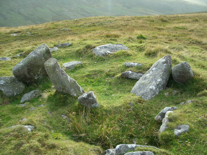
Fordsland Ledge Chambered cairn submitted by Bladup on 5th Oct 2014. Fordsland Ledge Chambered cairn.
(View photo, vote or add a comment)
Log Text: A walk up to the top of southern England, I park at Meldon reservoir and head over the dam then around the lake and up the West Okement river to an area of woodland and waterfalls, at which point I head up towards the top of the ridge north of Black Tor. I almost instantly regret this decision, as it is very hard going in very steep rough and wet ground, and I have a couple of falls, in the meantime seeing several other people descending much further upstream below the tor outcrop. Once up to Black Tor, and extremely weary, I have a serious talk to myself about heading directly back to the car along the track via Longstone Hill, as the weather is worsening and I am really starting to ache. However, after eating a sticky bun I feel the worst is over and decide to carry on up to Fordsland Ledge with its army huts and nice cairn with large stones protruding, seeing heavy rainshowers passing around, but none on me.
Forresters' Oaks Round Barrow
Date Added: 9th Sep 2020
Site Type: Round Barrow(s)
Country: Wales (Monmouthshire)
Visited: Yes on 5th Sep 2020. My rating: Condition 2 Ambience 3 Access 4
Forresters' Oaks Round Barrow submitted by thehappydruid on 11th Aug 2020. Forresters' Oaks Round Barrow
(View photo, vote or add a comment)
Log Text: Breezy but sunny afternoon walk up Gray Hill to check out the old stones, then a walk around Wentwood Forest. Just before the end of the walk, this round barrow can be found, with views up to Gray Hill.
Fort Harrouard
Trip No.202 Entry No.84 Date Added: 30th Mar 2020
Site Type: Ancient Village or Settlement
Country: France (Centre:Eure-et-Loire (28))
Visited: Saw from a distance on 3rd May 2005
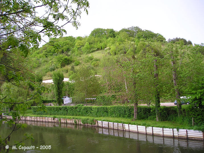
Fort Harrouard submitted by thecaptain on 10th Nov 2005. Fort Harrouard seen above the river Eure.
(View photo, vote or add a comment)
Log Text: This ancient defended settlement is positioned on a steep hillside high above the river Eure near the village of Marcilly-sur-Eure.
Fort Joret allée couverte
Trip No.201 Entry No.16 Date Added: 25th Mar 2020
Site Type: Passage Grave
Country: France (Normandie:Manche (50))
Visited: Yes on 22nd Nov 2004. My rating: Condition 2 Ambience 3 Access 4

Fort Joret allée couverte submitted by thecaptain on 21st Jan 2005. Allée Couverte de Fort Joret, Fermanville, Manche.
The view from the coastal footpath along the edge of the beach from the south.
(View photo, vote or add a comment)
Log Text: In a field overlooking the sea, with splendid views over the rocky beach, can be found the remains of this very ruinous Allée Couverte. It is about 500 metres along the coast path to the southwest of Fort Joret, in the Commune de Fermanville, just a few miles east of Cherbourg.
Estimated to have originally been about 17 metres in length, it runs in a north to south direction. The northern part of the remains are very ruined, with only a few stones here and there laying on the ground. The southern part of the tomb is in much better, but still very ruined and overgrown condition, and difficult to get to see in detail. The width of this part is much greater than the northern part, of the order 2.5 metres, and several large slabs remain in position.
Fortica
Date Added: 18th Sep 2010
Site Type: Hillfort
Country: Croatia
Visited: Yes on 30th Sep 2004

Fortica submitted by thecaptain on 30th Sep 2004. Splendidly positioned overlooking Hvar Town, the remains of the fortress date largely to the 16th century. However, the foundations of this castle are built upon remains of an ancient hillfort which dates back to the second millennium BC, some remains of which can still be seen under the south walls.
(View photo, vote or add a comment)
Log Text: None
Four-És-Feins
Trip No.203 Entry No.599 Date Added: 13th Jun 2020
Site Type: Passage Grave
Country: France (Bretagne:Ille-et-Vilaine (35))
Visited: Couldn't find on 28th Jun 2005
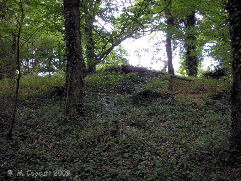
Four-És-Feins submitted by thecaptain on 20th Jun 2009. I found a place in a woodland to the left of the track, with a mound in it, and what looked to be some lumps sticking up, but it was very overgrown. It has to be here, surely. Closer inspection amongst the ivy and brambles, and there were clearly a few side set slabs sticking up through the ground.
(View photo, vote or add a comment)
Log Text: I had a good look around for the remains of this allée couverte, but could find nothing obvious. It's somewhere to the west of the hamlet of Vieux Bourg, beside the north to south expressway.
Four-És-Feins
Trip No.209 Entry No.10 Date Added: 13th Jun 2020
Site Type: Passage Grave
Country: France (Bretagne:Ille-et-Vilaine (35))
Visited: Yes on 12th Jun 2009. My rating: Condition 2 Ambience 4 Access 3
Four-És-Feins submitted by karolus on 12th Jan 2018. Site in Bretagne:Ille-et-Vilaine (35) France
(View photo, vote or add a comment)
Log Text: I went and had another look for this while in the area last weekend, now knowing to look nearby to the Beillac farm. I could see nothing obvious when driving slowly down the lane past the farm, but there was an old couple out tending their wonderful vegetable garden, so I stopped and asked them if they could tell me where the dolmen was. They were interested to know what an Englishman was doing looking for the remnants of the dolmen, but were happy to help.
Unfortunately, I struggled to understand fully all they were saying, a combination of strong accent and using some words I just could not figure out. But I thought I had got enough of a lead to find it easily. Park out of the way of the farm track by the corner of the farm. Cross the field to the south on the newly cut hay at the edge of the field for 200 metres until reaching the other side. Go straight on about another 100 metres (unknown words) until I get to the big trees, and it is on the left, (some more unknown words). Put boots on if you have them. Sounds simple.
Well, it was all very simple simple, until I tried to decide which of all the woodlands were the correct big trees. However, after a few false starts, I found a place in a woodland to the left of the track, with a mound in it, and what looked to be some lumps sticking up, but it was very overgrown. It has to be this, surely. Closer inspection amongst the ivy and brambles, and there were clearly a few side set slabs sticking up through the ground, and I was pretty sure I could determine two rows of slabs about 1.5 metres apart from each other, but with no stone more than 0.5 metres tall, and most substantially lower. I reckoned that what I had found on top of the mound was about 10 metres in length, and had to be the remains of a very ruined allée couverte.
However, walking back to the car, I thought that these poor remains were not really enough to be known by the name Four-es-Feins; the Fairies Oven. Surely something with a name like that must be a grander structure. I also thought it to be too ruined to be what the old couple were explaining to me, although they did say it was just the remains of an allée couverte. I would have thought they would have told me not to bother rather than gladly give me directions.....
Upon returning to the car, I remembered I had book with description in a box in the boot. "Rectangular chamber measuring 10m by 1.5m with 6 orthostats on the south side and 5 on the north. Their length is between 1 and 1.8 metres, height about half a metre and thickness 0.3 metres. Brilliant, this all fits to what I saw. But then, the description goes on. Three cover slabs about half a metre thick, and the backstone are still in place. Around the monument, a dozen or so other stones lie scattered.
Well, I can believe the stones are now more covered by undergrowth and soil than that description, and hence seem smaller. The size, orientation and almost everything seems right, with one major exception; the three cover stones. There was nothing at all which could have been them. Read the description again and realise it has been based upon a plan and writings from 1886 and 1928. Maybe it has become much more wrecked since then, but what of the old couples talk ?
So, was this Four-es-Feins or not? If it wasn't, what had I found ? I am not sure, but like to think I did find it. Certainly until anyone proves otherwise and can show me something better I'll count it.
Fox Covert NW
Date Added: 28th Aug 2023
Site Type: Chambered Tomb
Country: England (Wiltshire)
Visited: Yes on 9th Sep 2007

Fox Covert NW submitted by TheCaptain on 18th Sep 2007. Overgrown Long Barrow which has been cut in two by a hedge.
The eastern part of the barrow in the eastern field has now been completely ploughed out. The part in the western field is now about 30 metres in length, about 20 metres wide and up to 2 metres in height.
(View photo, vote or add a comment)
Log Text: A badly damaged overgrown Long Barrow with possible Chambered Tomb in a field, which has been cut in two by a hedge. The eastern part of the barrow in the eastern field has now been completely ploughed out. The part in the western field is now about 30 metres in length, about 20 metres wide and up to 2 metres in height. There are one or two big stones, which are almost certainly field clearance, dumped on top, otherwise there were no noticeable features that I could see. There are a few other tumuli marked on maps in neighbouring fields, but as far as I could see, these have no all been completely ploughed out, including the Tormarton 1 (Gloucestershire) long barrow in the field just to the north of the lane here.
Fox Tor stone setting
Date Added: 18th Sep 2010
Site Type: Standing Stones
Country: England (Cornwall)
Visited: Yes on 31st Aug 2010
Fox Tor stone setting submitted by TheCaptain on 31st Aug 2010. On the southeastern slopes of Fox Tor, above Redmoor Marsh, a stone setting is marked on the RCHM Bodmin Moor survey.
I am not sure what to make of this, a couple of large side set slabs about 1.5 metres tall, with perhaps many other smaller ones around them.
(View photo, vote or add a comment)
Log Text: None
Fraissinel Dolmen
Trip No.205 Entry No.223 Date Added: 6th Dec 2020
Site Type: Burial Chamber or Dolmen
Country: France (Languedoc:Lozère (48))
Visited: Couldn't find on 25th Sep 2005
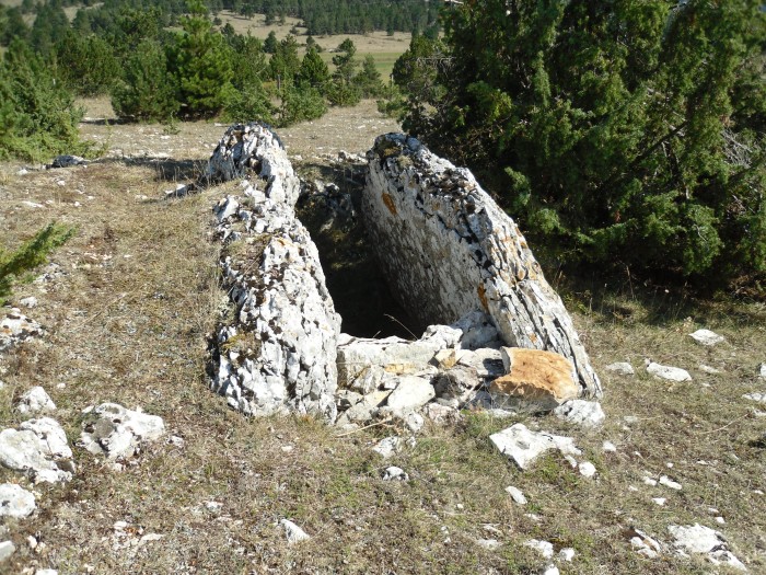
Fraissinel dolmen submitted by regina on 20th Oct 2011. Site in Languedoc:Lozère (48) France
dolmen du Fraissinel N44.44027 E3.49693
(View photo, vote or add a comment)
Log Text: I could find nowhere to park my campervan around here, so ended up turning round and going back, which was easier said than done! However, the menhir standing up on the top of its little hillock can be seen for miles around, and looks to be about 2.5 metres tall.
Frébouchère Dolmen
Trip No.203 Entry No.263 Date Added: 23rd Apr 2020
Site Type: Burial Chamber or Dolmen
Country: France (Pays de la Loire:Vendée (85))
Visited: Yes on 5th Jun 2005. My rating: Condition 5 Ambience 5 Access 4

Frébouchère dolmen submitted by thecaptain on 6th Jul 2005. Frébouchère dolmen is a MASSIVE Angevin type dolmen. It really is enormous, my pictures do not do it justice. The chamber is 6.5 metres by 3.5 metres, and 2 m high, with a single capstone.
(View photo, vote or add a comment)
Log Text: Easily found and signposted to the north of the village of Le Bernard, this wonderful dolmen has a little parking and picnic area. Ooooh, it’s a whopper, and absolutely fantastic !
It is a large Angevin dolmen with a main chamber 6.5 metres long by 3.5 metres wide, covered by a single massive capstone (now cracked into two parts) 2 metres high off the ground. There are three side stones along each side, and a single massive backstone at the western end. At the eastern end of the chamber are two partial closing stones and the two entrance porchway stones, with the chamber and its entrance facing towards the southeast at 130°.
Most of the stones are granite, but two of the stones, one on each side, are made from a different type of rock. Within the chamber, to the right near the entrance, is a granite stele, which almost reaches to the capstone, and has been very well smoothed and shaped. It is flat at the face near to the dolmen entrance, and side face near to the outside, but rounded around the back. The stone tapers upwards almost to a point, but has been cut short. There are no obvious engravings on it.
There is a lovely resonance inside the chamber, and two swallows or martins came flying through as I was inside. This is an all round excellent place, but it is a pity that it doesnt have a slightly larger enclosure around it like some, as it is nearly impossible to get a decent photograph of.
