Contributory members are able to log private notes and comments about each site
Sites theCaptain has logged. View this log as a table or view the most recent logs from everyone
Dolmen du Jogard
Trip No.202 Entry No.28 Date Added: 26th Mar 2020
Site Type: Burial Chamber or Dolmen
Country: France (Normandie:Manche (50))
Visited: Yes on 26th Apr 2005. My rating: Condition 1 Ambience 2 Access 3
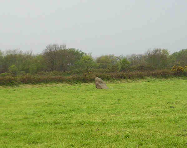
Dolmen du Jogard submitted by TheCaptain on 7th May 2005. Le Jogard, St Germain-des-Vaux, Manche.
I am not 100 percent sure that what I saw and photographed in a downpour here is the remains of this dolmen or not, but it is in the right sort of place.
(View photo, vote or add a comment)
Log Text: A much ruined dolmen just northwest of the village of St Germain-des-Vaux on Cap de la Hague right at the northwestern tip of the Cherbourg peninsular.
I am not 100 percent sure that what I saw and photographed in a downpour was the remains of this dolmen or not but it was in the right sort of place. What I saw was a single stone remaining in a field beside the track beyond the house called Le Jogard. I could not enter the field to see if there were any other stones flat to the ground here and there were several loose cows which came and wanted to inspect me !
Hague-Dick
Trip No.202 Entry No.27 Date Added: 26th Mar 2020
Site Type: Misc. Earthwork
Country: France (Normandie:Manche (50))
Visited: Yes on 26th Apr 2005. My rating: Condition 3 Ambience 2 Access 5

Hague-Dick submitted by TheCaptain on 9th May 2005. Several square miles at the northwestern tip of the Cherbourg peninsula, was once defended from the rest of the world by a 2 mile long ditch and bank, which connected between two deep valleys to defend the whole area.
Much of this dyke has now been destroyed, but a good section remains to the northwest of the village of Beaumont Hague, where it can be clearly seen as the roads to Digulleville cut through it.
(View photo, vote or add a comment)
Log Text: Cap de la Hague several square miles at the northwestern tip of the Cherbourg peninsula was once defended from the rest of the world by a 2 mile long ditch and bank which connected between two deep valleys to defend the whole area.
Much of this dyke has now been destroyed but a good section remains to the northwest of the village of Beaumont Hague where it can be clearly seen as the roads to Digulleville cut through it. The bank is generally about 4 metres in height but in places it must be nearer 10 metres tall with small ditches on the landward side. Excavations have shown that the bank was first built in the bronze age but much added to and increased during the time of the Viking occupation in the ninth century.
La Hutte-aux-Gabelous
Trip No.202 Entry No.26 Date Added: 26th Mar 2020
Site Type: Passage Grave
Country: France (Pays de la Loire:Mayenne (53))
Visited: Yes on 24th Apr 2005. My rating: Condition 4 Ambience 5 Access 5

La Hutte-aux-Gabelous submitted by thecaptain on 27th Apr 2005. La Hutte aux Gabelous, Saint Mars-sur-la-Futaie, Mayenne A cracking little find this, its been 2/3rds restored and the other end left as it was found. I think a Gabelou is some sort of soldier employed to crack down on smugglers, but cannot be sure yet.
(View photo, vote or add a comment)
Log Text: What a fantastic find this little Allée Couvert is a couple of kilometres to the east of the village of St Mars beside the D534 near the crossing with the D118 and is to be found in a nice little wooded area with its own little car park and picnic site.
The monument is the remains of a little Allée Couvert about 18 metres long by 5 metres width which was excavated and part restored in 1992 the northwestern 2/3rds being restored to as original condition. the southeastern 1/3rd being left in as found condition.. The chamber has its major axis on an alignment of 140° and is about 1.8 metres in both width and height with an unknown length due to the east end being in ruined condition. There are 5 large capstones in place on top of 6 pairs of uprights with a nice large slab forming the end of the chamber. The entrance is at the eastern end of the southern side.
This monument is said to be fairly unique because of the rectangular nature of the external peristalith which is formed with contiguous upright slabs. The gap between the external walling and the main chamber is filled with stones for the restored part. Flints and pottery were found within the chamber from a whole range of periods.
I almost missed this as it was getting late in the day but decided to have a quick little detour on the way back to look at the little dolmen symbol marked on the map. I ended up spending quite a long time here it’s suddenly become one of my favourite little megalithic sites. I was even moved to just sit on one of the rocks at the end and do a little drawing.
Dolmen de la Pierre (Hercé)
Trip No.202 Entry No.25 Date Added: 26th Mar 2020
Site Type: Burial Chamber or Dolmen
Country: France (Pays de la Loire:Mayenne (53))
Visited: Yes on 24th Apr 2005. My rating: Condition 3 Ambience 3 Access 3
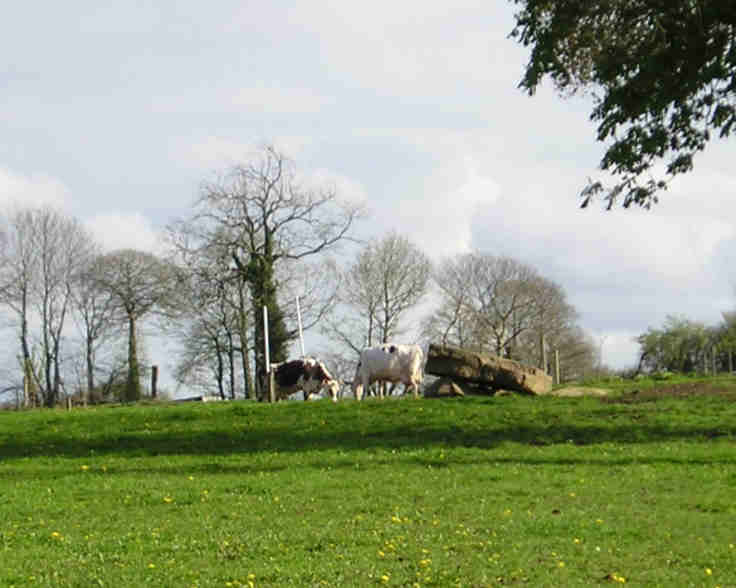
Dolmen de la Pierre (Hercé) submitted by TheCaptain on 7th May 2005. La Pierre dolmen, Hercé, Mayenne.
This is a simple dolmen with a large capstone supported by several small uprights in a field just in front of a farmhouse. Access to the dolmen was not available at the time of my visit, as it was in a field of young cows.
(View photo, vote or add a comment)
Log Text: This small dolmen can be found a few hundred metres to the south of the D33 road turning first left travelling westwards from Hercé. It is a simple dolmen with a large capstone supported by several small uprights in a field just in front of a farmhouse. Access to the dolmen was not available at the time of my visit as it was in a field of young cows but there was a signpost towards it as if it is possible to get to it at other times.
Menhir de la Roche (Gorron)
Trip No.202 Entry No.24 Date Added: 26th Mar 2020
Site Type: Standing Stone (Menhir)
Country: France (Pays de la Loire:Mayenne (53))
Visited: Couldn't find on 24th Apr 2005
Menhir de la Roche (Gorron) submitted by SMD on 25th Oct 2007. Site in Pays de la Loire:Mayenne (53)
(View photo, vote or add a comment)
Log Text: Unlike all the rest of the menhirs in this area I could find no signpost to this one despite it being clearly marked on the ign map and there being a large warehouse called Menhir Meubles or similar in the vicinity. After a while looking around I gave up not finding this one.
Menhir dit la Pierre Saint-Siviard
Trip No.202 Entry No.23 Date Added: 26th Mar 2020
Site Type: Standing Stone (Menhir)
Country: France (Pays de la Loire:Mayenne (53))
Visited: Yes on 24th Apr 2005. My rating: Condition 3 Ambience 3 Access 4

Menhir dit la Pierre Saint-Siviard submitted by TheCaptain on 7th May 2005. Menhir dit la Pierre Saint-Siviard, Le Pas, Mayenne.
Near L’Ervault on the is this smoothed menhir, 2.5 to 3 metres tall.
(View photo, vote or add a comment)
Log Text: Near L’Ervault on the D33 road from Ambrieres to Gorron this menhir can be found a few hundred metres north of the road up the trackway from the roadside cross. It is a smoothed menhir 2.5 to 3 metres tall in a little open area between fields used for storage of wood and other farm items.
Menhir de Moncorbeau
Trip No.202 Entry No.22 Date Added: 26th Mar 2020
Site Type: Standing Stone (Menhir)
Country: France (Pays de la Loire:Mayenne (53))
Visited: Yes on 24th Apr 2005. My rating: Condition 3 Ambience 3 Access 4

Menhir de Moncorbeau submitted by TheCaptain on 7th May 2005. Moncorbeau menhir, Couesmes-Vaucé, Mayenne.
This menhir is found in a field just to the north of the village beside a little stream, and is probably more than 2 metres tall. There are a few other pieces of stone nearby, which may have been broken from the menhir.
(View photo, vote or add a comment)
Log Text: This menhir is found in a field just to the north of the village on the road to Vaucé beside a little stream and is probably more than 2 metres tall. There are a few other pieces of stone nearby which may have been broken from the menhir.
Chataigneraie Menhir
Trip No.202 Entry No.21 Date Added: 26th Mar 2020
Site Type: Standing Stone (Menhir)
Country: France (Normandie:Orne (61))
Visited: Yes on 24th Apr 2005. My rating: Condition 4 Ambience 3 Access 4
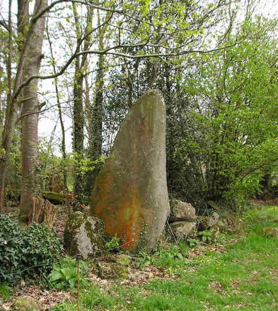
Chataigneraie menhir submitted by TheCaptain on 7th May 2005. Chataigneraie menhir, Saint-Siméon, Orne.
This menhir is about 3 metres tall, found at the edge of a little copse.
(View photo, vote or add a comment)
Log Text: This menhir is about 3 metres tall and can be found a couple of miles south of the village of Saint-Siméon from where it is signposted though its not on my ign map. It is a lovely smoothed menhir standing at the edge of a little copse across a field from the small lane.
Perron Menhir
Trip No.202 Entry No.20 Date Added: 26th Mar 2020
Site Type: Standing Stone (Menhir)
Country: France (Normandie:Orne (61))
Visited: Yes on 24th Apr 2005. My rating: Condition 3 Ambience 3 Access 5
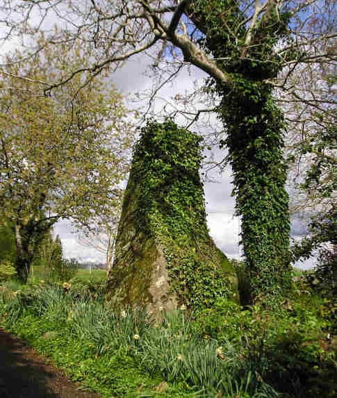
Perron menhir submitted by TheCaptain on 7th May 2005. Perron menhir, Passais, Orne.
At least 3 metres high, this menhir is found signposted about 30 metres from the road in a private garden, although access to the stone is allowed up a driveway.
(View photo, vote or add a comment)
Log Text: At least 3 metres high this menhir is found signposted about 30 metres from the road in a private garden although access to the stone is allowed up a driveway. There are at least two other large stones laying nearby and I wondered if one of these pieces was broken from the top of the menhir but the owner of the was in the garden and assured me that these had been put there as a garden feature by the previous owner.
La Table aux Diables (Passais)
Trip No.202 Entry No.19 Date Added: 26th Mar 2020
Site Type: Passage Grave
Country: France (Normandie:Orne (61))
Visited: Yes on 24th Apr 2005. My rating: Condition 4 Ambience 4 Access 5
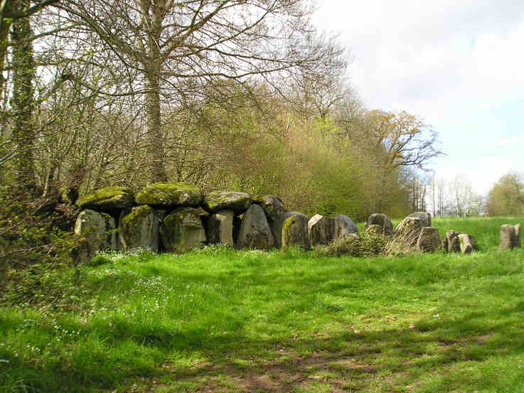
La Table aux Diables (Passais) submitted by TheCaptain on 7th May 2005. La Table aux Diables allée couverte, Passais, Orne.
A surprise find, this smashing little lateral entry Allée Couvert is about 12 or 13 metres in length, seen here from the southeast.
(View photo, vote or add a comment)
Log Text: Blimey what a pleasure to find this monument signposted from the Mantilly to Passais road as well as marked on the ign map. Heading south along the small road just west of Passais and turn right just before a little fishing lake is reached. A few hundred yards up a small track and the monument is found in a field to the right.
A surprise find this is a smashing little lateral entry Allée Couvert is about 12 or 13 metres in length with an orientation of 049° Magnetic. The main chamber is about 1.5 metres in width with 4 large capstones still remaining on 6 pairs of uprights at the western end with a height of 2 metres at the end dropping to 1.5 metres at the open end. The eastern end is more ruinous and the entrance is near the eastern end on the south side. The internal faces of the chamber stones have been nicely smoothed and are very well aligned with each other the gaps being filled with drystone walling. The outer walling of the peristalith is almost complete around the northern side and there are many stones remaining of the cairn filling between the inner and outer walls in the northwest quadrant. Only about half of the outer wall of stones remain on the southern side.
Les Cartesières
Trip No.202 Entry No.18 Date Added: 26th Mar 2020
Site Type: Passage Grave
Country: France (Normandie:Manche (50))
Visited: Couldn't find on 24th Apr 2005
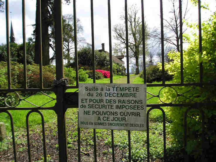
Les Cartesières submitted by TheCaptain on 7th May 2005. Les Cartesières allée couverte, St Symphorien-des-Monts, Manche.
This T shaped gallery grave is found in a zoo park. However, on the day of my visit, this park was well and truly shut, and looked like it hadn’t been open in many years.
(View photo, vote or add a comment)
Log Text: This T shaped gallery grave is the only one of this kind surviving in Normandy and is to be found in a zoo park near to the village. However on the day of my visit this park was well and truly shut and looked like it hadn’t been open in many years and was becoming very decrepit. No chance of getting in to see the monument.
Later note. Having seen the 1:25000 ign map of the area the dolmen is marked beside the little lane which runs down to the lakes along the western edge of the park. In fact its probably almost exactly where I stopped and had a look around to see if I could spot anything. If I am in the area again I will know where to look.
La Loge aux Sarrasins
Trip No.211 Entry No.4 Date Added: 26th Mar 2020
Site Type: Burial Chamber or Dolmen
Country: France (Normandie:Calvados (14))
Visited: Yes on 9th Oct 2011. My rating: Condition 4 Ambience 3 Access 4
la Loge aux Sarrasins submitted by hrun95 on 21st Jun 2011. These photos were taken in 2007, in the garden of the owners. So it's a bit boring because you are in their propriety. I get there by the little path coming by la Chaudronniere.
Site in Normandie:Calvados (14) France
(View photo, vote or add a comment)
Log Text: Having gone to Vire for a Vide Grenier and country show, persuaded Trevor and Sara to visit this stone for another look. Followed the same path as last time, and this time, once at the corner of the garden, the dolmen was clear to be seen in the back garden. At Last!
Its a lovely looking little dolmen. I can only assume that last visit there was a shed in the way, preventing it being seen. To get a better view, went back to the cornfield, and walked along its edge and up along outside the garden. I noticed that a bit further to the west, behind the garage, there was a separate standing stone, a couple of metres tall.
La Loge aux Sarrasins
Trip No.202 Entry No.17 Date Added: 26th Mar 2020
Site Type: Burial Chamber or Dolmen
Country: France (Normandie:Calvados (14))
Visited: Couldn't find on 17th Apr 2005
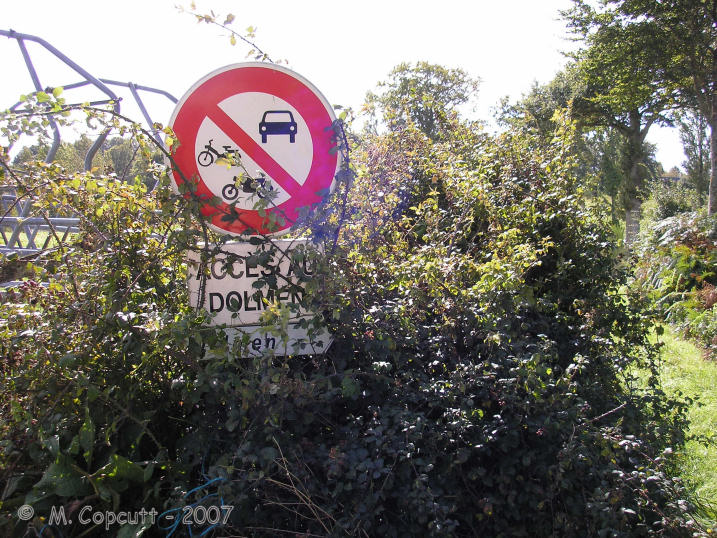
la Loge aux Sarrasins submitted by thecaptain on 28th Sep 2007. Despite the overgrown signs, this looked all very promising, and that I could add this elusive, rare Normandy dolmen to my list !
(View photo, vote or add a comment)
Log Text: Despite an accurate description of how to find this dolmen I could find nothing that looked like the picture from 1980. I did however find some large stones in about the right place a large single stone standing in the middle of the field and a couple of smaller ones with a small stone on top and a further large stone nearby. Perhaps I was looking in the wrong field but I think more likely is that this dolmen has recently been destroyed. A closer inspection of the photographs and I think that the large stone lying near the edge of the field might be the capstone from the dolmen upside down. A criminal shame that these things survive so long only to be destroyed in these modern times due to greed and laziness of a farmer.
Later note. Having seen the 1:25000 ign map of the area the dolmen is marked in a field further to the north than where I was looking beside the farm buildings which begs the question of what are the stones I did find.
Menhir dit Pierre de la Hoberie
Trip No.202 Entry No.15 Date Added: 26th Mar 2020
Site Type: Standing Stone (Menhir)
Country: France (Normandie:Calvados (14))
Visited: Couldn't find on 23rd Apr 2005
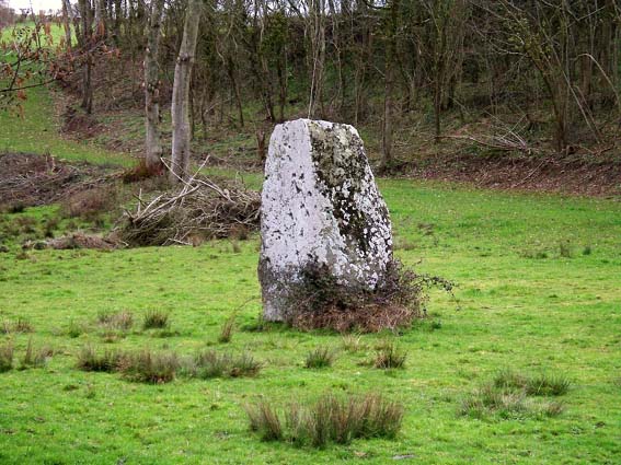
Menhir dit Pierre de la Hoberie submitted by Rida on 27th Feb 2011. Site in Normandie:Calvados (14) France
Menhir dit Pierre de la Hoberie
(View photo, vote or add a comment)
Log Text: This 3.1 metre tall menhir is said to be in the field downhill from the Ferme de Hoberie southwest of the village of Ussy. I could find nowhere to park and see no way through the farm without going through fields of cows so didn’t bother as I was in a rush to get back.
Bons Tassilly polissoirs
Trip No.202 Entry No.14 Date Added: 26th Mar 2020
Site Type: Polissoir
Country: France (Normandie:Calvados (14))
Visited: Yes on 23rd Apr 2005. My rating: Condition 3 Ambience 5 Access 4

Bons Tassilly polissoirs submitted by TheCaptain on 6th May 2005. Mont Joly polissoirs, Bons Tassilly, Calvados.
The first of two polissoirs beside the river which forms the gorge surrounding the Mont Joly promontory site.
On the top surface of this stone are two large polished bowl areas, and three grooves, made by polishing the hard stone into tools.
(View photo, vote or add a comment)
Log Text: Two polissoirs can be found beside the river which forms the gorge surrounding the Mont Joly promontory site. Follow signs to the Brèche de Diable park the car and then walk along the footpath which follows the river up this splendid rocky gorge. After several hundred metres the path diverges from the river and starts uphill to the left when you come to a fenced area. At this point go down towards the stream and the two polissoir stones can be found one on each side of the river.
The first one on the near side of the river is a block of hard stone sticking out of the hillside about 2 metres long and a metre wide. On the top surface of this stone are two large polished bowl areas and three grooves made by polishing the hard stone into tools. It is wonderful to sit down on one of the ends of this stone and imagine polishing away to make an axe or similar. In fact I was very tempted to just sit there and make one !
The polissoir on the far side of the stream has now been fenced off within private ground and cannot be reached although can clearly be seen.
Mont Joly
Trip No.212 Entry No.8 Date Added: 26th Mar 2020
Site Type: Ancient Village or Settlement
Country: France (Normandie:Calvados (14))
Visited: Yes on 7th May 2012. My rating: Condition 2 Ambience 4 Access 5
Mont Joly submitted by theCaptain on 15th Jan 2014. This promontory site is surrounded on three sides by the steep gorge of the river Laizon, and the eastern end has been defended by ramparts, a little of which can now be seen between the church and water tower.
In this picture a raise in the land can be seen to the left of my Dad.
(View photo, vote or add a comment)
Log Text: What an intriguing place this is, and deserving of much more thorough exploration.
Mont Joly
Trip No.202 Entry No.13 Date Added: 26th Mar 2020
Site Type: Ancient Village or Settlement
Country: France (Normandie:Calvados (14))
Visited: Yes on 23rd Apr 2005. My rating: Condition 2 Ambience 4 Access 5

Mont Joly submitted by TheCaptain on 7th May 2005. Mont Joly, Soumont-Saint-Quentin, Calvados.
This is a promontory site surrounded on three sides by the steep gorge of the river Laizon. The site has been inhabited and defended since Paleolithic times, and artefacts have been found from all times since this. It is said that although little ancient remains can be seen, they are everywhere underfoot, and every molehill will contain several flints and pottery sherds.
(View photo, vote or add a comment)
Log Text: This is a promontory site surrounded on three sides by the steep gorge of the river Laizon and the eastern end has been defended by ramparts little of which can now be seen between the church and water tower. The site has been inhabited and defended since Paleolithic times and artefacts have been found from all times since this. It is said that although little ancient remains can be seen they are everywhere underfoot and every molehill will contain several flints and pottery sherds. This region was a major supplier of flint tools in the past and there is much to be found here.
Langrais menhirs
Trip No.212 Entry No.6 Date Added: 26th Mar 2020
Site Type: Standing Stones
Country: France (Normandie:Calvados (14))
Visited: Yes on 7th May 2012. My rating: Condition 4 Ambience 3 Access 4

Langrais menhirs submitted by Rida on 27th Feb 2011. Site in Normandie:Calvados (14) France
(View photo, vote or add a comment)
Log Text: Having had a good look at the IGN 1:25000 map, I saw that there is a trackway running east from the road south of Mont Joly, which runs from the bottom of the hill diagonally up to the approximate position of the stones. Even better, when arriving there for a look, the trackway was open and easily driveable, and so I took this option on this showery afternoon, and when emerging from below the wood at the top of the hill, there was plenty of space to park amongst a large composting area! Left Dad in the car while I went out into the wind and drizzle to find the stones, and there they were, just round the back of the big pile of manure!
The two stones stand at the edge of an open rocky outcrop at the top of the hill, covered in wildflowers at this time of year, but I learned that the stones are not in their original positions, having been moved there by the farmer at some point in the past. The two stones are very different, the larger stone being a whitish quartz type stone, between 3.5 nd 4 metres tall, while its shorter neighbour is a reddish colour, and only about 1.6 metres tall. There are plently of other large lumps of stone laying about here, which may have been broken from the two menhirs, or just other examples of field clearance.
On the way down from the stones, through a gateway into the wood I could see another rocky outcrop with various large stones standing around, a couple of them probably at least 2 metres tall. This was all now made into a nice garden feature, but is there any ancient significance to the stones? Back onto the road, and I noticed it was called Route des Menhirs, and up towards the top of the hill there was another garden with some large rocks standing in it.
Onto the top of Mont Joly, and it is clear that there are large rocks all over the place, and it is easy to imagine that thee was once an alignement of large stones running along the top of the hill into the ancient settlement. Walking along the edge of the field, and then the pathway to the end of the promontary, and large stones can be seen laying around everywhere, many clearly not just a local outcropping of rock, but various shapes, sizes and types of stone. Many of these rocks were now incorporated into garden features, but many more are just laying there, slowly getting buried by the undergrowth. It really is a fascinating area, and I do wonder what a proper survey of this ancient hilltop would turn up.
Langrais menhirs
Trip No.202 Entry No.12 Date Added: 26th Mar 2020
Site Type: Standing Stones
Country: France (Normandie:Calvados (14))
Visited: Saw from a distance on 23rd Apr 2005
Langrais menhirs submitted by TheCaptain on 6th May 2005. Langrais menhirs, Soumont-Saint-Quentin, Calvados.
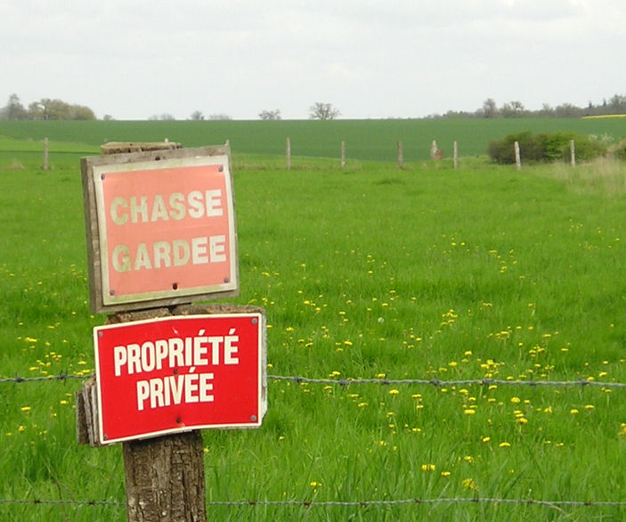
2 large menhirs in a field to the east of the village near Mont Joly, but which are 500 metres from the road across a field surrounded by barbed wire and with very clear keep out signs. One of the two menhirs stands 3.6 metres high, while the other is fallen.
The standing menhir can be seen here between the third and fourth fencepost along to the right of the sign.
(View photo, vote or add a comment)
Log Text: Two large menhirs in a field to the east of the village near Mont Joly but which are 500 metres from the road across a field surrounded by barbed wire and with very clear keep out signs. One of the two menhirs stands 3.6 metres high while the other is fallen.
In the region around here are many other large stones some of which may well be fallen menhirs and indeed perhaps a row can be determined in the lane called “Route des Menhirs”.
La Longue Pierre (St-Pierre-Eglise)
Trip No.207 Entry No.7 Date Added: 25th Mar 2020
Site Type: Standing Stone (Menhir)
Country: France (Normandie:Manche (50))
Visited: Yes on 5th Apr 2007. My rating: Condition 4 Ambience 3 Access 4
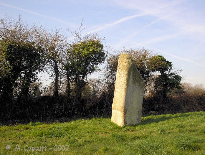
La Longue Pierre (St-Pierre-Eglise) submitted by TheCaptain on 29th Sep 2007. One of the "Three Princesses", this menhir stands 4.2 metres high, perhaps the largest menhir remaining standing in La Manche today.
(View photo, vote or add a comment)
Log Text: I was able to get right to this lovely stone this time, although in a rush as there was nowhere to park and I left the car blocking the little lane. The stone stands about 4 metres tall in a very swampy field, and I got soaking wet feet while walking up to the stone, but at least it washed clean all the mud from La Pierre Plantée. It now has a little information post at the gateway to the field, and is numbered on a marked walk around the village, so I must go and look for more information at St Pierre l'Eglise.
