Contributory members are able to log private notes and comments about each site
Sites SandyG has logged. View this log as a table or view the most recent logs from everyone
Aspers Field
Date Added: 7th Jan 2018
Site Type: Standing Stone (Menhir)
Country: England (Cumbria)
Visited: Yes on 8th Sep 2017. My rating: Condition 3 Ambience 4 Access 4
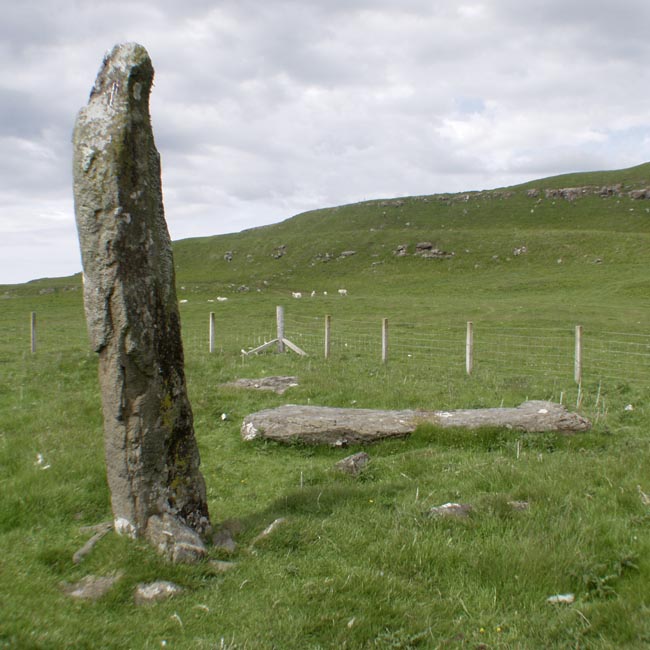
Aspers Field submitted by baz on 26th Apr 2003. This stone (at NY558152) lies in the next field to the more well known Goggleby Stone (NY559151), from which I took this picture (with zoom). Both of these stones form a part of the Shap Stone Avenue.
(View photo, vote or add a comment)
Log Text: None
Goggleby Stone
Date Added: 7th Jan 2018
Site Type: Standing Stone (Menhir)
Country: England (Cumbria)
Visited: Yes on 8th Sep 2017. My rating: Condition 3 Ambience 4 Access 4

Goggleby Stone submitted by blingo on 30th Jan 2003. Goggleby stone near Shap.
(View photo, vote or add a comment)
Log Text: None
The Giant's Foot (Cumbria)
Date Added: 7th Jan 2018
Site Type: Standing Stone (Menhir)
Country: England (Cumbria)
Visited: Yes on 8th Sep 2017. My rating: Condition 2 Ambience 3 Access 4
The Giant's Foot (Cumbria) submitted by baz on 21st Mar 2004. The Giant's Foot at NY563148. This stone is a remnant of the Shap Stone Avenue and lies in a field behind the houses on the A6 in Shap.
(View photo, vote or add a comment)
Log Text: None
Askham Fell Stone Row
Date Added: 7th Jan 2018
Site Type: Stone Row / Alignment
Country: England (Cumbria)
Visited: Yes on 8th Sep 2017. My rating: Condition 2 Ambience 4 Access 3
Askham Fell Stone Row submitted by SandyG on 7th Jan 2018. Stone row at NY 49246 22233. View from north west.
(View photo, vote or add a comment)
Log Text: Car parking is available at NY 50066 21704. From here walk along track leading west to the point where it joins the bridleway. Head north along the bridleway until you reach the row.
Moor Divock
Date Added: 7th Jan 2018
Site Type: Multiple Stone Rows / Avenue
Country: England (Cumbria)
Visited: Yes on 8th Sep 2017. My rating: Condition 3 Ambience 4 Access 3
Moor Divock 4 submitted by SandyG on 7th Jan 2018. The row is situated near a fine kerbed cairn. The ranging rod is standing beside the row. View from north west (Scale 1m).
(View photo, vote or add a comment)
Log Text: Car parking is available at NY 50066 21704. From here walk along track leading west to the point where it joins the bridleway. Head north along the bridleway until you reach the row which is a short distance beyond the Askham Fell Cairn row.
Broomrigg A
Date Added: 7th Jan 2018
Site Type: Stone Row / Alignment
Country: England (Cumbria)
Visited: Yes on 2nd Aug 2017. My rating: Condition 1 Ambience 2 Access 4
Broomrigg A submitted by rich32 on 22nd Jul 2004. Broomrigg A, Cumbria (NY548467)
The Broomrigg sites are set in a pine plantation and are near to a track This image shows part of Broomrigg ‘A’, it was quite difficult to get more in the shot due to the trees. I also found Broomrigg ‘B’, but gave up on ‘C’ & ‘D’ due to eating too many flies (protein or no protein not nice) and a dodgy GPS signal.
(View photo, vote or add a comment)
Log Text: The stone row is in a working forest and access is therefore sensibly restricted on occasions. Parking is available at NY 54190 46783. From here walk along the forest tracks to the row.
Blackhammer
Date Added: 6th Jan 2018
Site Type: Chambered Tomb
Country: Scotland (Orkney)
Visited: Yes on 3rd Jun 2015. My rating: Condition 4 Ambience 5 Access 4
Blackhammer submitted by SandyG on 11th Aug 2015. View of the chambered cairn from the north with the Orkney mainland in the background. (3rd June 2015).
(View photo, vote or add a comment)
Log Text: None
Langstane (Orkney)
Date Added: 6th Jan 2018
Site Type: Standing Stone (Menhir)
Country: Scotland (Orkney)
Visited: Yes on 3rd Jun 2015. My rating: Condition 4 Ambience 3 Access 5
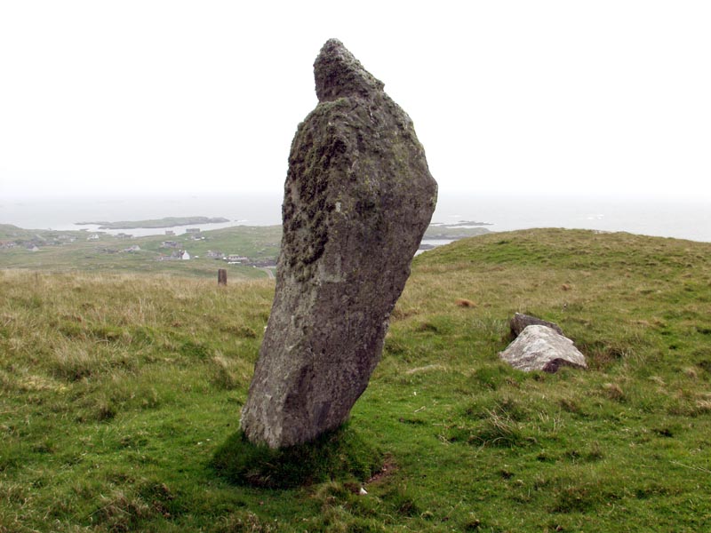
Langstane (Orkney) submitted by SandyG on 17th Sep 2015. Given its proximity to the road and cottage what are the chances that this stone is prehistoric and if so that it is its original location particularly as it has clearly at some time been broken in half and put back together (3rd June 2015).
(View photo, vote or add a comment)
Log Text: None
Midhowe Broch
Date Added: 6th Jan 2018
Site Type: Broch or Nuraghe
Country: Scotland (Orkney)
Visited: Yes on 3rd Jun 2015. My rating: Condition 3 Ambience 4 Access 4
Midhowe Broch submitted by SandyG on 20th Sep 2015. Helpful sign makes it easy to find. (3rd June 2015).
(View photo, vote or add a comment)
Log Text: None
Links of Noltland
Date Added: 6th Jan 2018
Site Type: Ancient Village or Settlement
Country: Scotland (Orkney)
Visited: Yes on 12th Jun 2015. My rating: Condition 4 Ambience 4 Access 4
Links of Noltland submitted by SandyG on 17th Jun 2015. Substantial wall forming part of the Neolithic settlement. Midden deposits visible in section to the right. (12th June 2015).
(View photo, vote or add a comment)
Log Text: None
Traigh Na Berie
Date Added: 6th Jan 2018
Site Type: Stone Row / Alignment
Country: Scotland (Isle of Lewis)
Visited: Yes on 8th Aug 2017. My rating: Condition 2 Ambience 4 Access 4

Traigh Na Berie submitted by SandyG on 6th Jan 2018. Plan of the stones and linear earthworks at Traigh Na Berie (Source: Survey at 1:200 by Sandy Gerrard).
(View photo, vote or add a comment)
Log Text: Parking is available at NB 09964 36016 and access to the field at NB 10019 35867.
The stones appear to denote the edges of narrow, parallel banks which are on the same alignment as the lazy beds in this area. Whilst the reason why the banks in this area were denoted with edge set stones is not clear, it is possible to be confident that this is not a prehistoric stone alignment. The adjacent cairn may be the result of field clearance.
Quinish (Stone Row)
Date Added: 6th Jan 2018
Site Type: Stone Row / Alignment
Country: Scotland (Isle of Mull)
Visited: Yes on 5th Jun 2016. My rating: Condition 2 Ambience 5 Access 1

Quinish (Stone Row) submitted by Tom_Bullock on 27th Feb 2005. Photo used by kind permission of Tom Bullock. More details of this location are to be found on his Stone Circles and Rows CD-ROM.
(View photo, vote or add a comment)
Log Text: This is not an easy row to get to. The nearest car parking spot is at NM 43350 52269. From here you can either head northward along forest tracks or head back into the village of Dervaig and walk along the road that leads beside Loch a’Chumhainn. When visited in 2016 I chose to walk to the row through the forest and returned alongside the loch. The route via the village is probably the easiest. A map and or reliable GPS device is essential or else the chances of getting hopelessy lost are high.
Eyre Stone Rows
Date Added: 6th Jan 2018
Site Type: Stone Row / Alignment
Country: Scotland (Isle of Raasay)
Visited: Yes on 4th Aug 2017. My rating: Condition 2 Ambience 4 Access 1
Eyre Stone Rows submitted by SandyG on 6th Jan 2018. Length of field boundary previously identified as a double stone row. View from south east (Scale 1m).
(View photo, vote or add a comment)
Log Text: The feature described in Canmore forms part of a field boundary that extends further west to NG 57452 34870. The length that was previously described is hidden by bracken making photography difficult in the summer months. The features described are however all discernible. The pairs of stones described are almost touching and represent two sides of an incomplete wall. Walls of this type are present in the vicinity and it was probably intended that the wall would have butted a nearby field boundary at around NG 57541 34821. This is definitely a field boundary and not a stone row.
Blanefield
Date Added: 6th Jan 2018
Site Type: Stone Row / Alignment
Country: Scotland (Stirling)
Visited: Yes on 26th Aug 2017. My rating: Condition 2 Ambience 5 Access 3

Blanefield submitted by Creative Commons on 16th Mar 2014. Duntreath Standing Stones. The line of stones shown here is located at the high point of a field, not far from the West Highland Way (the tops of these stones can be seen on the skyline from the adjacent section of that route). The hill that is prominent in the background is Dumgoyach.
Five stones can be seen in the photograph; another lies hidden by the tall grass between the leftmost two stones.
Copyright Lairich Rig and licensed for reuse under the Creative Commons Licence.
(View photo, vote or add a comment)
Log Text: Limited car parking is available at NS 53342 79669. From here walk north along the West Highland Way to NS 53280 80509 and take the path leading north.
A radio-carbon date of 2860 +/- 270 bc suggests that it was erected in the Middle Neolithic period. The Middle Neolithic date combined with the closeness of the stones and the presence of an associated mound suggests that this is more likely to represent the remnants of a chambered cairn facade than a stone row.
Brevig
Date Added: 5th Jan 2018
Site Type: Standing Stones
Country: Scotland (Barra and Vatersay)
Visited: Yes on 15th Aug 2017. My rating: Condition 2 Ambience 5 Access 3

Brevig submitted by Tom_Bullock on 17th Jun 2004. Brevig, Barra
(View photo, vote or add a comment)
Log Text: There is no safe car parking available nearby. Parking is available at NL 67876 98704 but this involves a long walk along the road to NL 68966 98814. From here it is a short walk up the hill.
Drumtroddan Stone Row
Date Added: 5th Jan 2018
Site Type: Stone Row / Alignment
Country: Scotland (Dumfries and Galloway)
Visited: Yes on 5th Sep 2017. My rating: Condition 2 Ambience 4 Access 4

Drumtroddan Stone Row submitted by DavidRaven on 26th Jun 2005. Description useless. Go visit :-)
(View photo, vote or add a comment)
Log Text: Parking is available at NX 36383 44051. From here it is a short walk up the hill to the stone row.
Torhousekie Stones East
Date Added: 5th Jan 2018
Site Type: Standing Stones
Country: Scotland (Dumfries and Galloway)
Visited: Yes on 5th Sep 2017. My rating: Condition 1 Ambience 4 Access 3

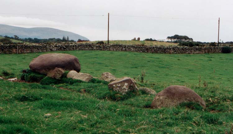
Torhousekie Stones East submitted by vicky on 29th Oct 2002. The ruined stone row near Torhousekie stone circle.
(View photo, vote or add a comment)
Log Text: This line of stones is probably entirely the result of field clearance. The largest stone at the northern end clearly sits on top of stones similar in size to those which lie in a line parallel to the field wall. The proximity of the stone circle has probably influenced the interpretation of this site as prehistoric. Whilst a prehistoric date cannot be wholly discounted the feature as a whole has the appearance of being the result of field clearance.
Torhousekie stone circle
Date Added: 5th Jan 2018
Site Type: Stone Circle
Country: Scotland (Dumfries and Galloway)
Visited: Yes on 5th Sep 2017. My rating: Condition 4 Ambience 4 Access 5

Torhousekie stone circle submitted by kelpie on 8th Jun 2002. A neat little circle easy to locate and very peaceful.
(View photo, vote or add a comment)
Log Text: Parking is available next to the stone circle at NX 38295 56502.
Torhousekie East
Date Added: 5th Jan 2018
Site Type: Stone Row / Alignment
Country: Scotland (Dumfries and Galloway)
Visited: Yes on 5th Sep 2017. My rating: Condition 4 Ambience 4 Access 4
Torhouskie East submitted by DrewParsons on 19th Oct 2010. PID
(View photo, vote or add a comment)
Log Text: Parking is available next to the stone circle at NX 38295 56502. From here the stone row is visible on the nearby knoll to the east. Carefully cross the road and enter by the gateway.
Dyke Row
Date Added: 5th Jan 2018
Site Type: Stone Row / Alignment
Country: Scotland (Dumfries and Galloway)
Visited: Yes on 6th Dec 2015. My rating: Condition 3 Ambience 1 Access 5
Dyke Row submitted by cosmic on 4th Jun 2004. Dyke Row at NT084036 is just to the south of Moffat
(View photo, vote or add a comment)
Log Text: Car parking is available at NT 08327 03648. From here walk towards Moffat on the roadside path until you reach the row. Carefully cross the busy road. Best visited in the winter or early spring before the vegetation obscures the stones. One of the few stone rows with dreadful ambience.
