Contributory members are able to log private notes and comments about each site
Sites SandyG has logged. View this log as a table or view the most recent logs from everyone
Isbister: Tomb Of The Eagles
Date Added: 3rd Jan 2015
Site Type: Chambered Cairn
Country: Scotland (Orkney)
Visited: Would like to visit
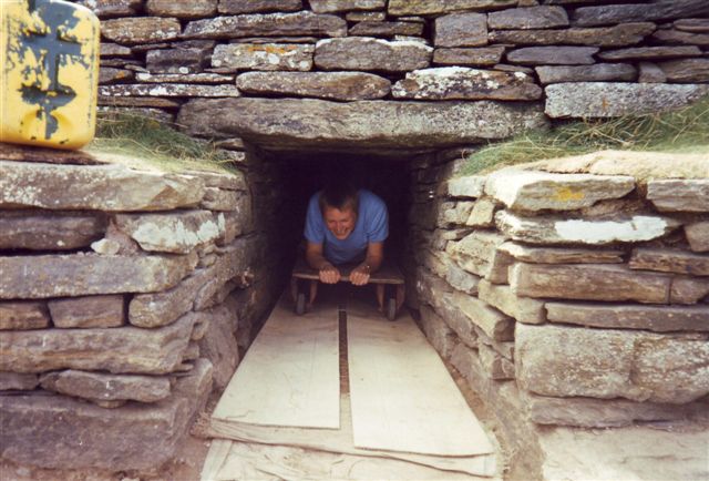
Isbister: Tomb Of The Eagles submitted by cosmic on 20th Feb 2005. Exiting the Tomb
(View photo, vote or add a comment)
Glenamacrie Farm
Date Added: 3rd Jan 2018
Site Type: Cairn
Country: Scotland (Argyll)
Visited: Yes. My rating: Condition 4 Ambience 3 Access 5
Glenamachrie Farm submitted by caradoc68 on 6th Feb 2012. This cairn can been easily seen from the road side, with the Glenomachrie standing stone's in the next field. The cairn is in the farmers yard/land though so might be better to ask before going to have a look.
(View photo, vote or add a comment)
Log Text: None
Dickmount Law
Date Added: 31st Jan 2019
Site Type: Cairn
Country: Scotland (Angus)
Visited: Yes on 1st Jan 1976. My rating: Condition 3 Ambience 4 Access 4

Dickmount Law submitted by SandyG on 31st Jan 2019. View from the north east. Photograph taken in around 1976.
(View photo, vote or add a comment)
Log Text: None
Westerton (Aberlemno)
Date Added: 18th Feb 2020
Site Type: Stone Circle
Country: Scotland (Angus)
Visited: Yes on 1st Jan 1976. My rating: Condition 3 Ambience 3 Access 5
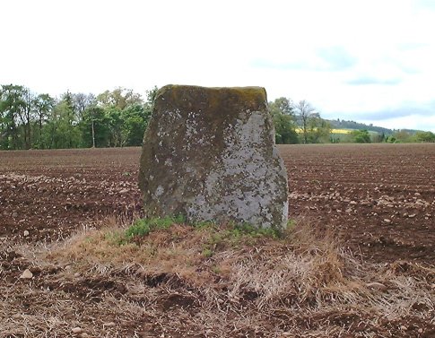
Westerton (Aberlemno) submitted by Nick on 5th Nov 2002. From Forfar head easton the A932 Friockeim road. Turn north onto the un-numbered Aberlemno road by Balgavies Loch, until a small crossroads is reached. Just north of this junction you will see the stone in a field on your left (west side of the road.) This is an unassuming stone, no marks, standing about 1.2m high. Flat-faced, with the faces approximately due south-east/north-west.
(View photo, vote or add a comment)
Log Text: None
Newmill souterrain
Date Added: 24th Feb 2020
Site Type: Souterrain (Fogou, Earth House)
Country: Scotland (Perth and Kinross)
Visited: Yes on 1st Aug 1977. My rating: Condition -1 Ambience 1
Newmill souterrain submitted by SandyG on 17th Feb 2020. The north western end viewed from the south east.
(View photo, vote or add a comment)
Log Text: The souterrain and associated archaeological remains were removed during the up-grading of the A9.
Fowlis Wester 1
Date Added: 19th Feb 2020
Site Type: Class II Pictish Symbol Stone
Country: Scotland (Perth and Kinross)
Visited: Yes on 1st Jan 1978. My rating: Condition 3 Ambience 3 Access 5
Fowlis Wester 1 submitted by cosmic on 19th Jun 2006. Viewed from West - Yes the sign does say replica but the images on it are better (more visible) than on original
(View photo, vote or add a comment)
Log Text: None
Fowlis Wester 2
Date Added: 19th Feb 2020
Site Type: Class III Pictish Cross Slab
Country: Scotland (Perth and Kinross)
Visited: Yes on 1st Jan 1978. My rating: Condition 3 Ambience 3 Access 5
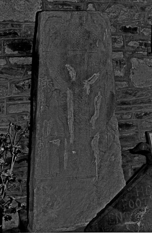
Fowlis Wester 2 submitted by SandyG on 19th Feb 2020. Quality is not great, but this is what the stone looked like in 1978.
(View photo, vote or add a comment)
Log Text: None
Bodowyr
Date Added: 18th Feb 2020
Site Type: Passage Grave
Country: Wales (Anglesey)
Visited: Yes on 1st Jul 1980. My rating: Condition 3 Ambience 4 Access 4

Bodowyr submitted by Postman on 14th Aug 2015. january 2010
(View photo, vote or add a comment)
Log Text: None
King's Quoit, Manorbier
Date Added: 18th Feb 2020
Site Type: Burial Chamber or Dolmen
Country: Wales (Pembrokeshire)
Visited: Yes on 1st Jan 1987. My rating: Condition 4 Ambience 5 Access 3

King's Quoit, Manorbier submitted by sem on 25th Aug 2004. Looking SW,the view here is outstanding.This must have been a very sought after plot of Neolithic real-estate.It is set in a hollow on the cliffside lined with stones bigger than any but the capstone.Children & Nash suggest "no covering mound would have existed because the ledge.....is far too narrow." (Logaston Press 2002)
(View photo, vote or add a comment)
Log Text: None
Strathpeffer
Date Added: 9th Feb 2019
Site Type: Class I Pictish Symbol Stone
Country: Scotland (Highlands)
Visited: Yes on 1st Jan 1988. My rating: Condition 4 Ambience 3 Access 5
Strathpeffer submitted by SandyG on 12th Jan 2015. The stone in 1988. The socket stone was clearly visible at the time this photograph was taken.
(View photo, vote or add a comment)
Log Text: None
Wayland's Smithy
Date Added: 15th Feb 2020
Site Type: Long Barrow
Country: England (Oxfordshire)
Visited: Yes on 21st Jan 1991. My rating: Condition 4 Ambience 4 Access 4
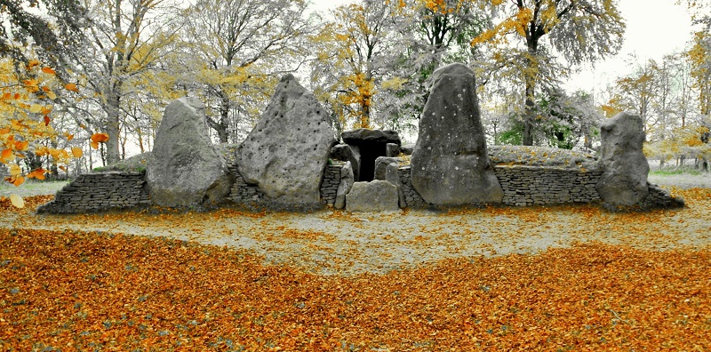
Wayland's Smithy submitted by StoneLee on 11th Jun 2015. Wayland's Smithy
(View photo, vote or add a comment)
Log Text: None
Lanhill
Date Added: 15th Feb 2020
Site Type: Long Barrow
Country: England (Wiltshire)
Visited: Yes on 22nd Jan 1991. My rating: Condition 3 Ambience 3 Access 5
Lanhill submitted by Thorgrim on 15th Oct 2003. The surviving burial chamber on the south side of the Lanhill long barrow.
(View photo, vote or add a comment)
Log Text: None
Long Stone (East Worlington)
Date Added: 15th Feb 2020
Site Type: Standing Stone (Menhir)
Country: England (Devon)
Visited: Yes on 1st Jan 1995. My rating: Condition 4 Ambience 3 Access 4
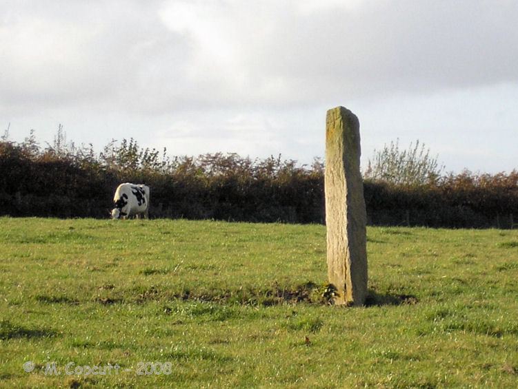
Long Stone (East Worlington) submitted by thecaptain on 17th Nov 2008. Adworthy Longstone, in a field of cows in deepest Devon.
(View photo, vote or add a comment)
Log Text: None
Stonehenge.
Date Added: 15th Feb 2020
Site Type: Stone Circle
Country: England (Wiltshire)
Visited: Yes on 1st Jan 1995. My rating: Condition 3 Ambience 5 Access 4
Stone-16 at Stonehenge. submitted by Feanor on 4th Oct 2017. Shot specifically for Angie Lake.
(View photo, vote or add a comment)
Log Text: None
Kestor Settlement
Date Added: 14th Feb 2020
Site Type: Ancient Village or Settlement
Country: England (Devon)
Visited: Yes on 1st Jan 1999. My rating: Condition 4 Ambience 5 Access 3
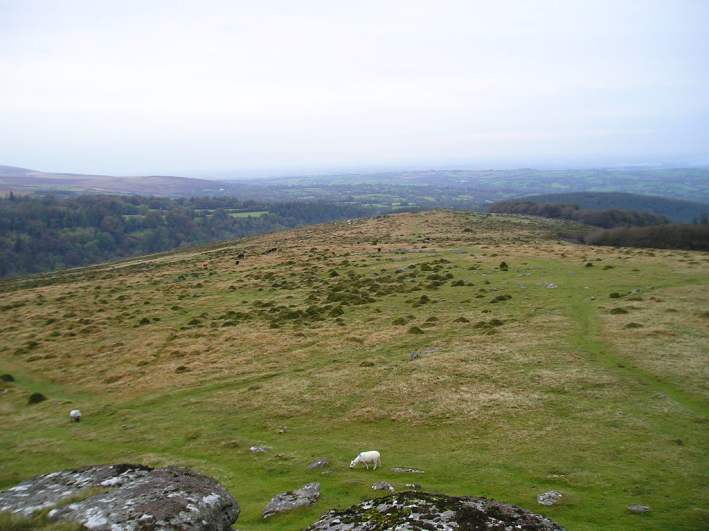
Kestor Settlement submitted by thecaptain on 24th Oct 2004. View northeast from Kestor rocks overlooking Kestor Settlement. The entire hilltop and hillsides here are covered in the ancient remains of ancient huts and field systems.
(View photo, vote or add a comment)
Log Text: Parking is usually available at NGR SX 6680 8655. Allow at least a day to explore this amazing prehistoric landscape.
Routrundle North
Date Added: 14th Feb 2020
Site Type: Ancient Village or Settlement
Country: England (Devon)
Visited: Yes on 1st Jan 2004. My rating: Condition 2 Ambience 3 Access 3
Routrundle North submitted by SandyG on 14th Feb 2020. View from south.
(View photo, vote or add a comment)
Log Text: The enclosure stands in non-access land but can be seen from adjacent footpaths.
Shell Top Chambered Cairn
Date Added: 14th Feb 2020
Site Type: Cairn
Country: England (Devon)
Visited: Yes on 27th Apr 2011. My rating: Condition 3 Ambience 4 Access 3

Shell Top Chambered Cairn submitted by davep on 2nd Dec 2019. The Shell Top Chambered Cairn from the Prehistoric Dartmoor Walks (PDW) website. Photograph taken 25th August 2017.
(View photo, vote or add a comment)
Log Text: None
Mynydd y Betws
Date Added: 25th Sep 2014
Site Type: Stone Row / Alignment
Country: Wales (Carmarthenshire)
Visited: Yes on 16th Jan 2012. My rating: Condition 3 Ambience 4 Access 2
Mynydd y Betws submitted by SandyG on 17th May 2012. View from south west of the stone row leading up Bancbryn. This photograph was taken on 16th January 2012.
(View photo, vote or add a comment)
Log Text: None
Nant-y-Llyn (Powys)
Date Added: 10th Jan 2018
Site Type: Cairn
Country: Wales (Powys)
Visited: Yes on 15th Nov 2012. My rating: Condition 3 Ambience 4 Access 4
Nant-y-Llyn (Powys) submitted by SandyG on 26th Dec 2014. The cairn seems to have been positioned to maximise views of the nearby waterfalls. View from east (15th November 2012).
(View photo, vote or add a comment)
Log Text: None
Maen Mawr
Date Added: 16th Jan 2019
Site Type: Stone Row / Alignment
Country: Wales (Powys)
Visited: Yes on 15th Dec 2012. My rating: Condition 4 Ambience 5 Access 4

Maen Mawr submitted by AngieLake on 8th Aug 2005. This view of Maen Mawr looks north towards the even-shaped flat-topped mountain that blocks the north aspect of this lovely symmetrical valley. The larger Fan Brycheiniog mountain is out of sight to the NW of this view. Behind me is Cerrig Duon circle, overlooking the alternate E/W folds either side of the southern slopes of the valley from the semi-circular south end of this platform.
(View photo, vote or add a comment)
Log Text: None
